Severe storms threaten large hail in Alberta on Friday
Stay alert for rapidly changing conditions across parts of Alberta on Friday
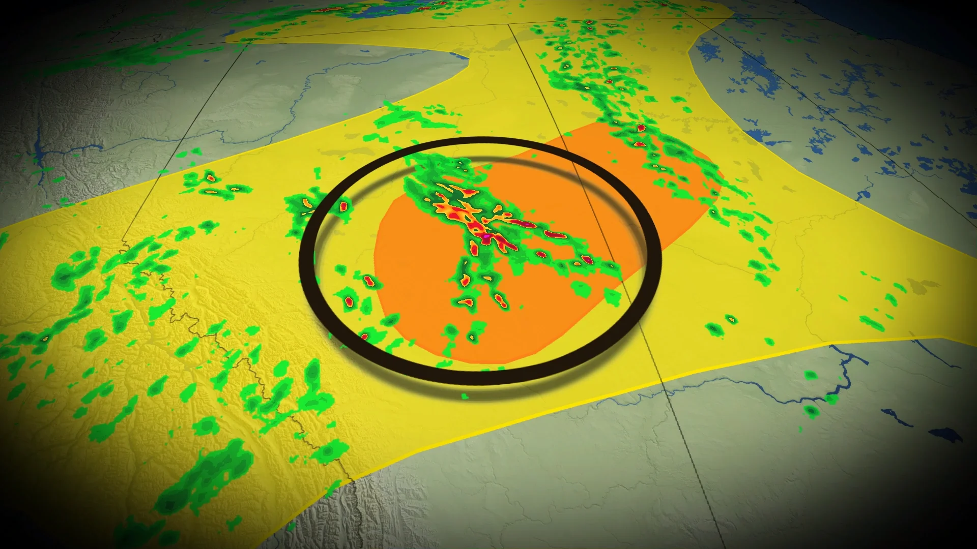
Stay alert for severe weather watches and warnings across portions of Alberta on Friday as an active pattern sets the stage for a possible round of severe thunderstorms.
DON’T MISS: The pros and cons of an El Niño summer across Canada
A boundary moving through central Alberta will serve as the trigger for scattered thunderstorms to develop through the afternoon and evening hours on Friday.

Expect storms to pop up around Red Deer and Edmonton early Friday afternoon and track northeast across the region.
Instability will be strong enough to favour large hail in the strongest storms, which may grow large enough to damage homes and vehicles. Treat warnings seriously; stay away from exterior walls and windows if a severe-warned storm approaches your location.

Commuters should prepare for potential traffic slowdowns around Red Deer, Edmonton, and roadways along and east of the QE2. Do not stop beneath bridges or overpasses during a hailstorm, as this creates a very dangerous traffic jam.
Storms will congeal into clusters by the evening hours as they track toward the Alberta/Saskatchewan border, at which point the main threat will transition to strong wind gusts.
Farther south, strong downsloping winds will develop by Friday evening, with gusts of 40-60+ km/h expected.
A risk for isolated thunderstorms will continue through the weekend as an unsettled pattern remains in place over Western Canada.
Stay with The Weather Network for all the latest on conditions across Alberta.