Tornado warnings issued as severe storms fire up

An active couple of days will give way to rising temperatures across much of the Prairies heading into the weekend
2:44 p.m. CST - Severe thunderstorms prompted a tornado warning in southern Saskatchewan on Friday afternoon.
Environment and Climate Change Canada issued a tornado warning for the following areas in southern Saskatchewan:
R.M. of Douglas incl. Speers, Richard, and Alticane
R.M. of Battle River incl. Sweet Grass Res. and Delmas
R.M. of North Battleford Northwest of the Battlefords
The Battlefords
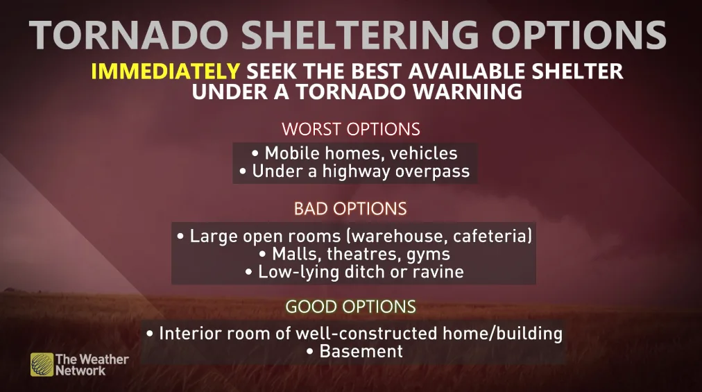
"This is a dangerous and potentially life-threatening situation. Take cover immediately, if threatening weather approaches," ECCC said in its warning.
The agency added: "Go indoors to a room on the lowest floor, away from outside walls and windows, such as a basement, bathroom, stairwell or interior closet. Leave mobile homes, vehicles, tents, trailers and other temporary or free-standing shelter, and move to a strong building if you can. As a last resort, lie in a low spot and protect your head from flying debris.”
CURRENT TORNADO WARNINGS (SASKATCHEWAN):
R.M. of Douglas incl. Speers, Richard, and Alticane
R.M. of Battle River incl. Sweet Grass Res. and Delmas
R.M. of North Battleford Northwest of the Battlefords
The Battlefords
The original article with the full forecast for the region continues below.
An active pattern across the centre of the country produced several tornadoes this week. The same pattern will produce another round of severe weather on Friday.
Isolated supercells are still expected in central Alberta and parts of Saskatchewan by the evening. Residents should closely monitor watches and warnings throughout the day.
DON’T MISS: Rapid El Niño may force the slowest hurricane season in years
Friday supercells are possible
The environment remains supportive for severe weather as we head into the end of the week across the Prairies.
Manitoba will largely miss out on Friday’s risk as the possibility for severe thunderstorms shifts back toward Alberta and Saskatchewan.
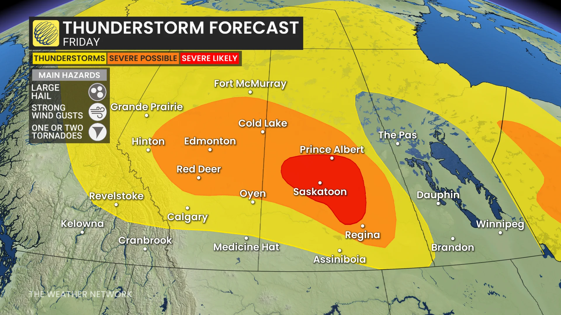
Models show storms developing throughout the evening hours, around the 6-9 p.m. timeframe, with some in central Saskatchewan persisting overnight.
The main threats will be large hail and strong to destructive wind gusts, potentially reaching 100 km/h. An isolated tornado is also possible.
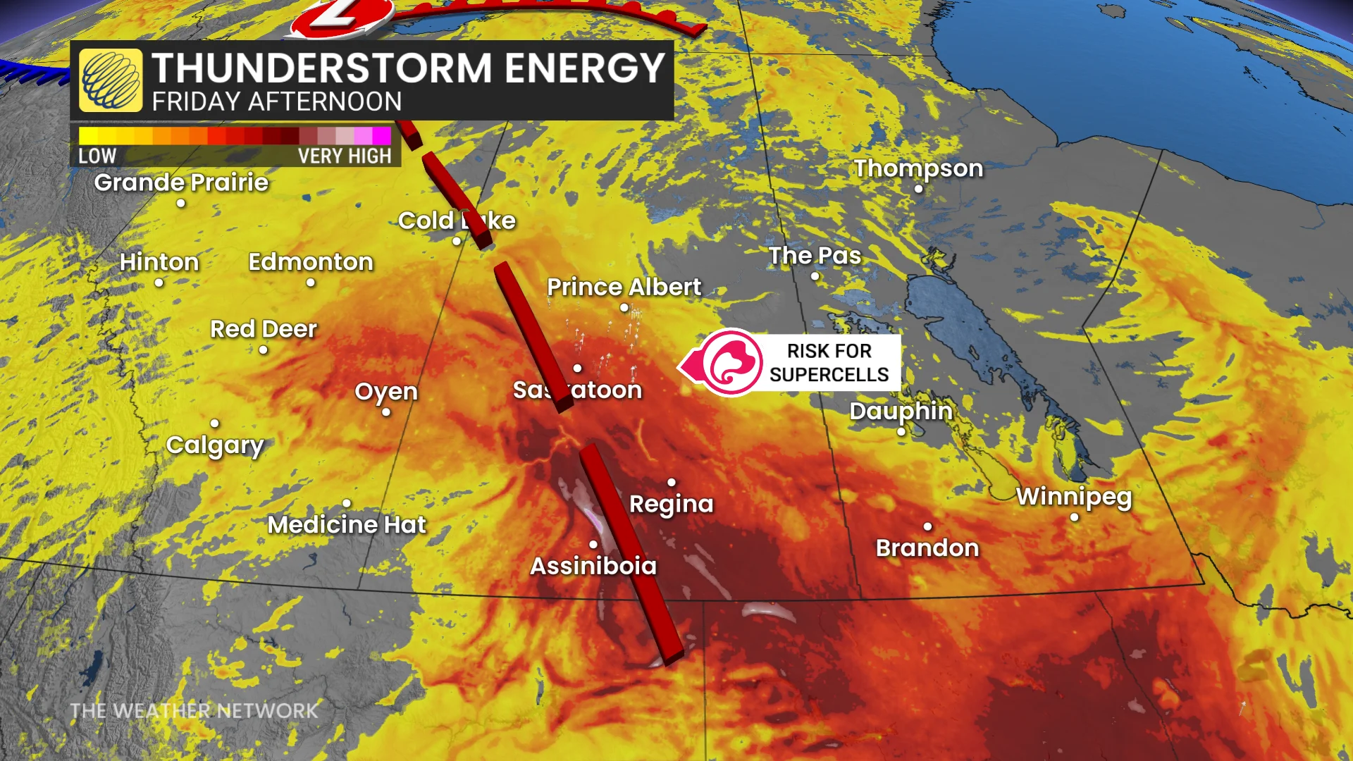
Friday’s storm potential will affect some larger population centres, including Edmonton, Red Deer, Saskatoon, and Regina. In Saskatchewan, the risk is higher due to stronger triggers, increased CAPE, and enhanced wind shear.
It’s worth noting that wildfire smoke drifting in from British Columbia may hamper storm development in Alberta.
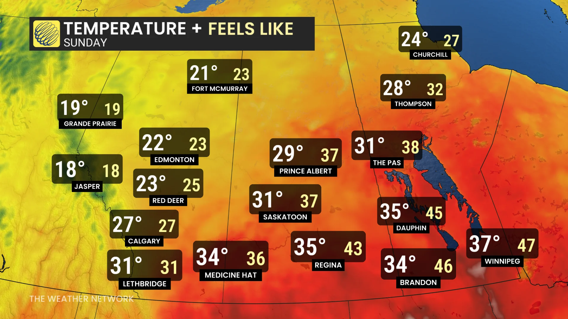
By this weekend, a heat dome building over the United States will begin to influence conditions over the southern Prairies. Temperatures will climb into the mid-30s with humidex values into the 40s on Saturday and Sunday.
This stateside ridge will shunt the active storm track up toward northern regions of Alberta, Saskatchewan, and into the Northwest Territories.
Stay with The Weather Network for all the latest on conditions across the Prairies.