Severe storms likely Saturday with very large hail, tornado risk

Prepare for dangerous weather to pop up in portions of Alberta during the day on Saturday
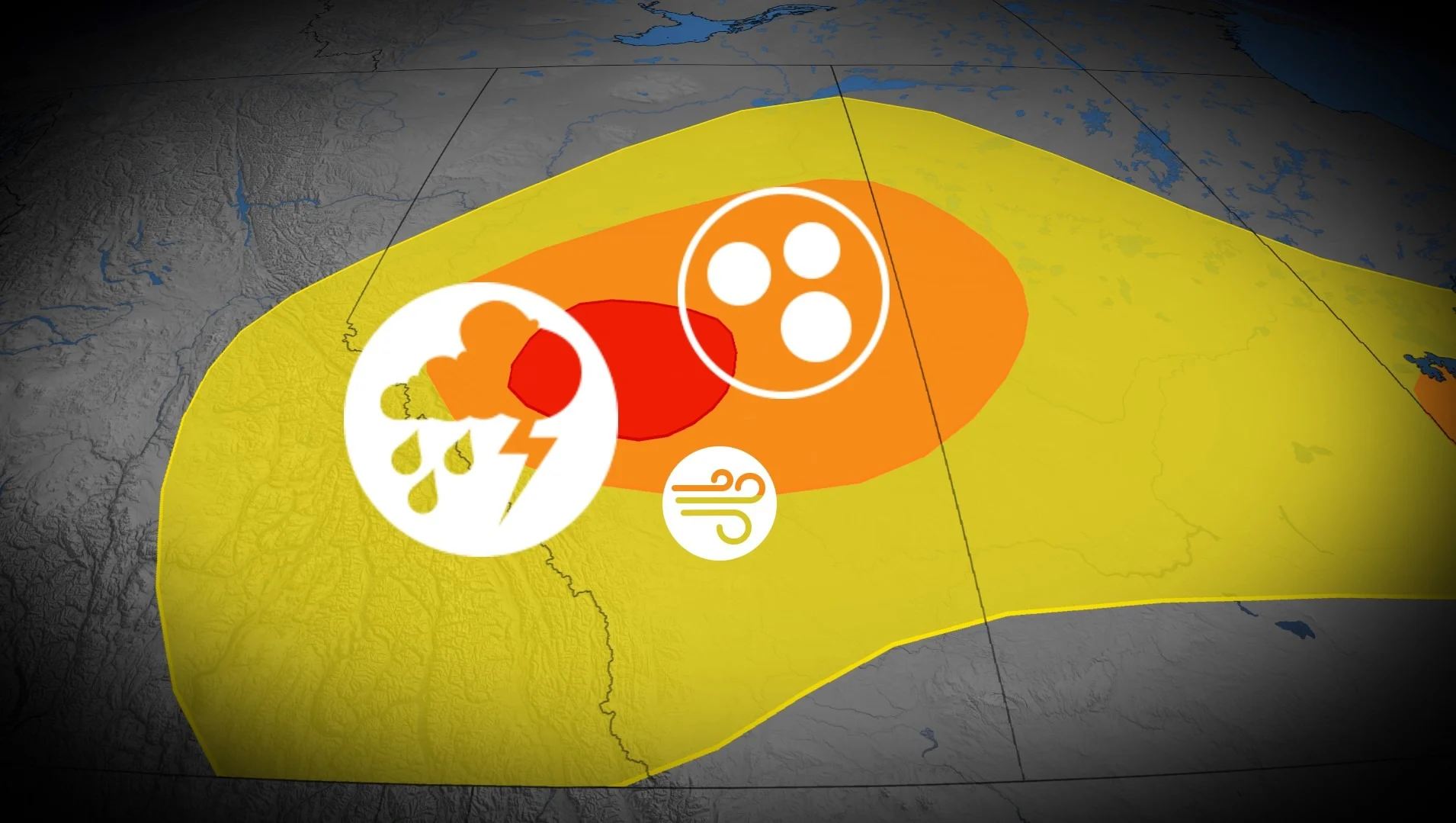
A renewed round of severe thunderstorms expected over Alberta on Saturday will carry the risk for very large hail and even one or two tornadoes.
Storms will develop in the afternoon and continue through the evening hours.
Keep up with the latest watches and warnings in your area. Take immediate action if a tornado warning is issued for your location.
DON’T MISS: Busy summer sends Canada's tornado count soaring above normal
Severe storms likely in Alberta on Saturday
A low-pressure system developing off the foothills on Saturday will set the stage for a round of strong to severe thunderstorms throughout much of the province.
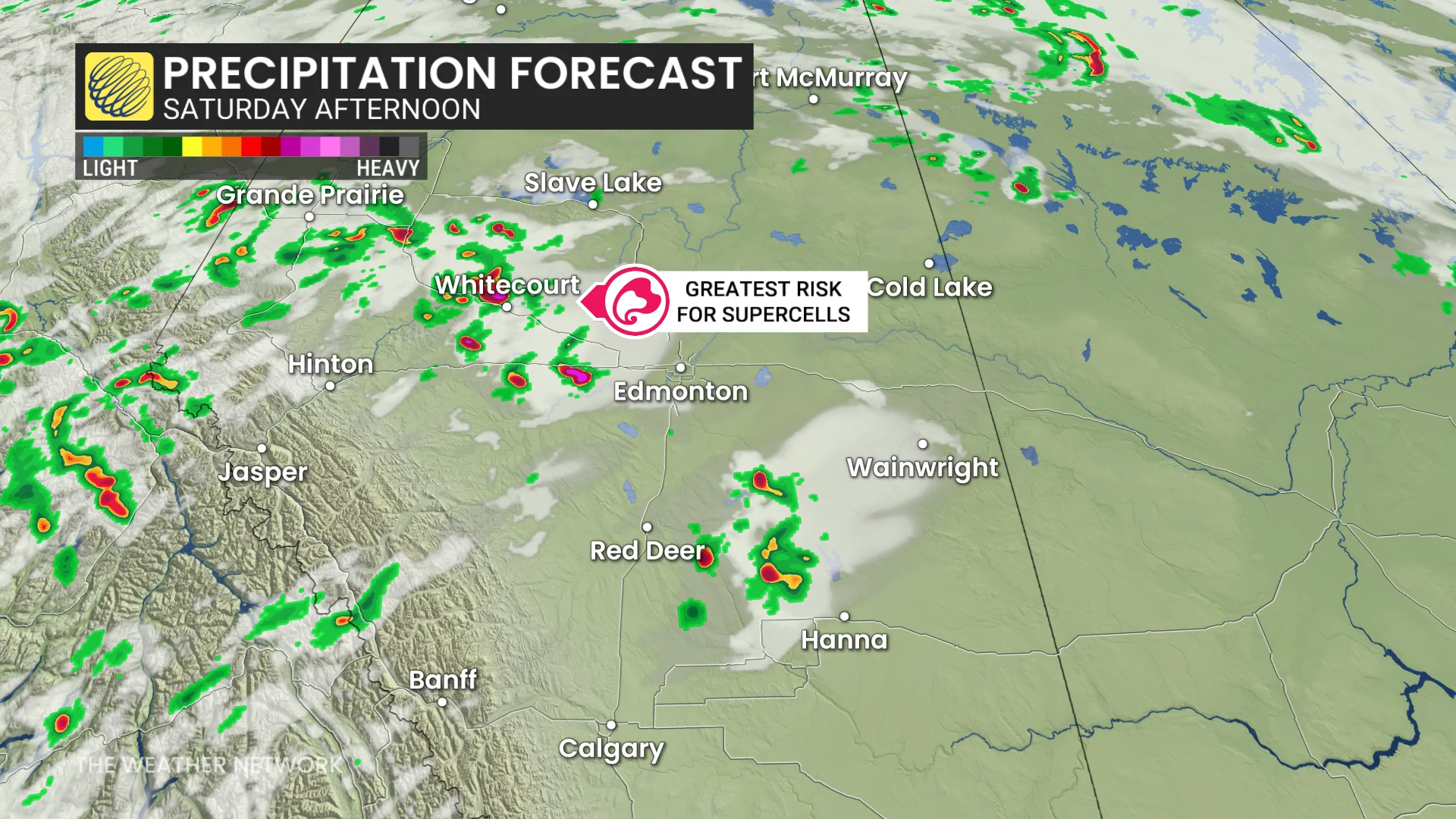
Moderate to high instability and strong wind shear will combine to afford the opportunity for thunderstorms to organize into supercells.
Expect these storms to develop in the mid-afternoon hours and sustain through Saturday evening.
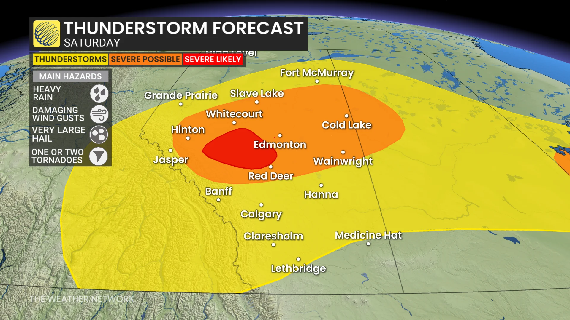
The main hazard with the strongest storms will be very large hail, possibly up to the size of golf balls. One or two tornadoes are also possible, especially west of Edmonton. Residents should also look out for damaging wind gusts and heavy rainfall.
However, wildfire smoke will act as a wildcard in Saturday’s storm development and how severe they’re able to grow. Smoke can suppress the development of severe thunderstorms.
Although a wind shift is expected to improve the smoky conditions to start the weekend, upper-level smoke will remain present and could serve to moderate the storm activity.
Farther south, very hot conditions into the 30s will linger into much of next week. The ridge responsible for these sizzling temperatures will act as a cap on the atmosphere, suppressing thunderstorm development on Saturday throughout much of southern Alberta.
Stay with The Weather Network for all the latest on conditions across Alberta.