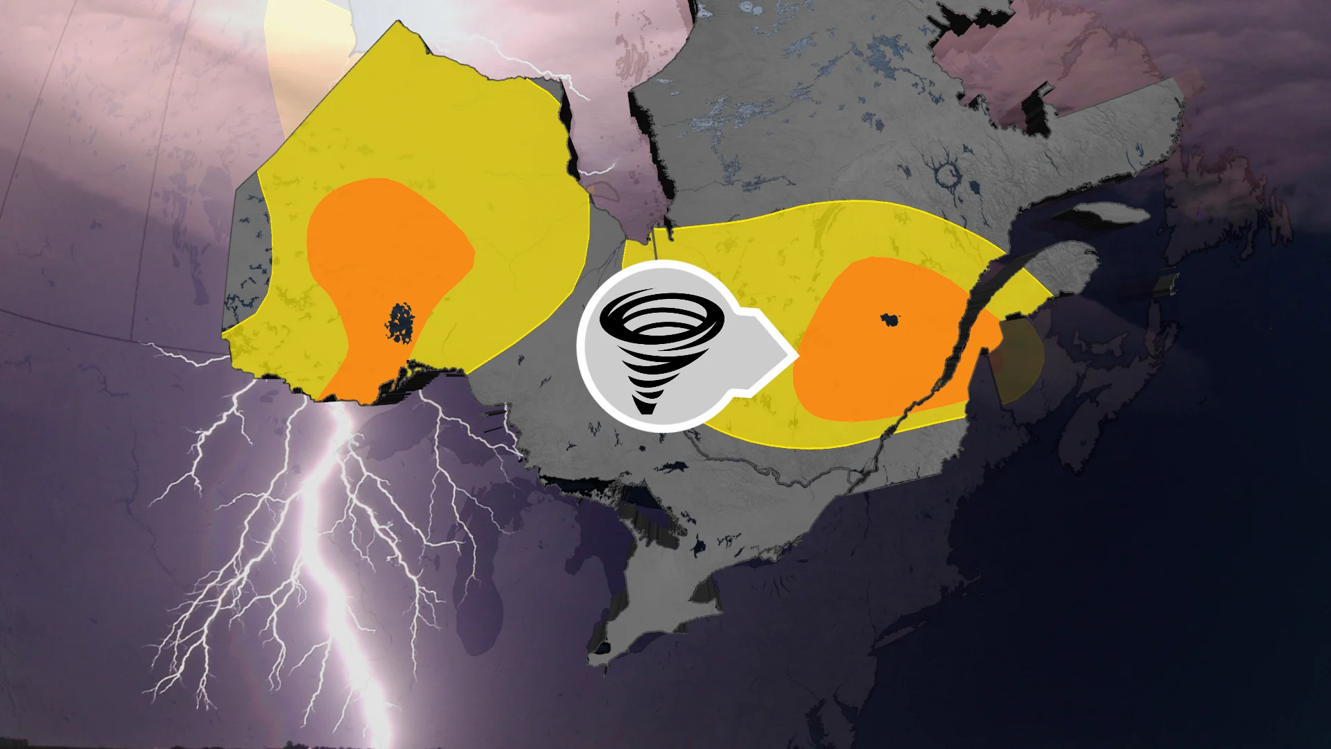
Severe storms, large hail threatens northwestern Ontario, Quebec

A severe thunderstorm risk will span across the two provinces to kick off the final week of May.
Summer weather is finally around the corner, and that means hotter temperatures and thunderstorms. The final week of May looks to kick off in northwestern Ontario and central Quebec on a thunderous note, as forecasters look at a severe thunderstorm risk that could bring large hail to some communities on Monday and Tuesday.
A ridge of high pressure parked over the Prairies will spill some summer-like heat into northwestern Ontario to start the week, which, in turn, will help to fuel thunderstorms as a low-pressure system sweeps eastward into Quebec.
SEE ALSO: Two tornadoes confirmed in Ontario after impactful severe storms
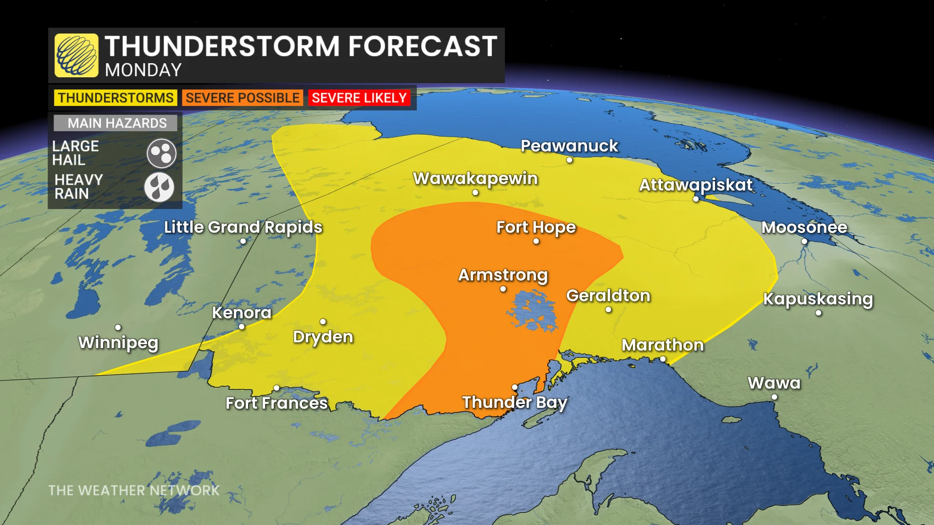
Large hail, winds threaten parts of northwestern Ontario Monday
As temperatures surge into the mid- to upper 20s, thunderstorms are forecast to develop in northwestern Ontario on Monday afternoon. Forecasters are also looking at a chance for a cluster of storms to become severe around Sandy Lake and Fort Hope, with large hail being the main threat.
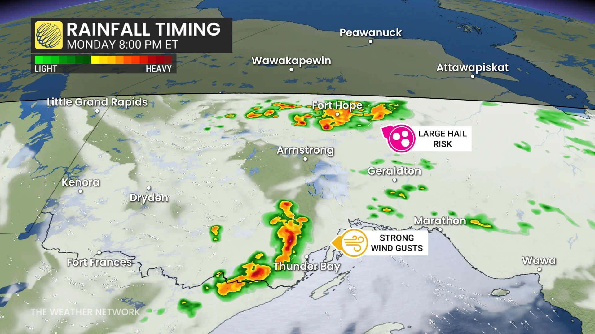
To the south, we could see a line of storms develop behind the system's cold front later in the afternoon and into the evening hour. The main areas at risk will be around Thunder Bay, where we could see damaging wind gusts.
Folks driving highways 11 and 71 should stay alert for sudden storms that could drop heavy rain and reduce visibility on the highway.
Severe storm risk moves into central Quebec Tuesday
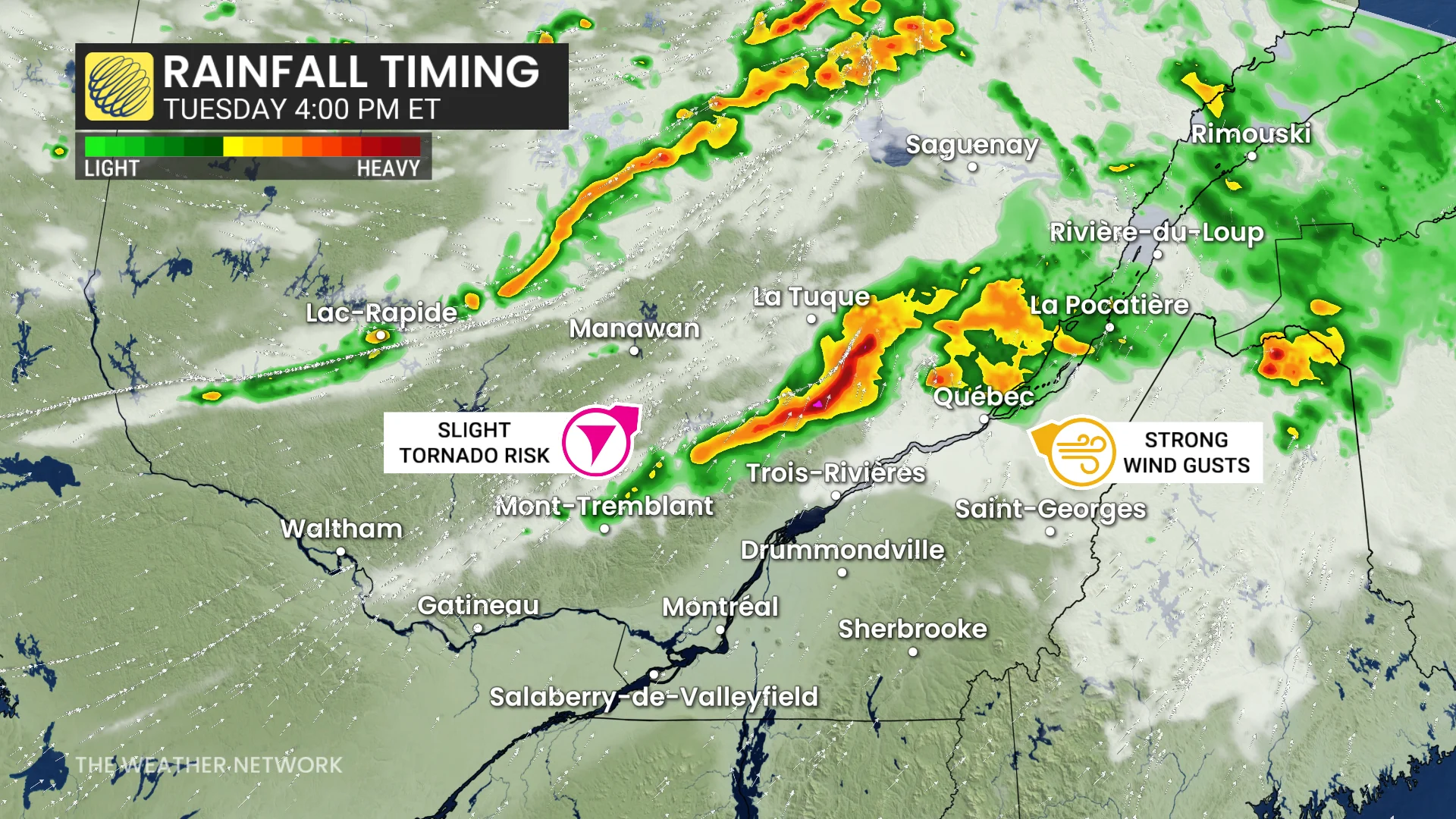
The same low-pressure system will track into central Quebec on Tuesday, triggering thunderstorms in the late afternoon as it moves through the Lac-Saint Jean and Saguenay areas. There is higher forecast confidence that these storms will reach severe limits.
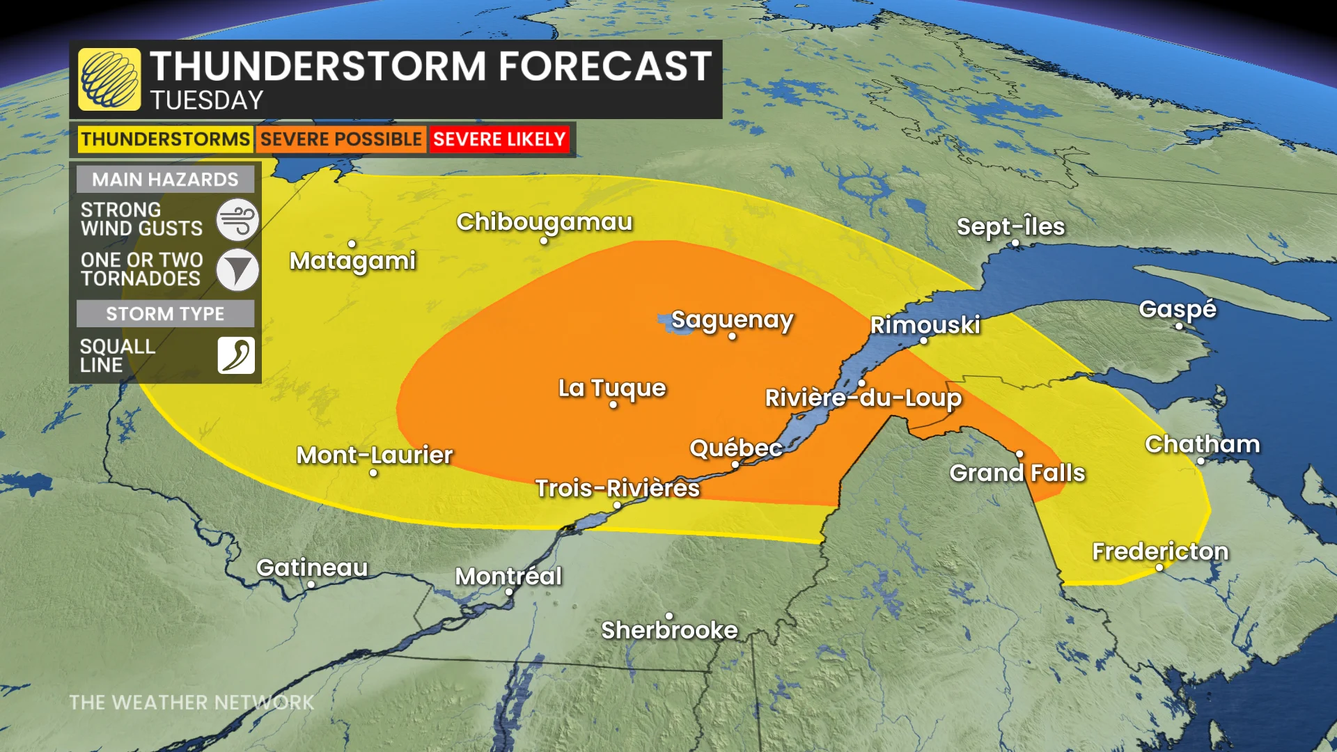
As the storms make their trek across northern Ontario, we could see them organize into a broken squall line, raising the risk of strong wind gusts. Folks may even get to see some shelf clouds as the storms approach.
DON'T MISS: Tornado season is underway in Canada. Here's what you need to know
High wind shear in the upper atmosphere will also bring a risk for some embedded rotation within the squall line. As such, the risk of a tornado cannot be ruled out.
Be sure to keep an eye out for local weather alerts and be aware of changing conditions as the storms roll in.
Stay with The Weather Network for more information and updates on your forecast for Ontario and Quebec.