Severe storm threat lingers over the Prairies after three confirmed tornadoes
After a stormy Tuesday in southern Manitoba, including three confirmed tornadoes, a threat for severe weather will pop up again on Wednesday, also extending into northwestern Ontario.
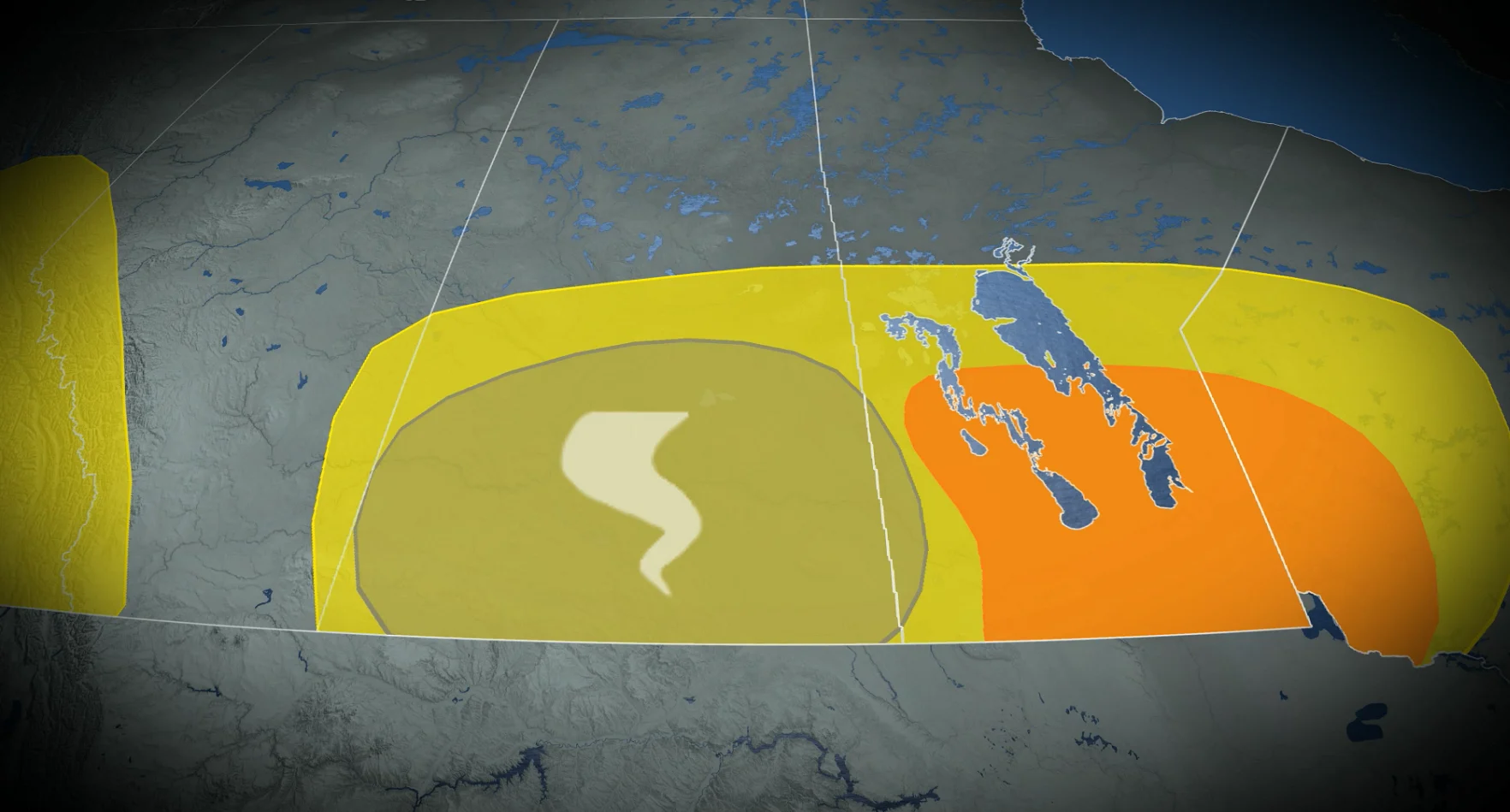
The Prairies have been a focal point for severe weather across Canada this week, highlighted by three confirmed tornadoes in southern Manitoba on Tuesday.
On Wednesday, the storm risk will reappear in southern Manitoba, though with reduced intensity, extending into northwestern Ontario. By Thursday, storm chances will expand and shift westward into parts of Alberta.
DON'T MISS: PHOTOS: Twin tornadoes, hail spotted in Manitoba amid volatile storms
Be sure to stay alert to the changing conditions and stay updated on any weather warnings in your area.
Thunderstorm risk continues for southern Manitoba Wednesday, shifts to Alberta Thursday
The slow-moving low pressure system over Manitoba on Wednesday will maintain the risk of severe thunderstorms through the afternoon. While conditions aren't as volatile as Tuesday, there is still a threat of large hail and strong winds.

Disorganized storms are expected to develop in south-central Manitoba by early afternoon, intensifying by late afternoon and evening. Overnight, heavy rain and frequent lightning are likely as the storms move east of Winnipeg into northwestern Ontario.

DON'T MISS: Funnel cloud vs. tornado - what's the difference?
In southern Saskatchewan, the interaction between the surface low and an upper-level low may increase atmospheric spin, creating a chance for funnel clouds or even a landspout on Wednesday. In Alberta, non-severe thunderstorms are possible in the Rockies and foothills.
By Thursday, thunderstorm activity will become more widespread in the province as an upper-level trough moves in and a surface low forms east of the Rockies, providing the necessary trigger.

Most storms are expected to remain non-severe as conditions are less favourable for intense storm development.