Severe storm risk, flooding rains threaten southern Ontario Saturday
Heavy rains and thunderstorms may disrupt your outdoor plans this long weekend.
One down, one to go. A second Colorado low tracking into the Great Lakes region will bring a renewed opportunity for heavy rainfall and thunderstorms to begin the weekend.
A few of the storms on Saturday could turn severe. Watch out for warnings and rapidly changing conditions in your area.
DON'T MISS: Will Canada's April bring a summer preview or a winter rewind?
Weather Highlights
Widespread rainfall warnings are in effect to start the weekend
Thunderstorms may turn severe in spots through Saturday afternoon and evening
Wintry conditions spread into the region again by Sunday
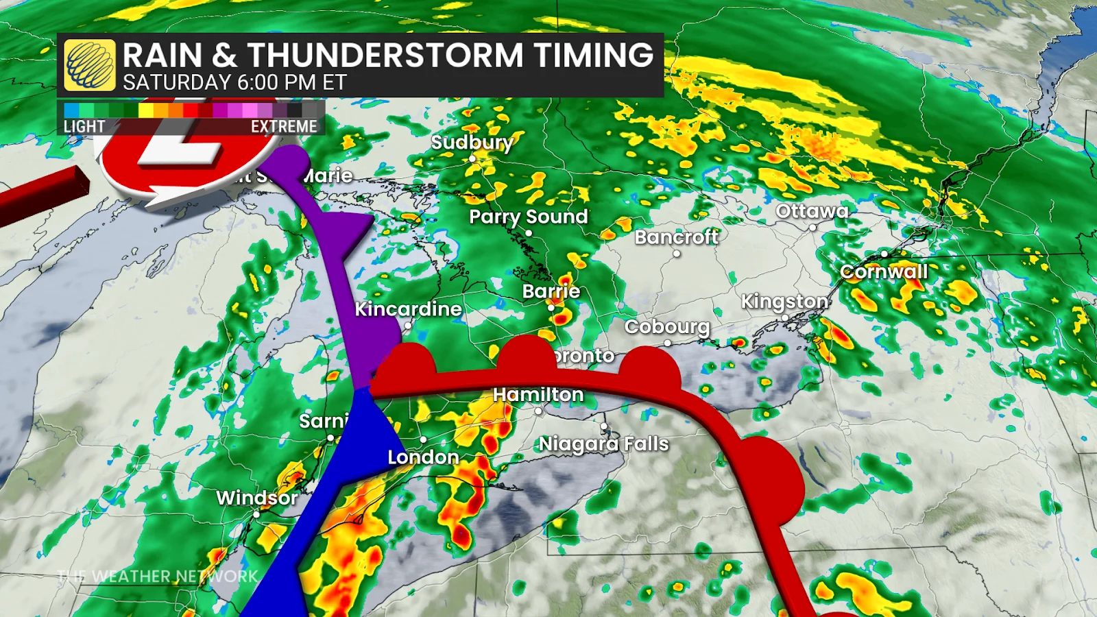
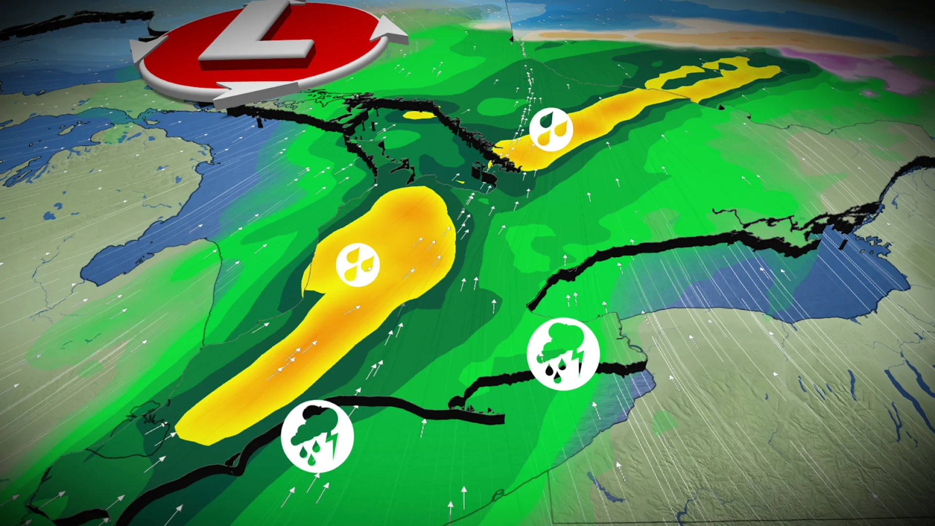
Heavy rainfall, severe storm risk arrives Saturday
Rainfall began to spill across southern Ontario early Saturday morning as the low-pressure system moved into the region. Chilly easterly winds off Lake Ontario will keep much of the province, including the Greater Toronto Area (GTA), in the single digits throughout the day. Warm air pushing in from the south, however, will make for some hot spots in the southwest.
RELATED: How Colorado lows and Texas lows affect our weather in Canada
A cold front approaching through the afternoon/evening hours will trigger another round of thunderstorms. There is the risk of some severe storms to develop across the southwest and along the Golden Horseshoe, including the GTA, as unstable air aloft mixes with the chilly surface air.

The main threats from any severe storms will be heavy rain, strong wind gusts, and small hail. There is also a chance for some isolated storms to have a bit of rotation, although the tornado risk will remain low.
Rainfall warnings remain in effect through Saturday as an additional 10-30 mm of rain is on the way. Locally higher totals may fall in thunderstorms. The combination of heavy rainfall and saturated ground may increase the flood risk in some areas. The Grand River Conservation Authority issued a flood watch for the entire watershed on Friday as a result.
Things will change in a hurry behind this cold front. Temperatures will tumble back into the single digits by Sunday, with the chance for a wintry mix spreading across southern Ontario.