Severe storm risk pops up again Friday across Ontario, Quebec

Scattered showers and thunderstorms will continue rolling over Ontario through Friday morning. A renewed risk for severe storms will pop up Friday afternoon.
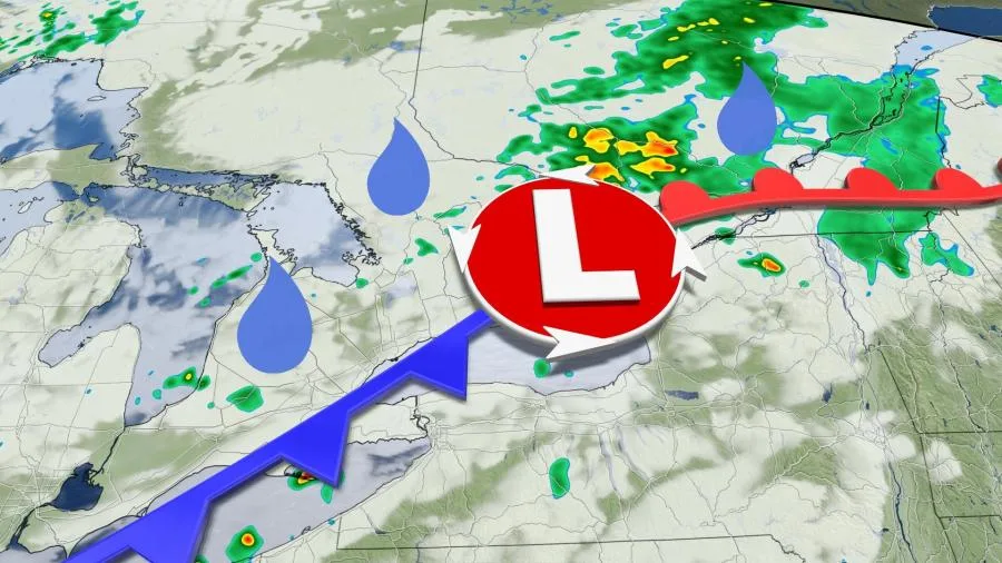
We saw some rough weather across southern Ontario on Thursday as a low-pressure system slid across the area. Hefty thunderstorms produced torrential downpours and even prompted a tornado warning near Milton during the afternoon hours. This system isn’t done with the region just yet.
PLAN AHEAD: The top waterproof backpacks for students of all ages
Friday will see another risk for stormy weather from Windsor to the St. Lawrence as the low-pressure system responsible for the foul conditions makes its way east.
Rain and storms are likely to continue overnight Thursday in southern Ontario, pushing into the National Capital Region in time for the Friday morning commute. Rain will move into the Montreal area later in the morning.
The day’s instability will see a renewed chance for thunderstorms to develop over the region by the afternoon hours.

Plenty of tropical moisture streaming over Central Canada will lead to a continued risk for heavy rain in any storms on Friday.
MUST SEE: Watch this otherworldly cloud roll over the Rock of Gibraltar
These storms should move a little faster than those we saw on Thursday, though, cutting down on the risk for localized flooding. Even so, stay aware of hazardous conditions and make alternate travel plans in case you encounter flooded roads.

In addition to heavy rainfall, some severe storms are possible across portions of eastern Ontario, the Montreal metro, and the Eastern Townships as we head into the afternoon and evening hours.
Any of these stronger storms could produce strong wind gusts and small hail.
WATCH: Storm chaser recalls tracking supercell storms in southern Ontario
Things are looking up once this system clears the region. Abundant sunshine, seasonable temperatures, and lower humidity will bathe the two provinces heading into this final weekend of August.
Saturday looks to be the winning day for Ontario and Quebec, with daytime high temperatures in the low- to mid-20s and comfortable humidity levels.

The warmth and moisture will start to push in by Sunday, but conditions will still remain pleasant compared to what things could feel like at the end of August.
Hot and humid conditions will build back early next week, bringing with it a chance for scattered thunderstorms.
A cold front will arrive by the middle of next week, and forecasters are watching the potential for cooler-than-seasonal temperatures heading into the first few days of September.
Check back frequently for the latest on conditions across Ontario and Quebec.