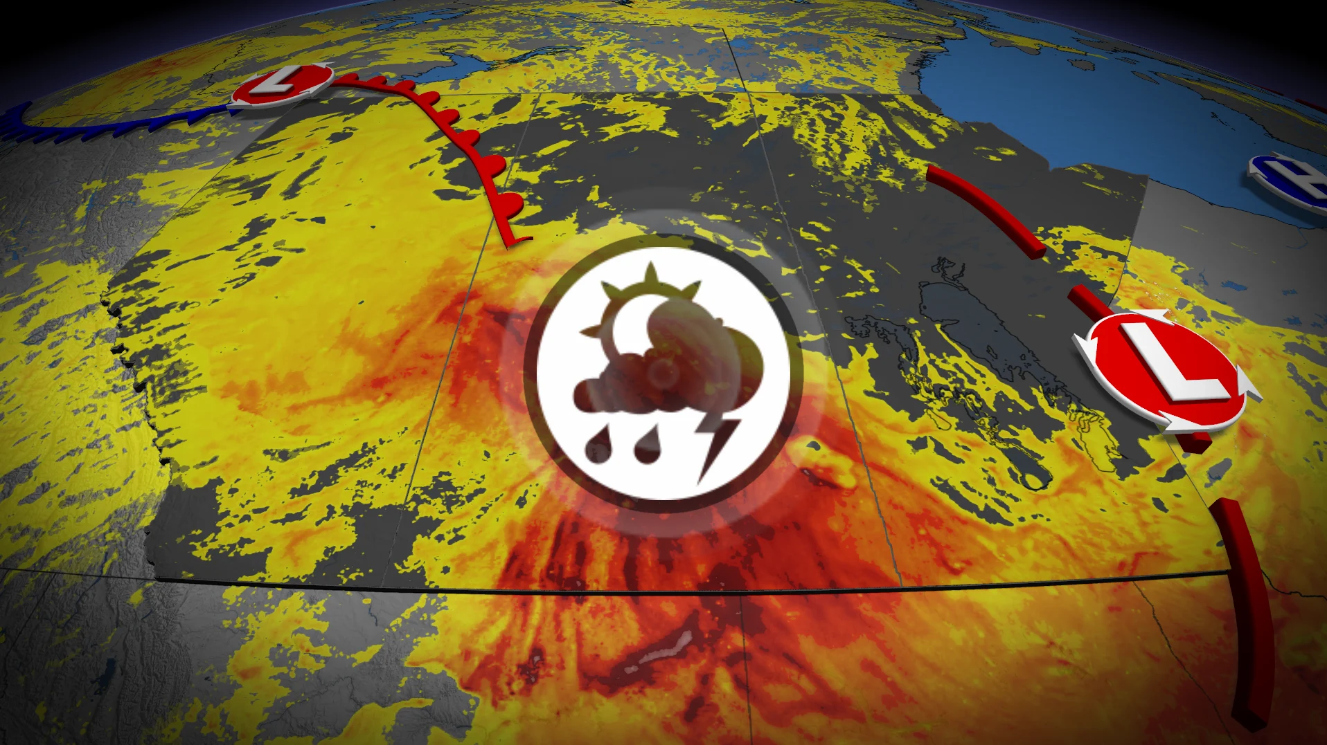
Severe storm potential reignites on the Prairies with setup in place

Another day of severe storm potential is forecast for parts of the Prairies and northwestern Ontario on Sunday, so make sure to stay weather-aware and have a plan in case of threatening weather
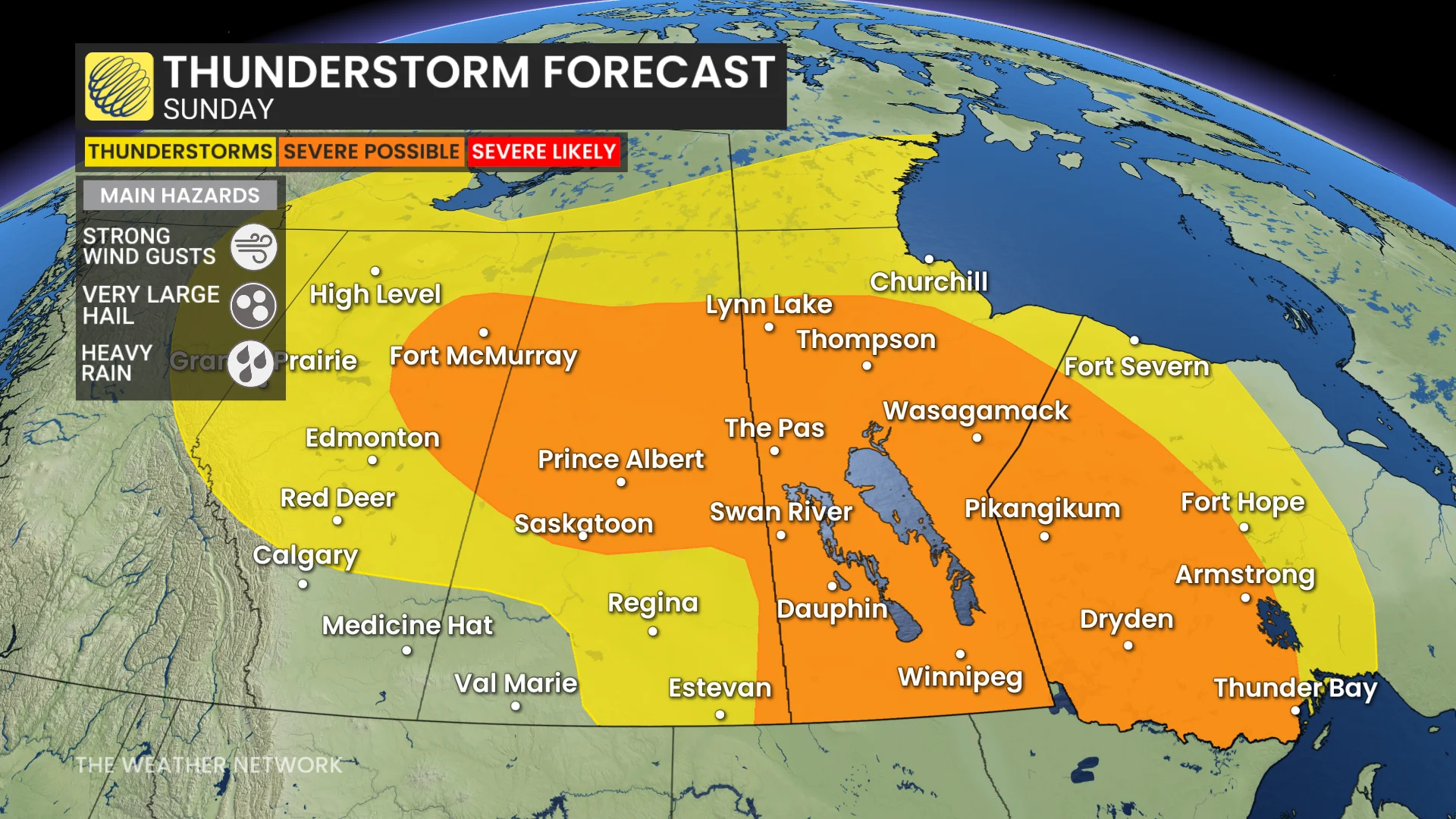
After a tornado was confirmed west of Rocky Mountain House on Saturday evening, the Prairies will see a renewed threat for severe weather on Sunday, stretching into northwestern Ontario.
The main hazards will be large hail, damaging wind gusts and heavy downpours. But there will also be a potential for funnel clouds along the Alberta-Saskatchewan border and a tornadic threat in southern Manitoba in the late-evening hours, depending on a cap in place.
SEE ALSO: Tornado causes 'significant damage' to parts of west-central Alberta county
Please keep up with the latest watches and warnings in your area. Take immediate action if a severe thunderstorm or tornado warning is issued for your location.
Sunday severe weather risk pops up again across the Prairies
Ingredients are forecast to come together again on Sunday for severe weather on the Prairies and northwestern Ontario.
Severe storms will be possible from the Rockies through northwestern Ontario.
DON'T MISS: Showering during a thunderstorm: Risky business or just a myth?
A trough moves across the Prairie provinces, bringing instability and high storm energy--more so in eastern sections.
High, atmospheric moisture is associated with low-pressure system, so heavy downpours are to be expected with the storms.
A funnel cloud risk exists along the Alberta-Saskatchewan border as cold air aloft over the surface low creates spin.
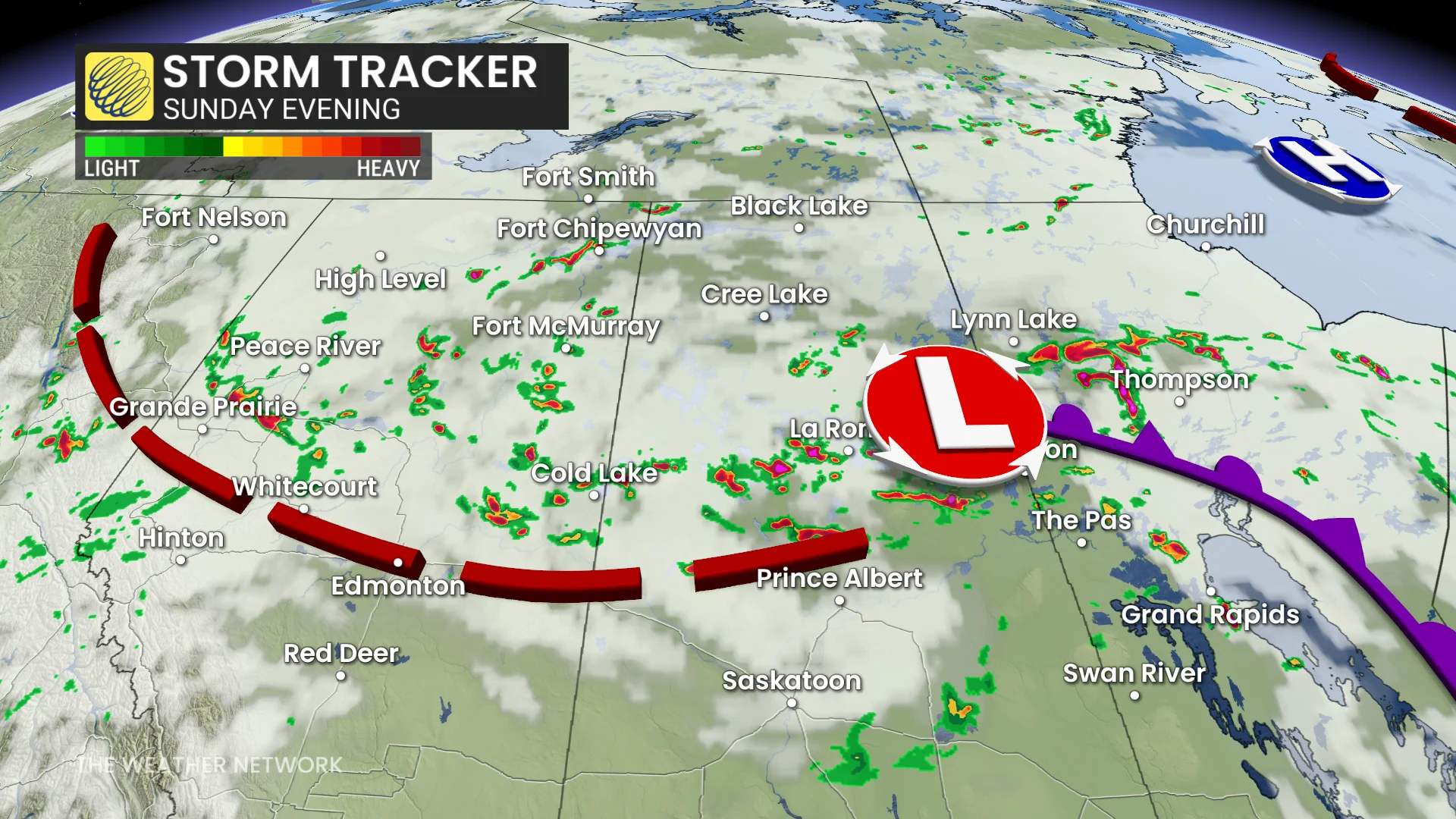
Widespread, potent winds will also be associated with the low and the subsequent trough in its wake.
Alberta through Saskatchewan, isolated, non-severe storms are most likely. That swath is primarily north of the Yellowhead Highway.
On Sunday night, strong storms will be possible from southern Manitoba into northwestern Ontario.
A tornadic threat will be place in southern Manitoba through the late-evening hours.
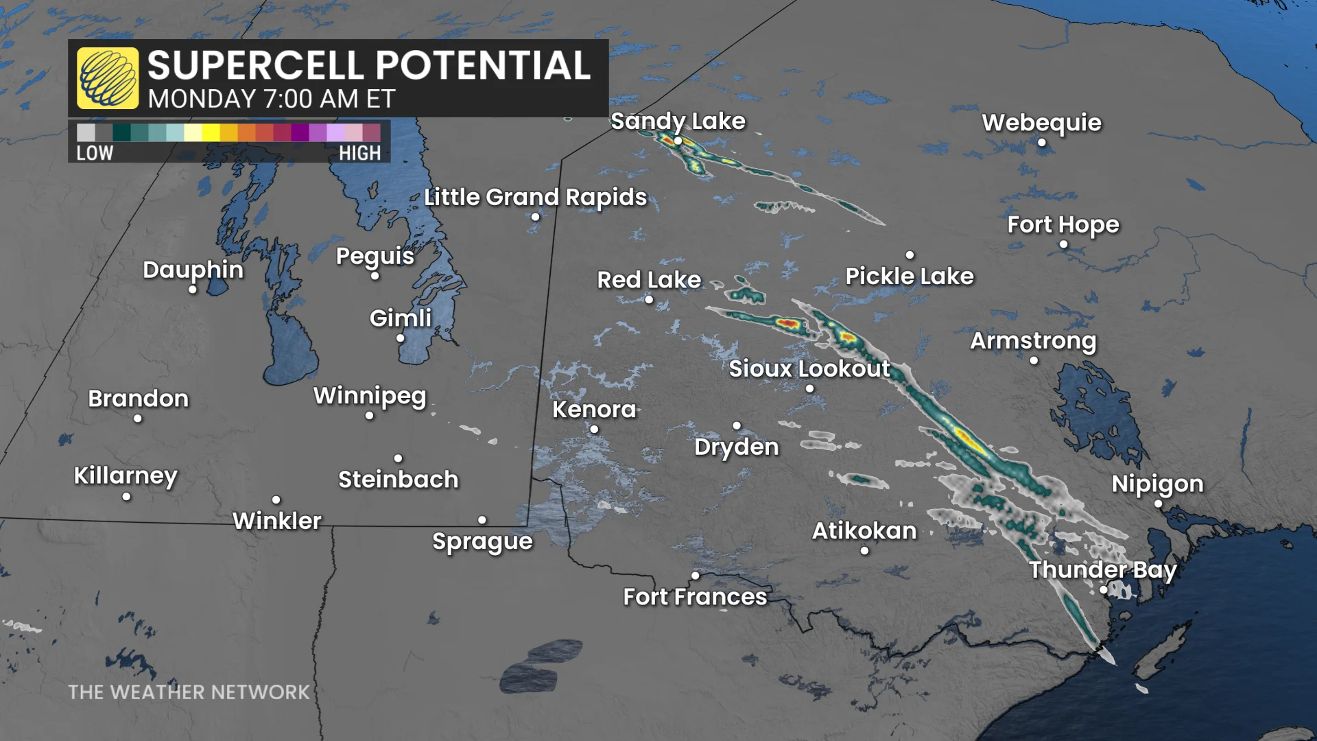
There will be a cap in place, but if it breaks, storms will turn severe.
The aforementioned regions are where the supercell potential lies.
Also, frequent lightning could ignite new fires in northwestern Ontario, a region that has hundreds of active blazes. But the good news will be the widespread rain in northern sections, a benefactor to help quell some of the wildfires.
Stay with The Weather Network for the latest on your weather across the Prairies and northwestern Ontario.