Severe, damaging storms possible in Ontario as humidex rises
Ontario is heating up on Tuesday, with a severe weather potential that could boom or bust in the Greater Toronto and Hamilton Area (GTHA), and other locales in the province
Residents in northern and southern Ontario will need to stay alert Tuesday.
A couple of rounds of thunderstorms are in the cards through the day and night on Tuesday across different portions of Ontario.
DON'T MISS: How the atmosphere bakes a perfect thunderstorm
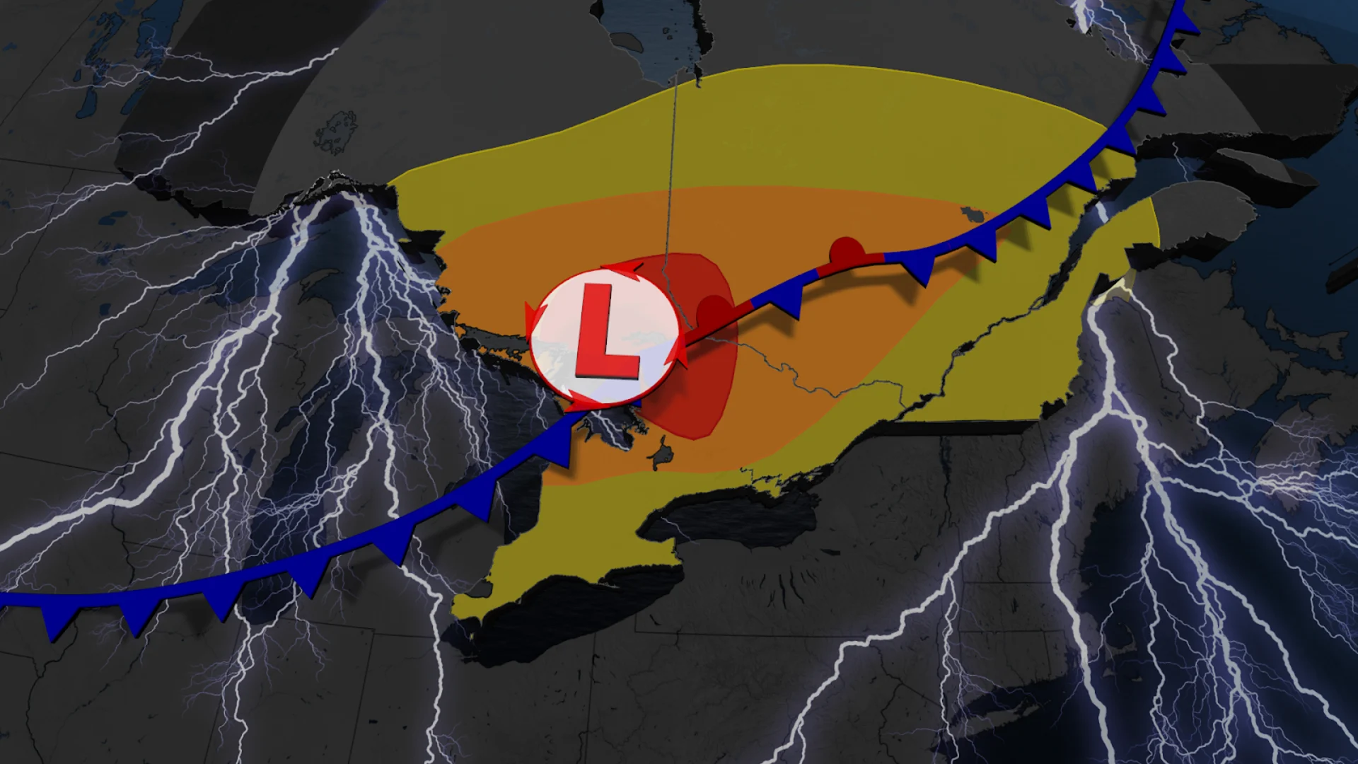
A widespread risk of thunderstorms will include a severe chance that stretches from extreme southwestern Ontario to northeastern sections along the Quebec border. The main hazards will include torrential rainfall, with localized flooding a concern for some, large hail and strong wind gusts.
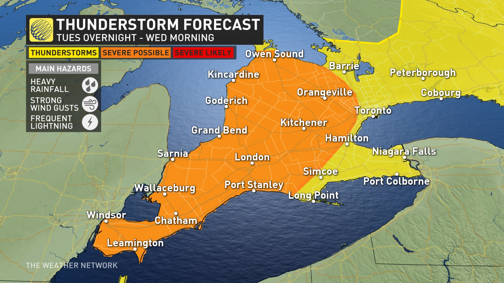
The potential for stormy weather will linger through the overnight period in southern Ontario, so it is important to keep an eye on the radar in your area, and stay alert for watches and warnings that may be issued on Tuesday.
Severe storms likely throughout northeastern Ontario Tuesday
A trough is interacting with a humid environment in Ontario, leading to the risk of thunderstorms. A line of thunderstorms will first move through northeastern Ontario and into southern Quebec through Tuesday's afternoon hours.
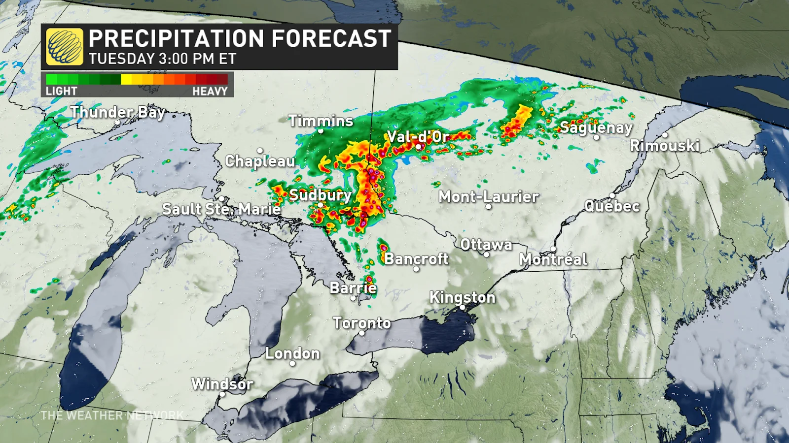
A cluster of storms will first reach the Greater Sudbury Area around the lunch hour before tracking eastward through the afternoon and early evening. A line of storms from this cluster will also extend into southern Quebec.
The strongest storms are expected to be around North Bay and Algonquin during the afternoon and early evening hours.
Main threats include torrential rains and localized flooding, as we could see 30-50+ mm of rain falling over areas impacted by thunderstorms, large hail and strong, potentially damaging, wind gusts of 80-90+ km/h. There will be a risk of localized power outages.
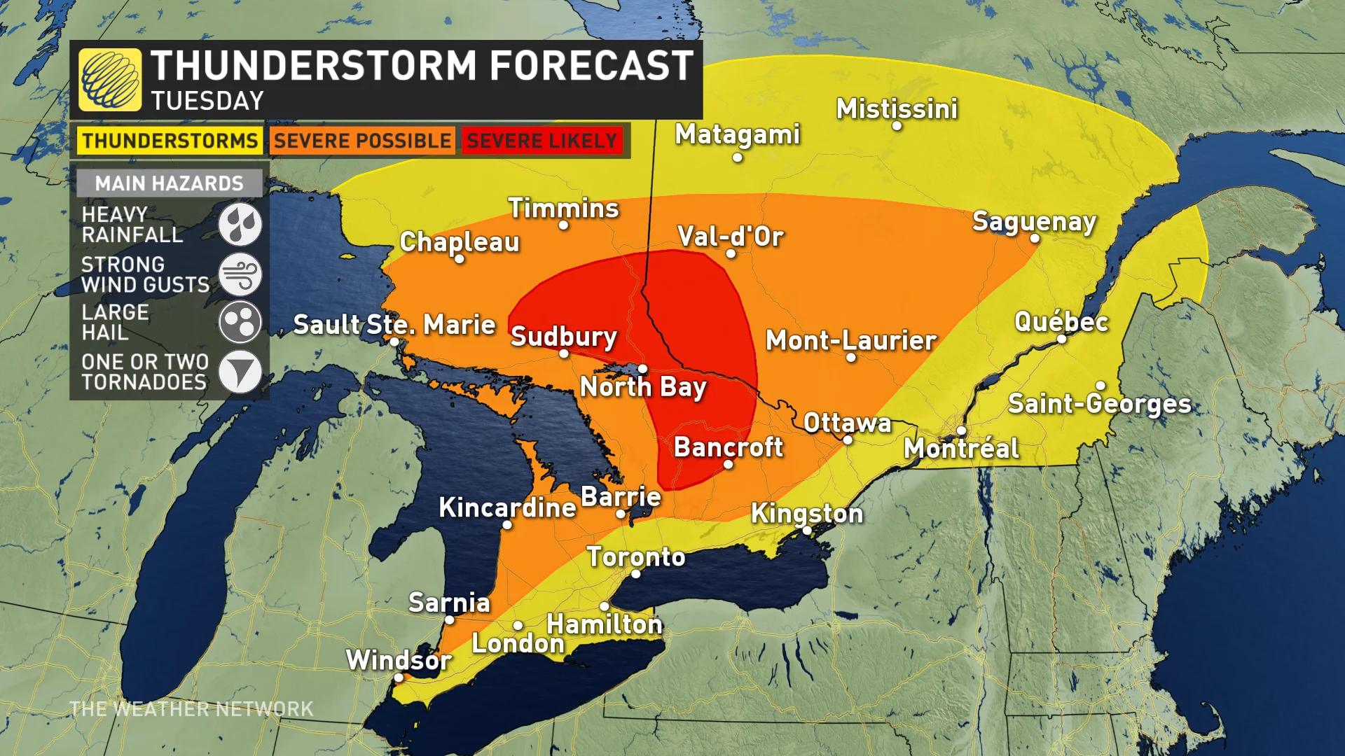
Ingredients will also come together for there to be a tornado risk, especially around Cottage Country and the Georgian Bay area.
The good news is that the storms are not expected to train repeatedly over the same locations, with the setup working to limit significant flood threats.
Muggy air and storm risk sink across southern Ontario later Tuesday
Folks across southern Ontario will spend much of the day marinating in a warm sector with uncomfortably high humidity. Temperatures will be feeling like the high-30s to low-40s before triggering thunderstorms in the late-afternoon hours. Storms will likely be quite scattered, with many locations missing out on the first round.
The severity of the storms will largely depend on the morning cloud cover. If the sunshine is able to break through the clouds, we will see more surface heating and, therefore, stronger storms.
Southern Ontarians could also be hearing some rumbles of thunder overnight as another round of active weather enters the region.
RELATED: Why nocturnal thunderstorms can be particularly dangerous
Southern Ontarians could also be hearing some rumbles of thunder overnight as another round of active weather enters the region.
How severe these storms are will depend on timing and what environment is left after the initial trigger. Additional adjustments to the risk will likely be required as we gain confidence in the evolution of the system.
Stay with The Weather Network for more forecast information and updates on your weather in Ontario.