Setup for flooding rising in parts of southern Ontario with storm risk
Southern Ontarians will need to be weather-aware Tuesday as a risk of slow-moving thunderstorms and heavy rainfall brings an elevated chance of flooding.
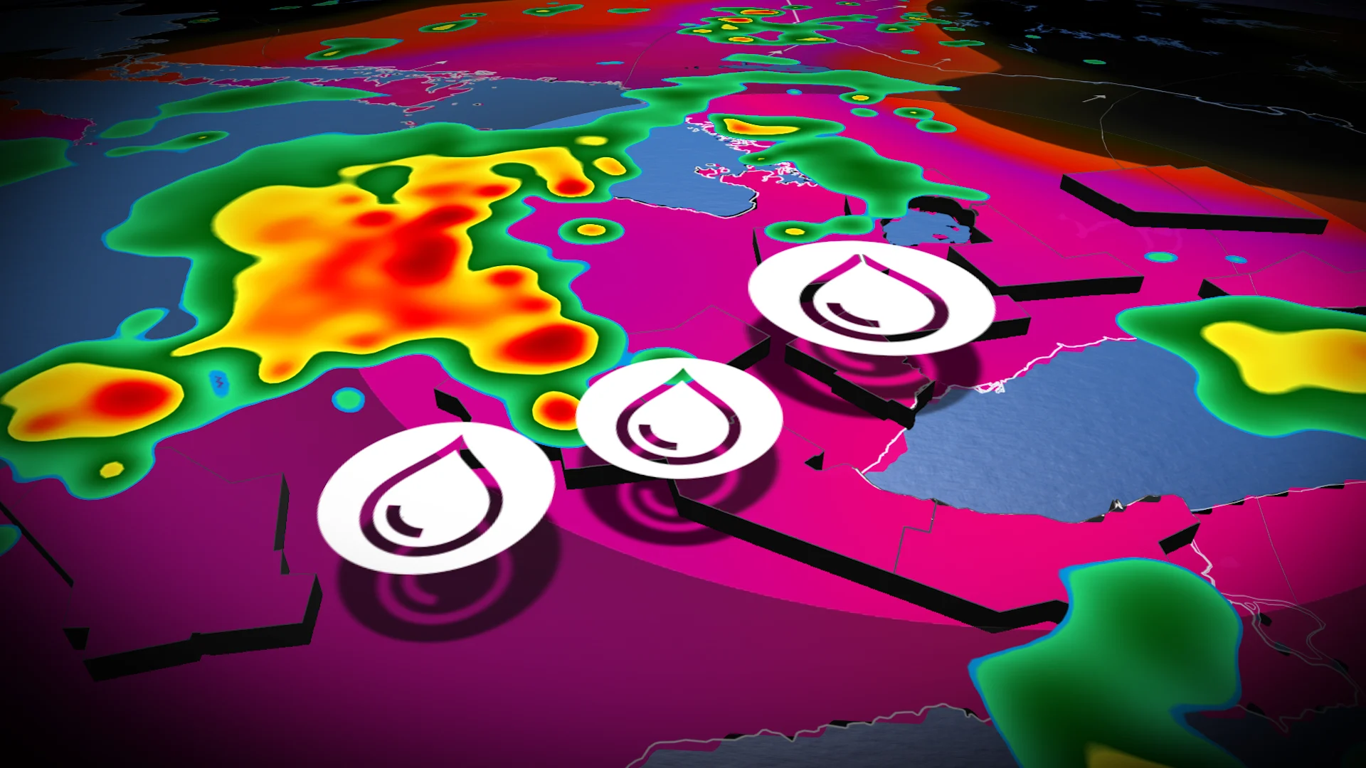
Flooding concerns have arisen in southern Ontario again due to the favourable weather setup that is taking shape on Tuesday.
The atmosphere will be primed with high amounts of moisture, with a low-pressure system in place, so the ingredients are aligning to bring a soaking and thunderstorms to southern Ontario on Tuesday –– elevating the risk of localized flooding.
SEE ALSO: Could the cost of Toronto's recent, major flood match the 2013 event?
The timing of the rainfall may be poor, potentially affecting the evening commute.
Be sure to regularly check for watches and warnings in Ontario as conditions can change quickly when severe weather hits.
Tuesday sees an renewed opportunity for flooding amid new round of heavy rainfall
A weakening low-pressure system will sit over southern Ontario, possibly leading to rounds of intense rainfall.

Precipitation begins Tuesday morning near Lake Erie, with thunderstorms possible, too. Additional rounds of thunderstorms are expected through the afternoon and evening in southern Ontario.
Very high moisture in the atmosphere will be present to drop heavy to torrential downpours, with amounts as high as 10-20+ mm falling in an hour.
The storms will be slow-moving due to a lack of atmospheric forcing. So, well-saturated storms result in very high rainfall totals over narrow locations.

The weather wild card are lake breeze-initiated storms. If they can form, it will likely impact the Greater Toronto Area (GTA) but there is uncertainty.
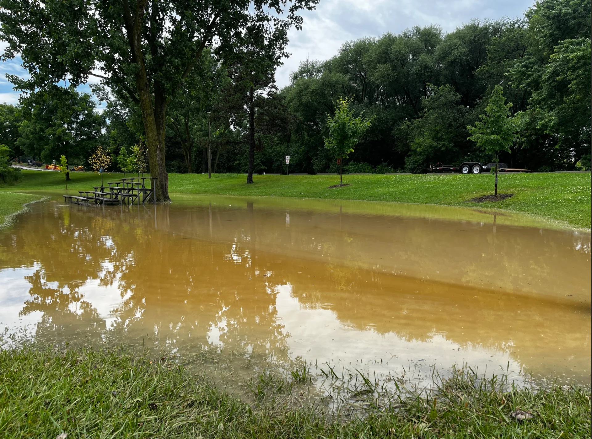
It’s likely Toronto records its rainiest month on record as of Tuesday, as less than six mm of rainfall is needed at Pearson International Airport to bring the monthly total higher than October 1954, when 213.8 mm of precipitation fell with impacts from Hurricane Hazel.

It will not take much to see flood impacts in the GTA. Last week's storm dumped just 30 mm of rain but prompted DVP flooding and Lake Shore Road closures.
The timing is uncertain and it may result in travel delays for those commuting around the dinner hour or passed that.
Flooding, especially over urban areas are possible but over a localized regions.

Localized flooding is near certain, but exact location is unsure. It will depend on where storms initiate. With the lack of strong steering or forcing, it is changeable.
There is a higher chance for heavy rain and flooding north of the GTA and 401 corridor, affecting areas such as Barrie and the Lake Huron shorelines.
DON'T MISS: Move over Prairies; Ontario is now Canada’s tornado 'hot spot'
A fickle lake breeze setup may favour the Golden Horseshoe, but stay tuned to The Weather Network for the latest forecast updates.
Flood safety
There are a number of things you can do at or away from the home to avoid damage and injury during a flood, or if there is a risk of it occurring.
At home, this can include:
Sealing your basement to prevent water from seeping into creeks
Raising electrical system components as high as possible
Making sure your sump pumps are working properly
If a big storm is coming, consider stocking up on supplies, like: sandbags, plywood, plastic sheeting and shovels
(Tyler Hamilton/The Weather Network)
RELATED: What you can do to recuperate following a flood
If you can, arrange to leave your car in a high-elevation area, and avoid driving in flooded areas at all costs.
Streams, creeks and low-lying areas should be avoided. Flash flooding can happen in a matter of minutes during, or shortly after, a major rain event.
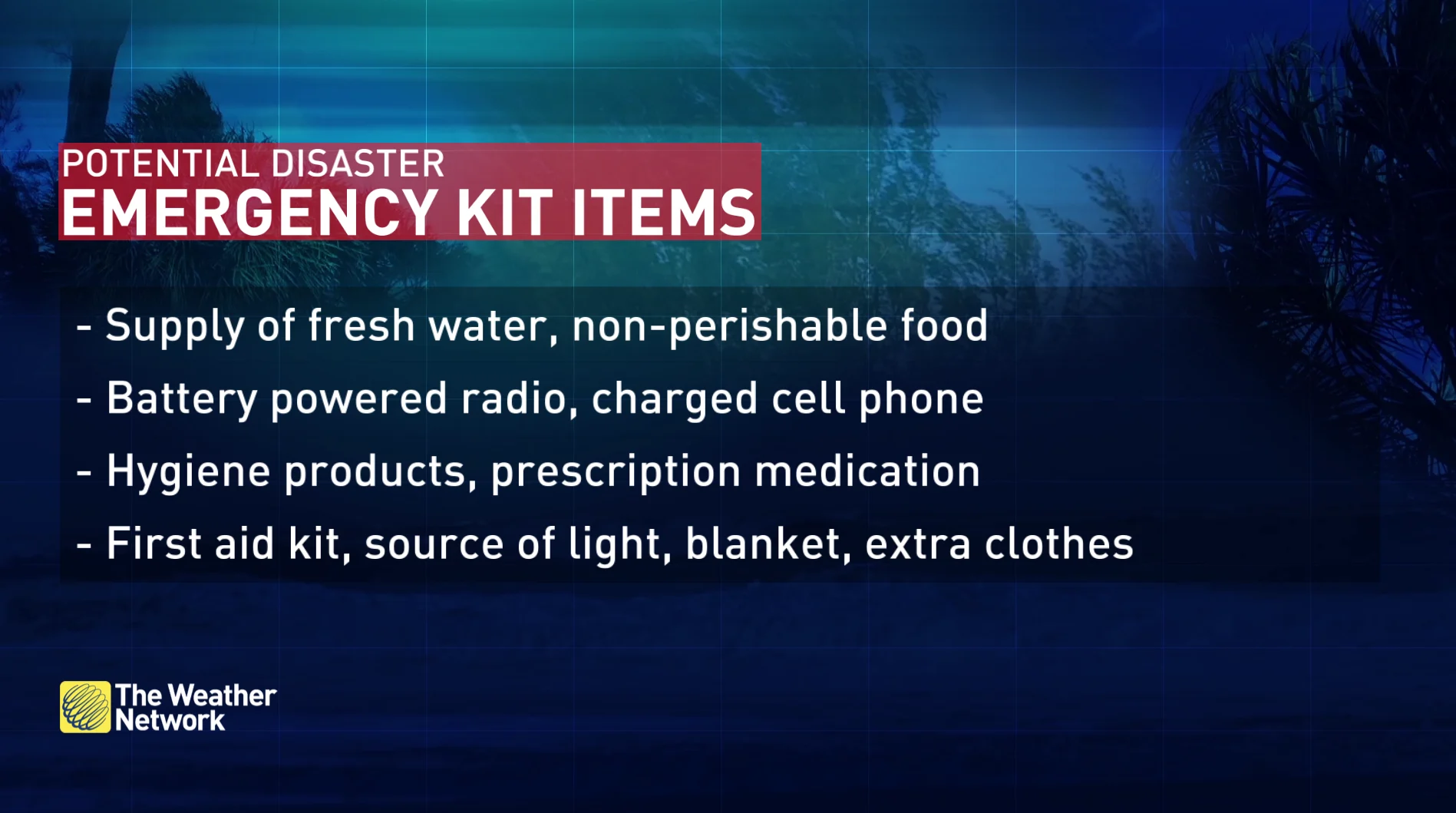
Make sure you have an emergency kit. Stock up on bottled water, canned food, blankets and first aid supplies. Make sure medication is topped off and kept in an elevated, dry place.
DON'T MISS: Everyone needs a home emergency kit. Here's what to stock yours with
Monitor The Weather Network's app or TV channel, and pay attention to local announcements for flood updates and watches.
If you are forced to leave your home due to an evacuation, be aware of which roads are safe to drive on. If your area has been evacuated, do not return home until authorities have allowed you to do so.
WATCH BELOW: What to do if a tornado warning occurs while in an apartment
Thumbnail courtesy of Cynthia McLeod/X.
Stay with The Weather Network for more forecast information and updates on your weather in Ontario and Quebec.