Season's first snow could hit some major cities this Thanksgiving

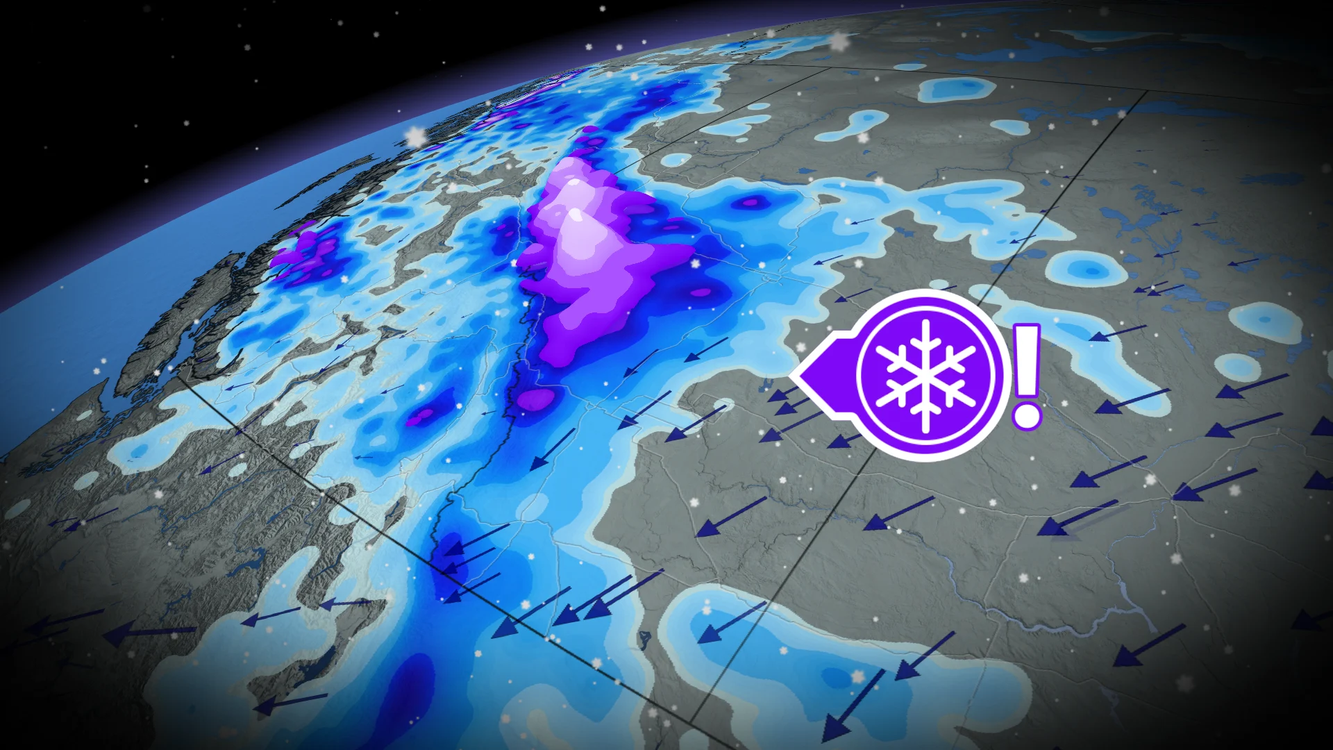
A major cooldown sweeping Western Canada is set to bring the season's first snow to several areas. Track the forecast as rain transitions to snow from Friday through the weekend
Thanksgiving weekend is set to bring snow to parts of Western Canada as a significant weather pattern change ushers in much colder temperatures and the chance for the season’s first snowfall.
DON'T MISS: First blizzard warning of the season for major Canadian highway
A strong trough of cold Arctic air will move into the region, leading to a drop in temperatures near or below 0°C across Alberta on Saturday and Sunday mornings.
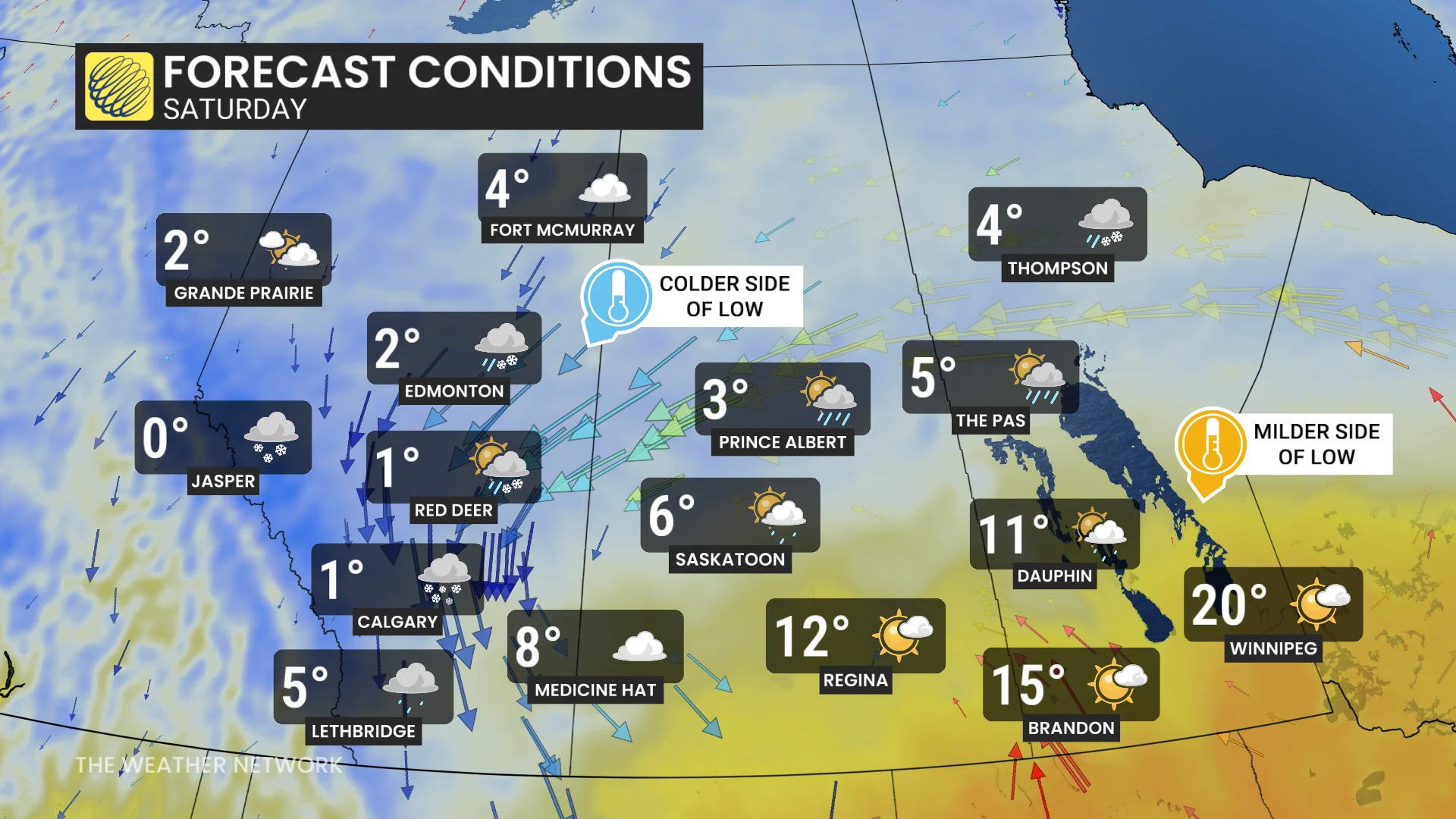
Saskatchewan sits on the boundary, while southern Manitoba remains more mild.
Rain transitions to snow by Friday morning
As the cold air interacts with warmer air to the south, a storm system will take shape in central Alberta.
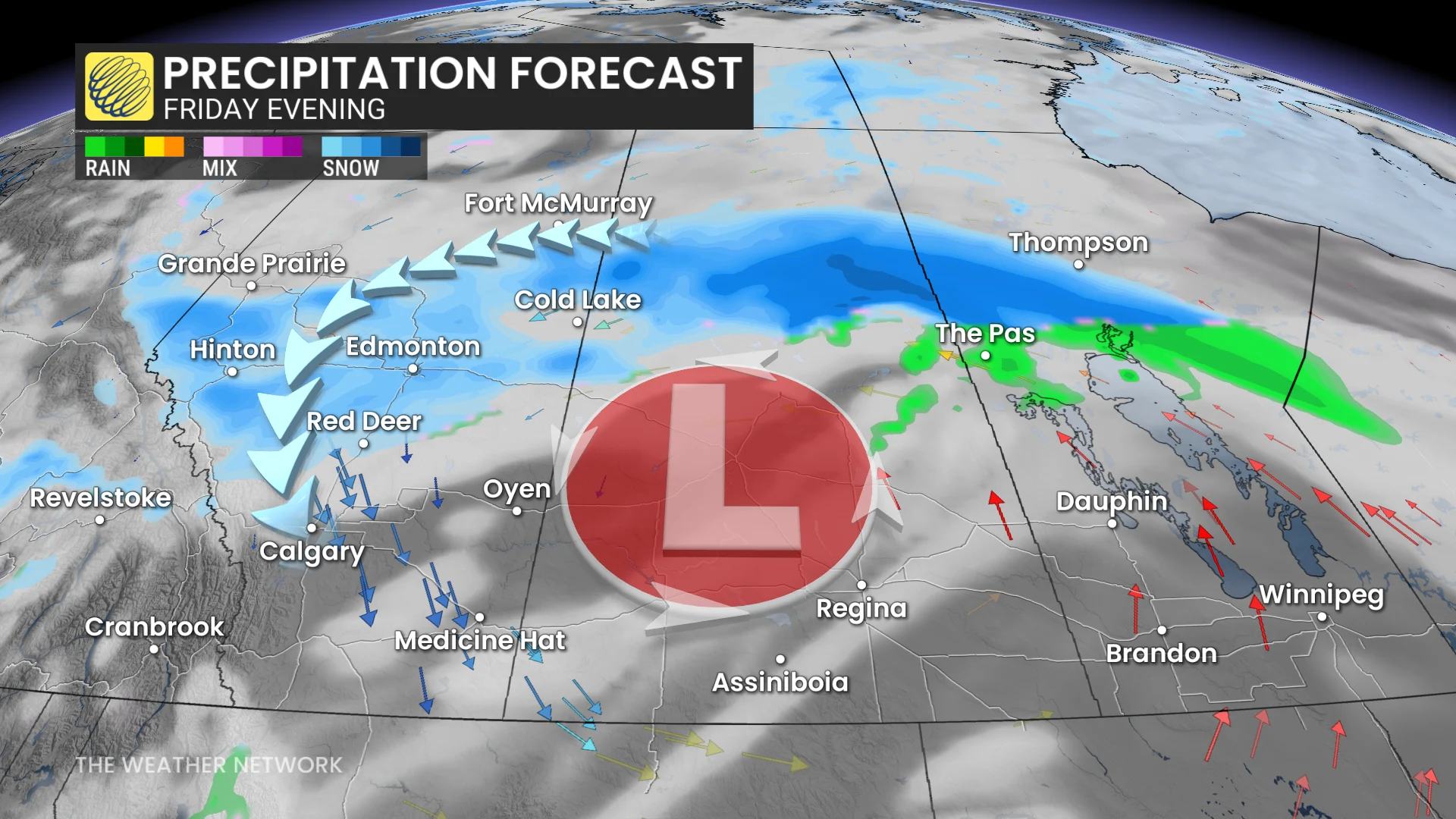
Starting Friday morning, rain is expected to transition to snow as temperatures fall, with areas from Hinton to Grande Prairie and into northern Saskatchewan seeing the first impacts.
Flurries will likely spread toward Edmonton and Red Deer Friday evening, and there is a chance for wraparound snow in Calgary by Saturday morning.
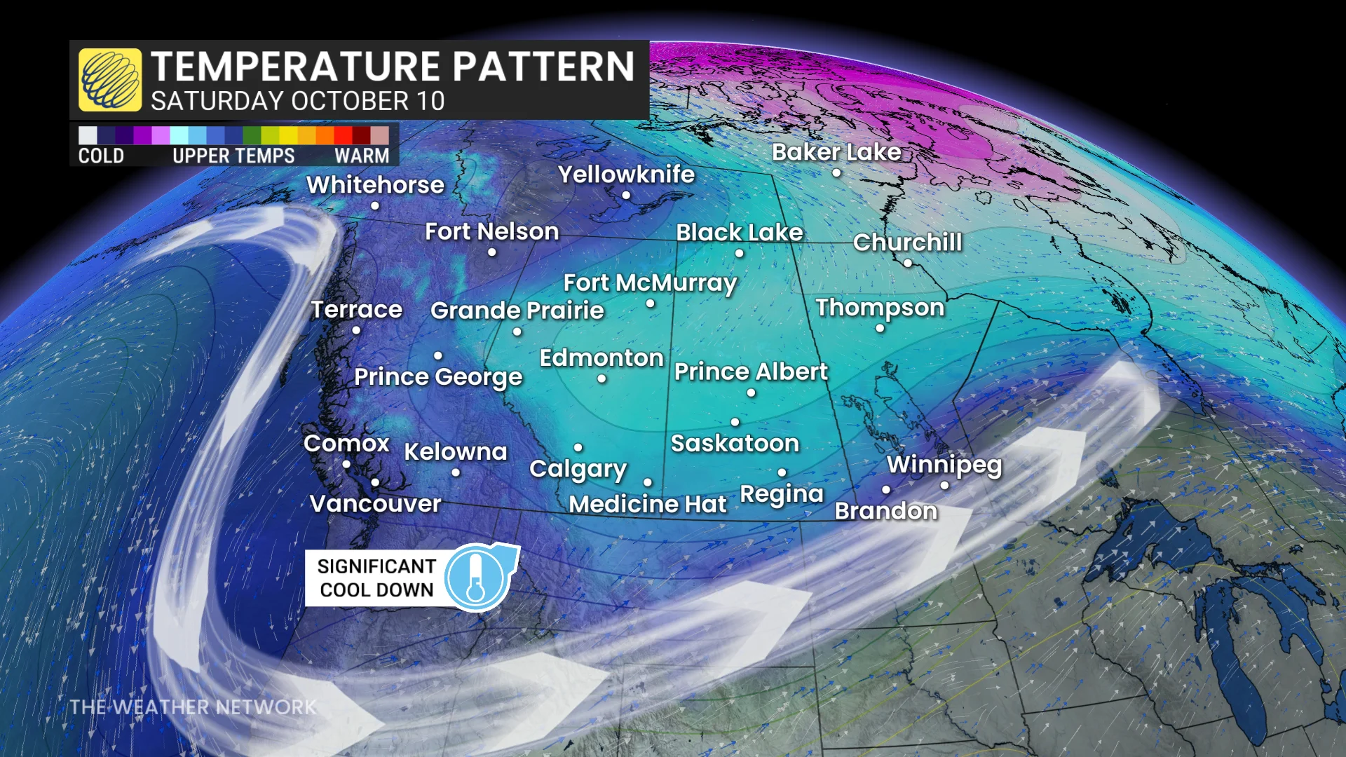
The Rockies are forecast to receive the most significant snowfall, with subfreezing conditions in higher elevations.
DON’T MISS: With a 'super' El Nino, does that guarantee late-fall warmth in Canada?
While snowfall accumulations for major cities remain uncertain, a few centimetres could stick to untreated surfaces. Thanksgiving travel plans in parts of Alberta may be affected.
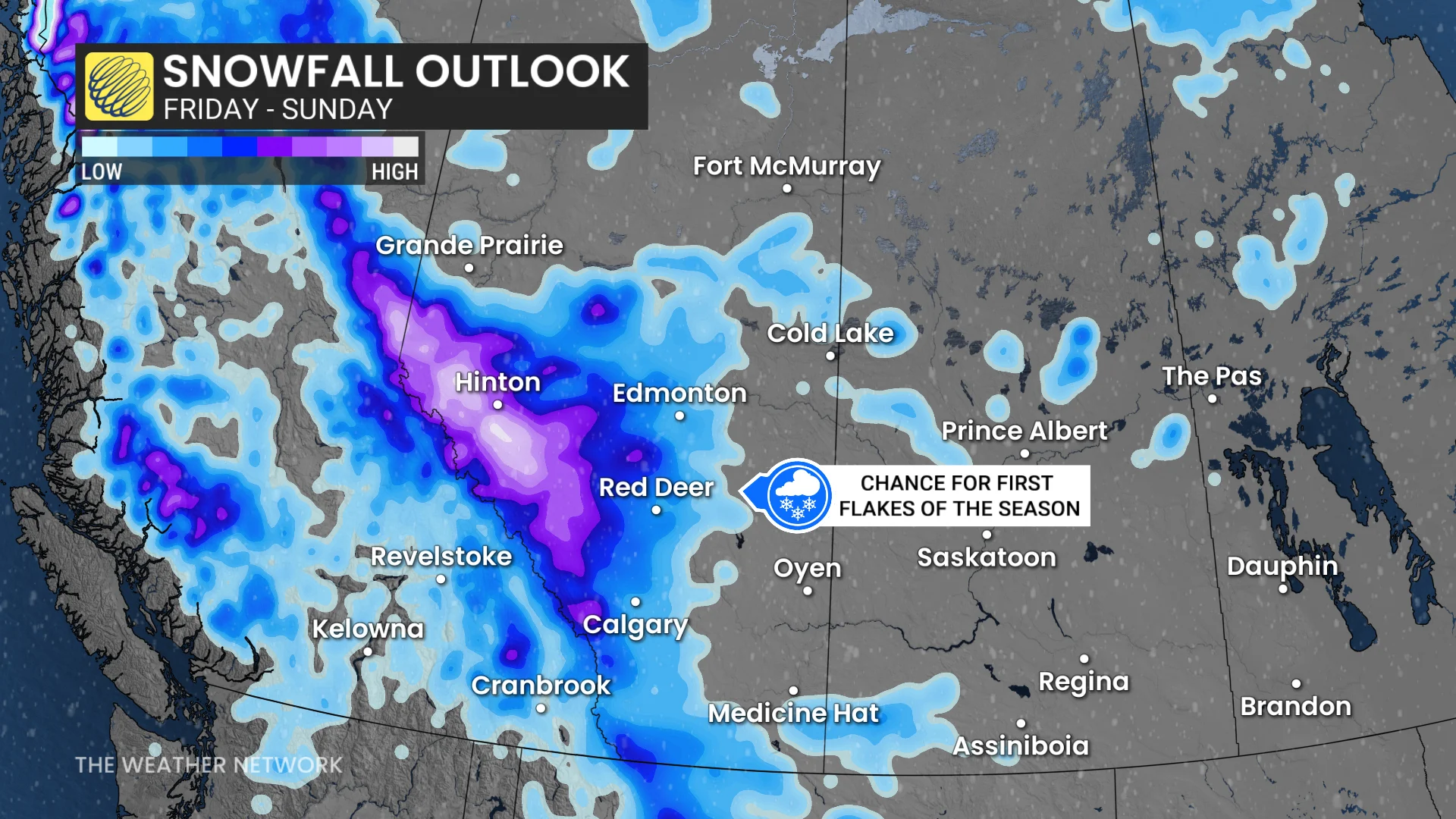
Historical averages for first snowfall in Calgary (Sept. 27) and Edmonton (Oct. 1) suggest the timing aligns with seasonal patterns.
Stay updated for the latest weather alerts, and check road conditions before venturing out.
Watching for tropical influence across parts of Eastern Canada
Forecasters are closely monitoring the potential development of a tropical storm, which is projected to track into the U.S. Its path could influence southern Ontario's weather on Sunday, depending on how far north it reaches.
Southern Ontario is set for a warm Thanksgiving weekend, with highs in the low to mid-20s resembling late-summer conditions. This weather pattern will extend into southern Quebec, starting Saturday. The warmth is expected to persist through Sunday and could carry over into Monday.
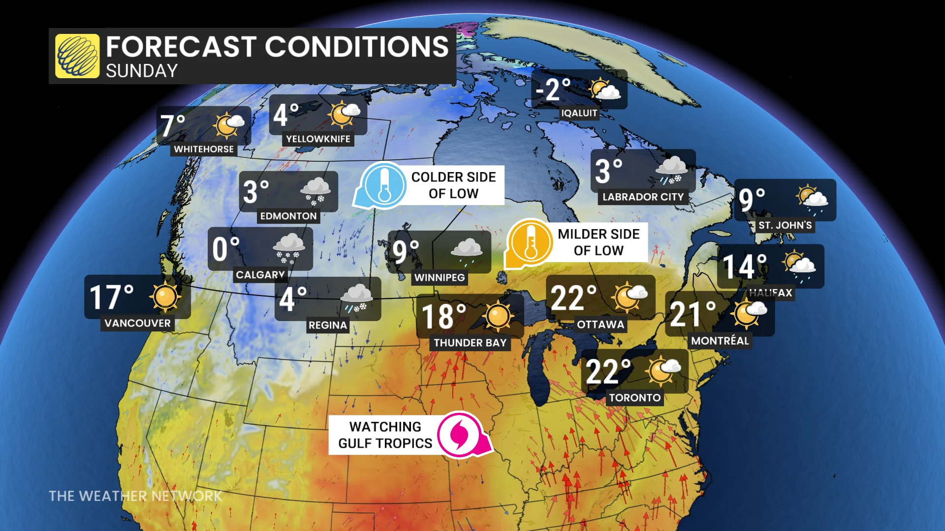
However, the remnants of the tropical system could introduce added moisture late in the weekend, which may impact the forecast for southern Ontario and parts of Quebec. Residents should stay updated for any changes.