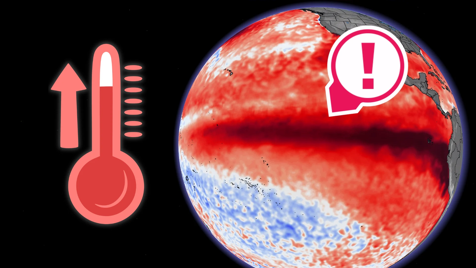
Scientists confirm a 'super' El Niño is in progress. Here's what it means

We suspected it, and now it is confirmed: We are currently in a 'super' El Niño event. Here is a detailed look at what that means
Summary:
Pacific Ocean surface waters are two degrees warmer than normal
This is the highest temperature ever observed on this date
The Pacific Ocean surface temperature is very close to the all-time record set in November 2015
SEE ALSO: A strange shift is happening in Antarctica, but it's not all bad
At full speed
El Niño has just crossed a threshold rarely reached.
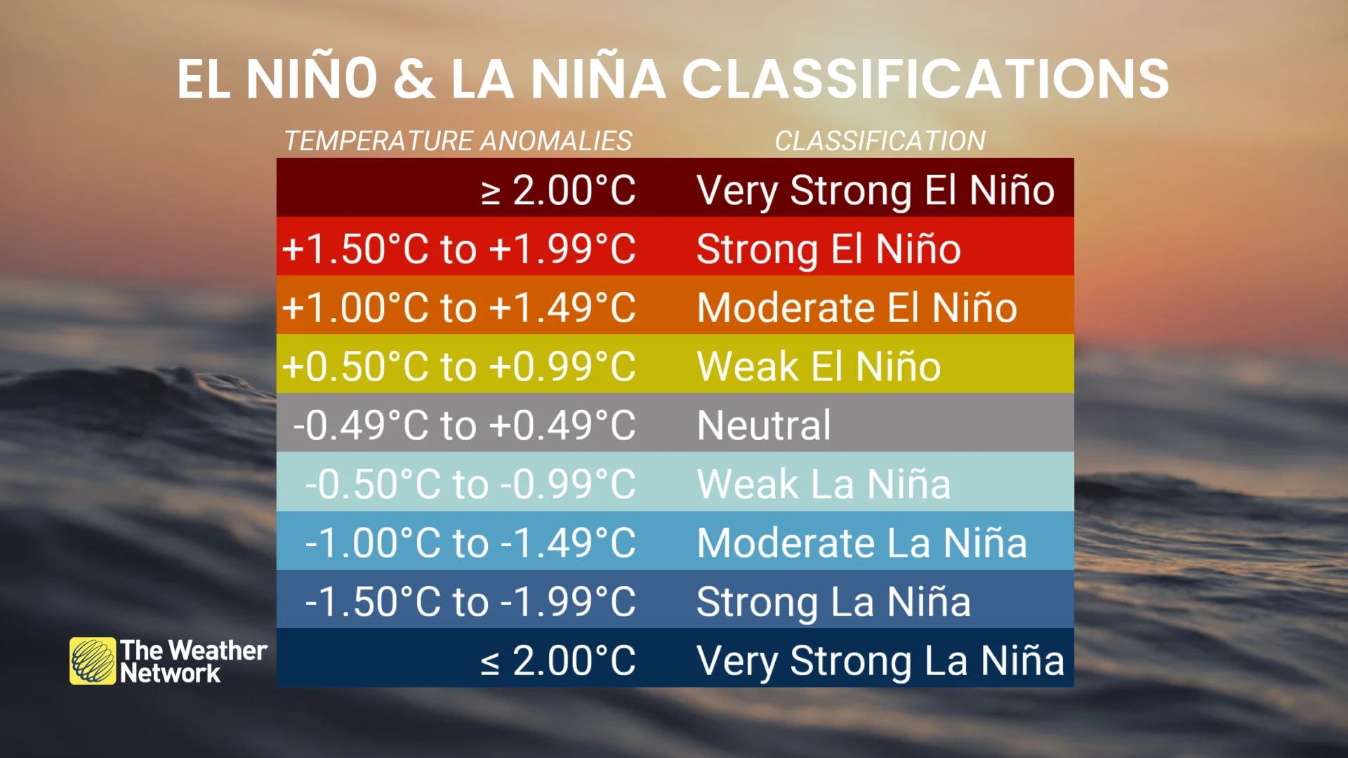
The climate phenomenon, already classified as strong for several months, has officially evolved into a "super" El Niño--a status reflecting the exceptional scale of this event.
Declared back in June, El Niño has intensified at a rapid pace, and it has not yet reached its full potential.
Figures confirming the scale of the phenomenon
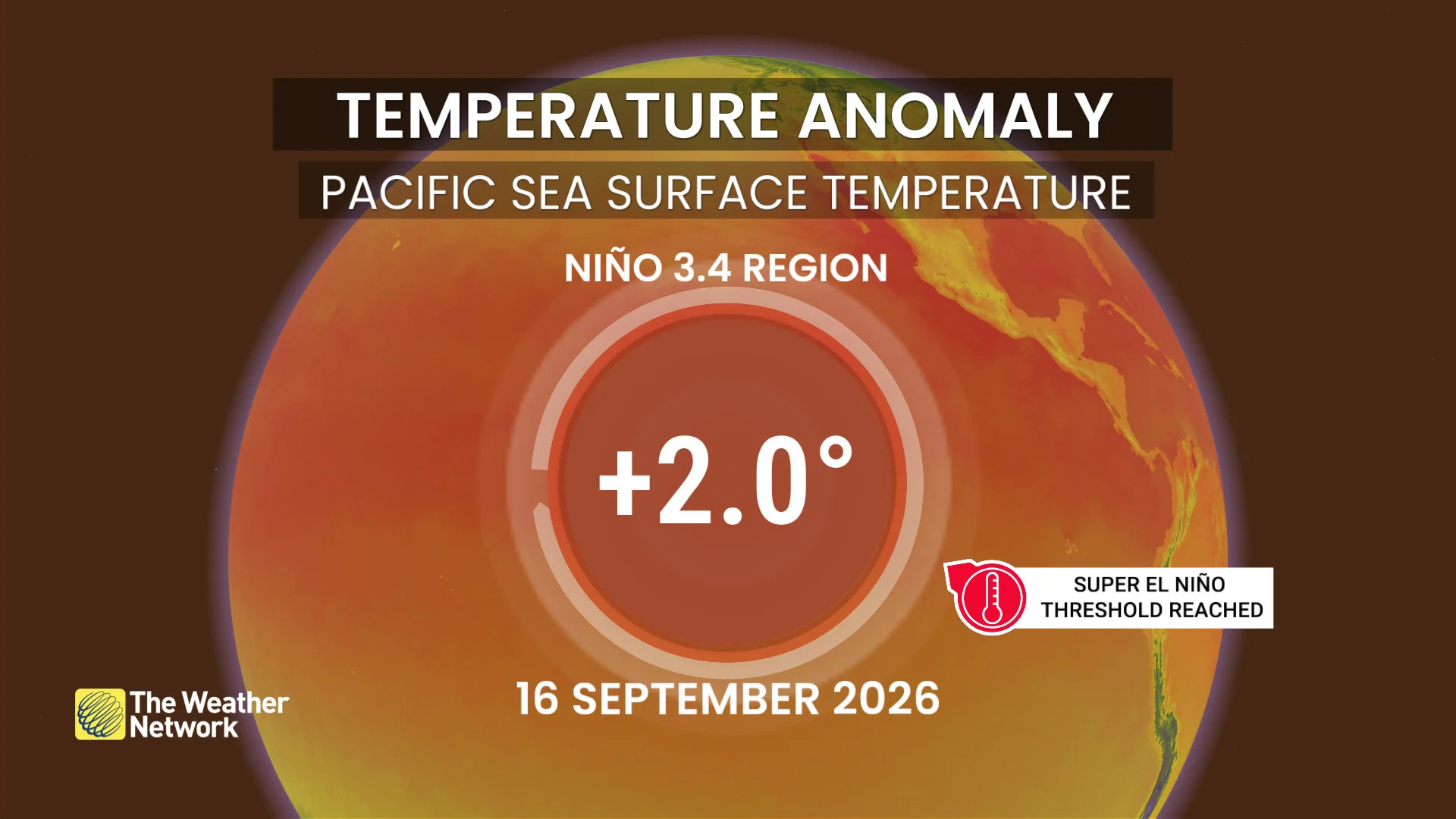
In the El Niño 3.4 region, the key sector of the tropical Pacific used to measure the strength of an El Niño event, the sea-surface temperature anomaly reached +2.0°C on Sept. 14, a level corresponding to the threshold for a super El Niño.
Farther east, in the El Niño 1+2 region near the coast of South America, the anomaly climbs as high as +3.7°C.
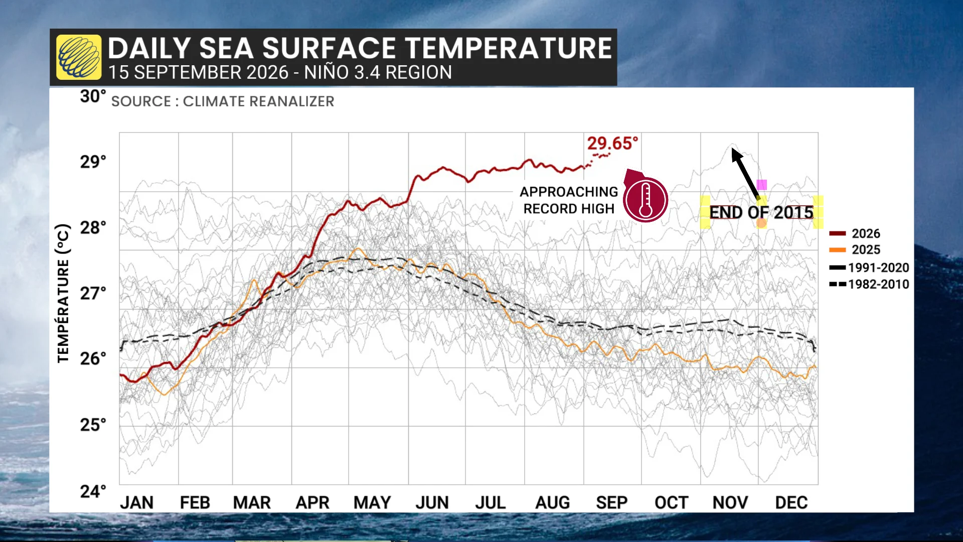
Another signal to watch: Surface water temperatures in the El Niño 3.4 region have reached 29.6°C, a figure now closely approaching the peak recorded in late 2015 during the previous, major El Niño event.
Given that El Niño continues to intensify and will not peak for several months, it is highly likely, almost certain, that this 2015 record will soon be surpassed.
A long reign
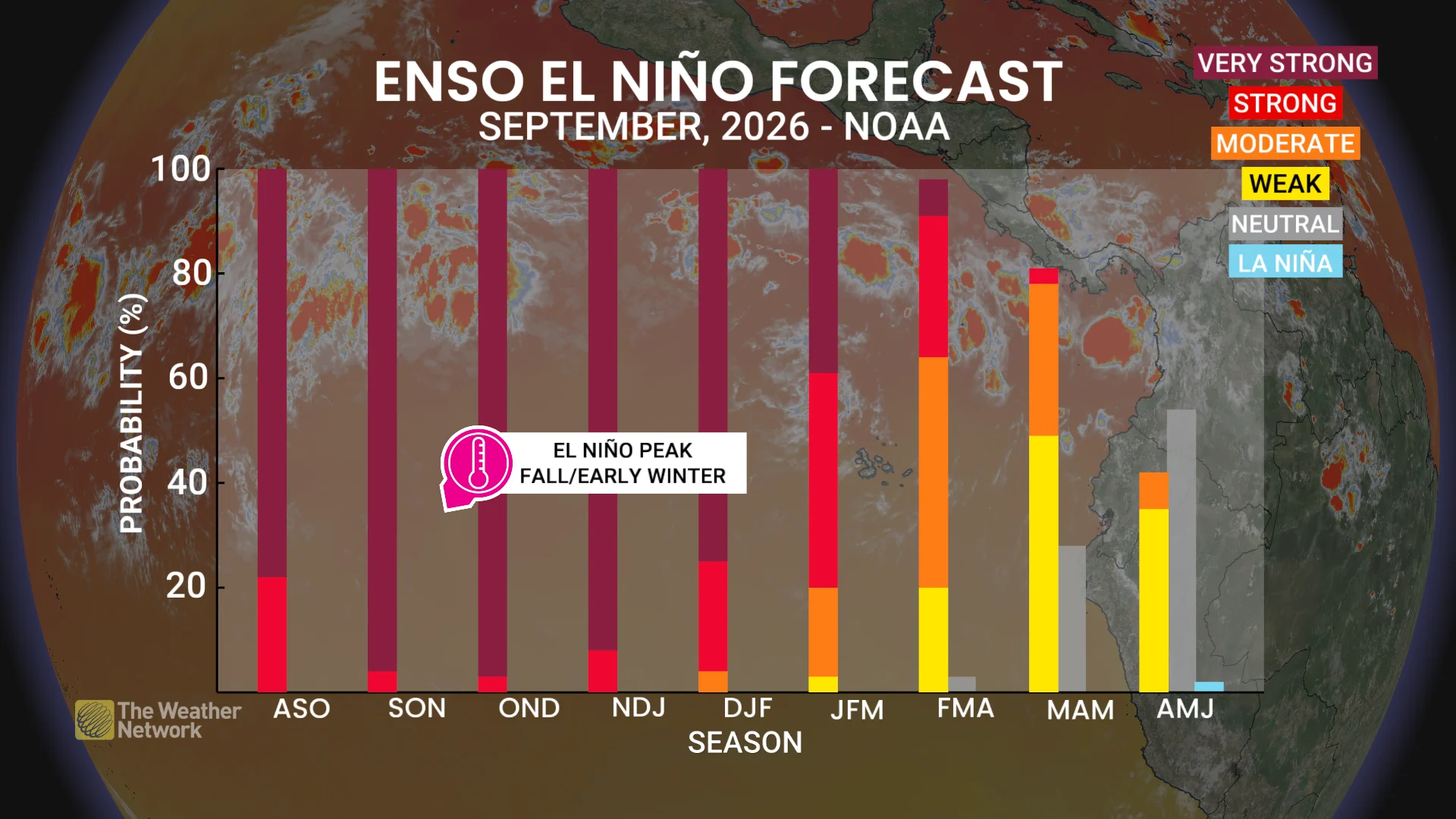
According to the latest, seasonal forecasts, the probability of a super El Niño remains high, exceeding 90 per cent, through the early winter period of November 2026 to January 2027.
Some experts even estimate a roughly 70 per cent chance that the current event will become the strongest on record since data collection began in 1950, with peak intensity expected between October and December.
A phenomenon that will leave its mark
The temporary effects of this super El Niño are also expected to amplify the impacts of long-term global warming, significantly increasing the likelihood of global temperature records being broken during the 2026–27 period.
Indeed, August 2026 was the hottest ever recorded on Earth, a potential harbinger of a spell of record-breaking heat that could culminate in a particularly hot 2027.
Effects that are already very real
Some of the impacts of El Niño are already being felt in tangible ways. The hurricane season in the Eastern Pacific has surged with at least 16 systems, including two Category 5 hurricanes. Hawaii has had to contend with three tropical systems in less than a month.
Fourteen of these storms originated in the Eastern Pacific, which is expected to exceed its usual seasonal average well before the season ends.
In Indonesia, particularly dry conditions associated with El Niño fuelled major forest fires, with parched vegetation serving as fuel and low rainfall hampering efforts to bring the blazes under control.
Key takeaways for the coming winter
Although El Niño is already a major factor in the current climate picture, its most pronounced influence on winter patterns will be felt primarily over the coming months as it continues to intensify before reaching its peak.
That is when it will begin to play its full role in the jet stream dynamics that determine winter conditions across North America.
With files from Nicolas Lessard, a meteorologist at MétéoMedia.
Editor’s note: This article has been translated from French to English for The Weather Network, originally published by MétéoMedia. Read the original article, written by Benoit Chartier, here.