Expect slower commutes Tuesday as snow, wintry mix make messy roads
While temperatures are set to rise this week in southern Ontario, so, too, will the unsettled weather chances. Tuesday will see snow, rain and/or ice for parts of the region, so expect dicey roads
A pleasant warm-up is headed to Ontario this week, giving folks a break from the recent cold. However, that also means a bout of messy weather for the coming days, especially on Tuesday.
DON’T MISS: Winter takes a breather in major Canadian cities with January thaw
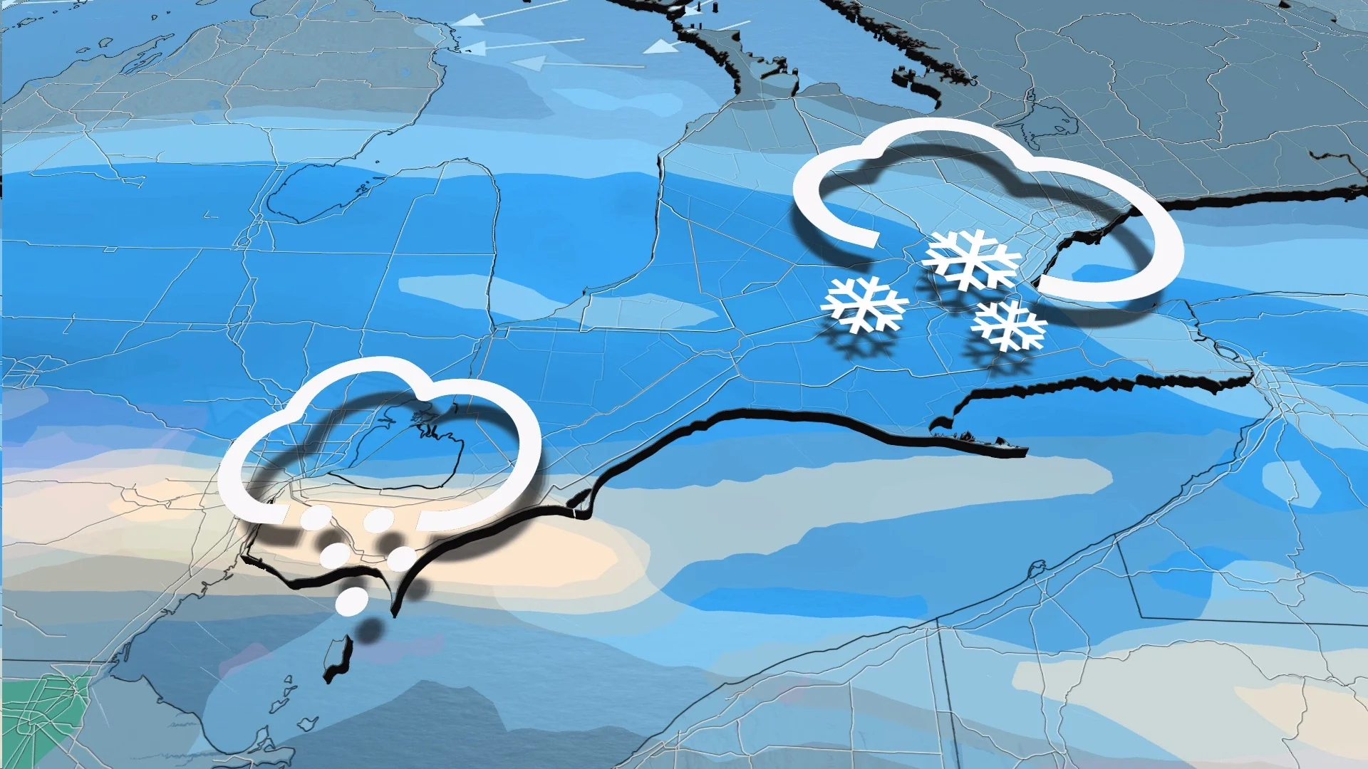
A potent disturbance is set to bring 5-10 cm of snowfall across a good swath of southern Ontario Tuesday, in addition to a mix of freezing rain and/or ice pellets for some.
Winter weather travel advisories and freezing rain warnings are in effect for parts of southern Ontario.
Surfaces such as highways, roads, walkways and parking lots may become icy and slippery. Ice buildup may cause tree branches to break. Utility outages may occur. Be prepared to adjust your driving with changing road conditions.
Tuesday
The more potent system lifts north on Tuesday, providing a stronger snowfall signal in southwestern Ontario. Snowfall enters Tuesday morning from Sarnia to the west end of the Greater Toronto Area (GTA).

There is the chance of some freezing drizzle to start early Tuesday morning for extreme southwestern Ontario, but it will be brief before snow and ice pellets move in soon after.
Both the morning and evening commutes will be impacted with accumulating snowfall, and a potential for freezing drizzle and ice pellets for some areas, so drivers are being urged to plan ahead and be prepared for the slower travel times possible.

5-10 cm of snowfall is expected across the Golden Horseshoe, with about 10 cm from London to the Lake Huron shores. With temperatures hovering near the freezing mark, it will a wet snowfall that has the risk of impacting the Tuesday evening commute times.
There's also the chance for ice pellets to impact the Windsor area, where a nose of warm air aloft may sneak just north of the border. That will lead to less snowfall totals here, but there will be a slippery drive in and out of the city.

Through the day, warm air may surge north, bringing rainfall to Windsor, London and Lake Erie shores briefly in the late afternoon and early evening.
Enjoy the snow while it lasts because a wall-to-wall warm-up in North America will bring an extended thaw across southern Ontario. It will not keep things white for long.
Looming rainy pattern
As warmer air moves into the region, more moisture will come in on Wednesday, bringing light rain to southwestern Ontario and the Golden Horseshoe. Unsettled weather continues with more light rain Thursday evening through Friday.

It’s a setup ripe for fog development, with the warmer air mass traversing the chillier Great Lakes. Look out for the fog by mid-week and beyond.
Stay with The Weather Network for the latest on your forecast across Ontario.