Heavy rain hits parts of southern Ontario, coolest weather in months

While localized flooding will be a concern for some, the bigger story in southern Ontario will be the unseasonably cool temperatures on Tuesday. It’s going to be the coolest day of the astronomical summer for several cities.
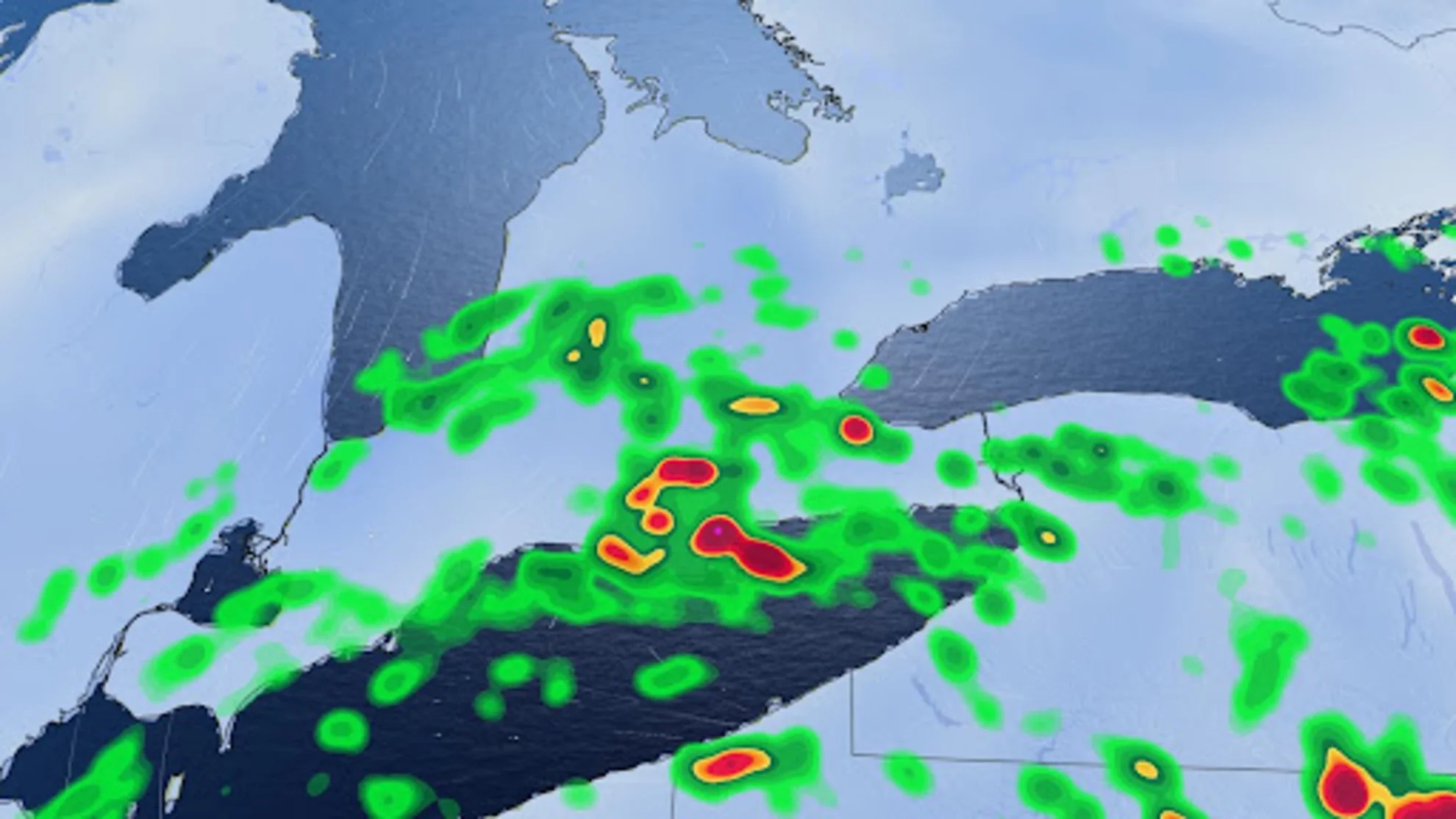
Widespread special weather statements cover much of southern Ontario with the threat for some heavy rainfall across the region on Tuesday. Between 10-20 mm of rain is likely by the time it winds down on Wednesday, with locally higher amounts up to 40 mm in areas that see thunderstorms.
PHOTOS: Huge hail, possible tornado reported as storms hit Ontario
While localized flooding will be a concern for some on Tuesday, the bigger story in southern Ontario will be the unseasonably cool temperatures ushering into the region.
Tuesday is going to be the coolest day of the astronomical summer for several cities.

Tuesday
Areas: Southern Ontario
Timing: Through Tuesday night
Weather: A low pressure system will track south of the Great Lakes and will bring rain and embedded thunderstorms. The storms will not pose much of a threat except for heavy rain and lightning.

The periods of rain will continue for much of the day on Tuesday, with the system bringing precipitation to eastern Ontario through Tuesday afternoon and ending by Wednesday morning.
The most persistent rain will be closer to the shorelines of lakes Erie, Ontario, and southern Huron. There will be more breaks for areas near Georgian Bay and central Ontario. In all, between 10-20 mm of rain is expected, but areas that see prolonged periods of heavy rain or multiple thunderstorms may see higher amounts.

In addition to the rain, it’s also going to be the coolest day of the astronomical summer for a bunch of cities on Tuesday.
We haven’t seen daytime highs hover near 20°C this summer, but Aug. 15 will be one of them.

Strong winds whip in for Thursday
Drier conditions move in on Wednesday, however, there is a long low-pressure system moving through Ontario for Thursday, bringing a cold front for southern sections.
The low-pressure system is forecast to be uncharacteristically strong by August standards, so gusty winds and below-seasonal temperatures will spread across northern Ontario on Thursday.

The entire province will see blustery winds out of this low, gusting as high as 60-70 km/h at times.
A mix of sun and clouds and warmer temperatures are expected this weekend, but still rather cool for eastern Ontario and southern Quebec during the day on Saturday.
Be sure to check back for the latest forecast updates across Ontario.