Risk of hazardous travel with blizzard-like conditions in Newfoundland by Friday
Winter storm watches and warnings are in effect as a powerful winter storm takes aim at parts of Newfoundland to end this week. Drivers urged to avoid non-essential travel
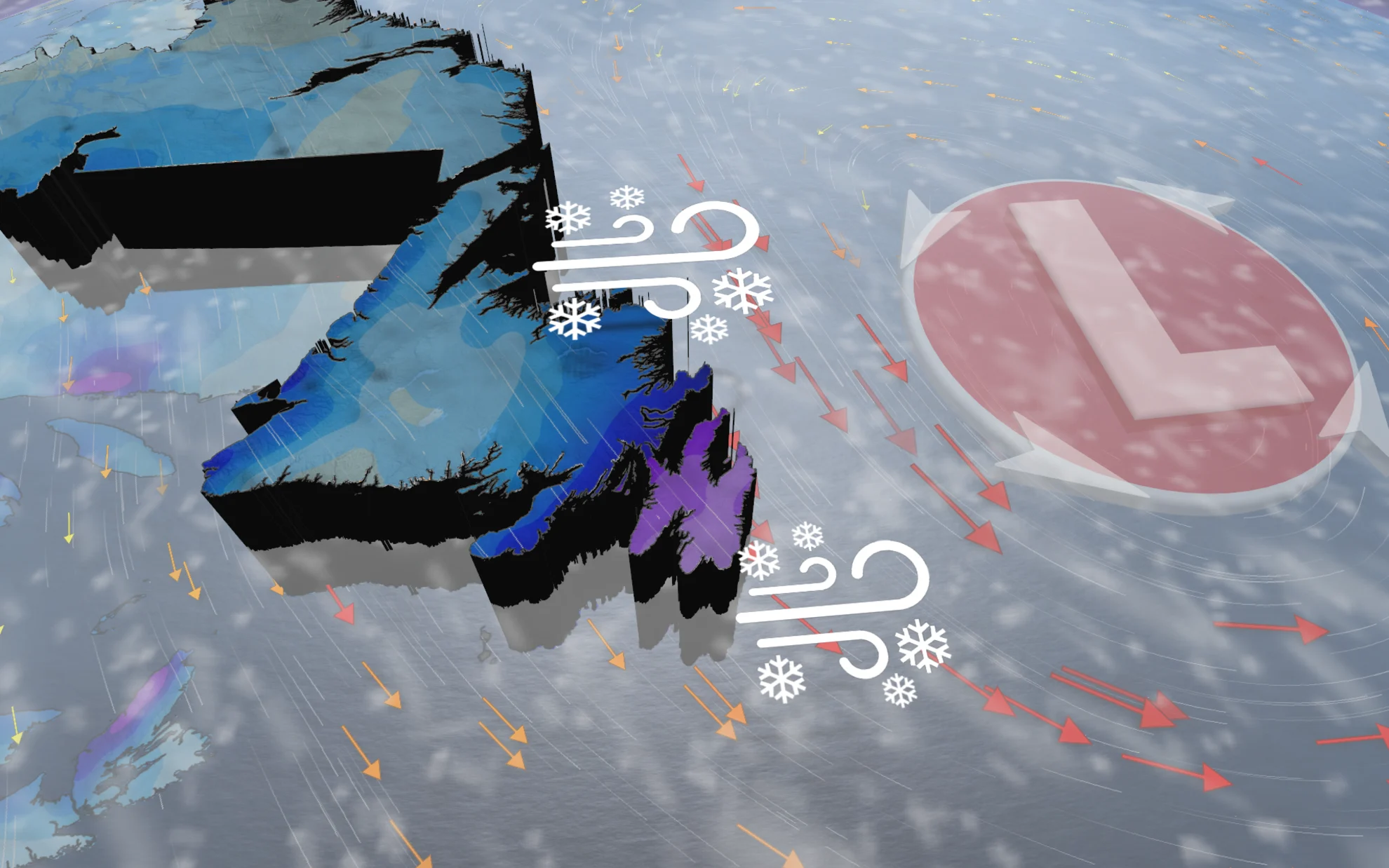
A powerful winter storm will bring significant snowfall and hazardous travel across Newfoundland as we head into this first weekend of January.
The storm threatens between 15-35 cm of snowfall, with impressive rates at times, potentially being the highest totals of the season so far. However, the bar isn’t set too high from the lacklustre cold and snow this season.
MUST SEE: Winter to finally show up in January as El Niño bested by polar vortex
Travel is expected to deteriorate quickly through Friday evening, with heavy blowing snow and reduced visibility in some locations. Drivers are being urged to avoid non-essential travel if possible.

Friday through Saturday morning
Impactful winter weather is on its way. Heavy snowfall rates and gusty winds are forecast as a strong storm moves in Friday through Saturday. That combination will significantly reduce visibility on the roads, with blowing snow and whiteout conditions. People are urged to stay off the roads during that time.
By Friday morning, snow moves into Newfoundland’s southern shores. Snowfall rates significantly intensify by the afternoon and evening –– possibly hitting 5 cm per hour through the event, especially for the Burin and southwest Avalon Peninsula. Central and western sections of the island will see much lighter accumulations.
Winds between 60-80+ km/h may also lead to blizzard conditions Friday evening.

The Avalon is forecast to see the most amount of snow, with 20-35 cm in total, from Friday through Saturday morning. The Burin is forecast to see 15-25 cm. Gander will be on the western edge of the system, so it is forecast to only see 5-10 cm.
Although the snow will end by Saturday morning, winds will continue to gust upwards to 70 km/h throughout the day, reducing visibility from the freshly fallen snow.

P.E.I. and eastern Nova Scotia will likely see a combination of sea-effect and a touch of the system snow Friday, totaling 5-10+ cm, with higher totals likely for higher elevations.
More snow is to come on Sunday for the Maritimes, with a strong system from the U.S. Northeast moving into Canadian waters.
Biggest snow of the season so far for St. John's
This all comes after St. John’s airport saw its driest December on record with 55 mm of precipitation, and 42 cm of snow, Newfoundland will be in the crosshairs for some active weather later this week.
St. John’s hasn’t seen a snowfall event with 15 cm of accumulation or higher, yet, this winter, but that could soon change.
Stay with The Weather Network for the latest on your forecast across Newfoundland.