Risk of funnel clouds, severe storms on the table for Saskatchewan
A funnel cloud and severe thunderstorm potential pops up in Saskatchewan on Monday, with a low, but non-zero, tornado threat
Stay alert on Monday, Saskatchewan.
A threat for funnel clouds and severe thunderstorms exists in parts of Saskatchewan on Monday. While low, the risk for a weak tornado can't be ruled out. Special weather statements are in place for the funnel cloud chance.
If conditions become more favourable for the development of landspout tornadoes, watches and warnings will be issued by Environment Canada.
SEE ALSO: Alberta jumps to seven tornadoes in 2026 after landspouts confirmed
Be sure to stay weather-aware and alert to all of the advisories, watches and warnings in your area as conditions quickly change.
Potential for funnel clouds and severe storms on Monday
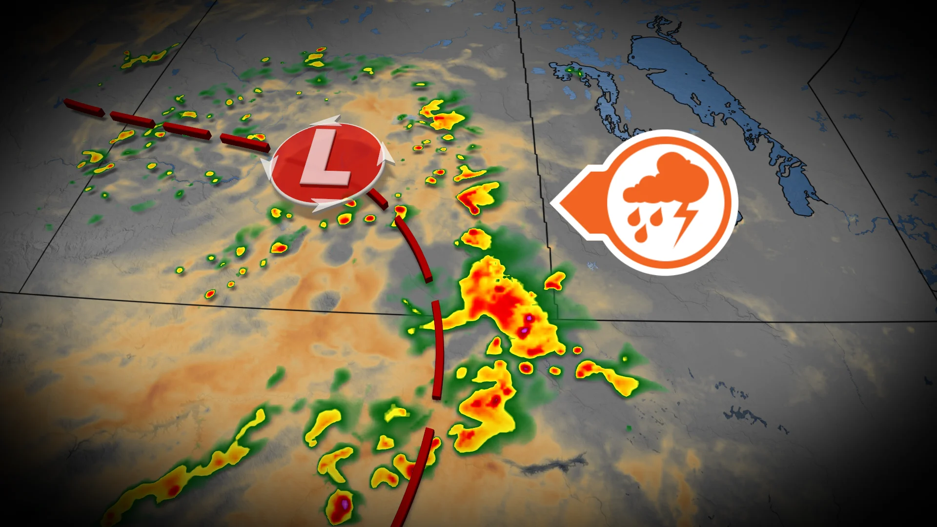
A large, upper level low is spinning along the Alberta-Saskatchewan border on Monday. Underneath it, unsettled weather swirls through the day.
Isolated, heavy showers or small hail is possible. Cold air in the upper atmosphere sinks, bringing the chance of funnel clouds.
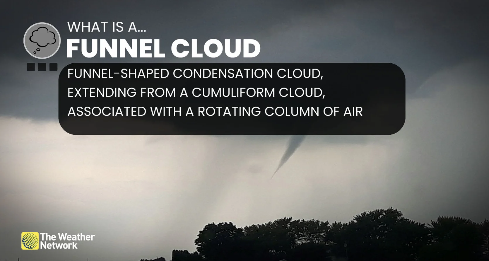
Funnel clouds are not particularly dangerous. Funnel clouds can form in environments with thunderstorms and rotating columns of air. It is a cone or funnel-shaped condensation cloud that extends from a storm without reaching the surface.
Severe weather is possible east of the low where its warm fronts lift in an unstable air mass. A very narrow region of high CAPE, moderate shear and moisture is possible later in the afternoon.
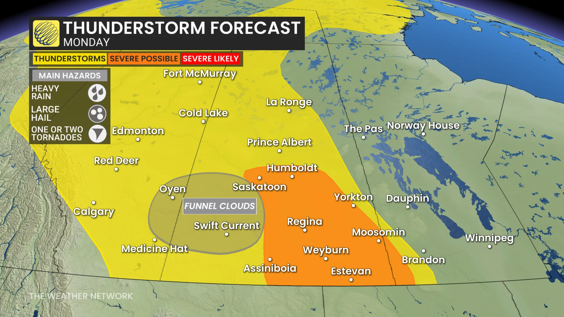
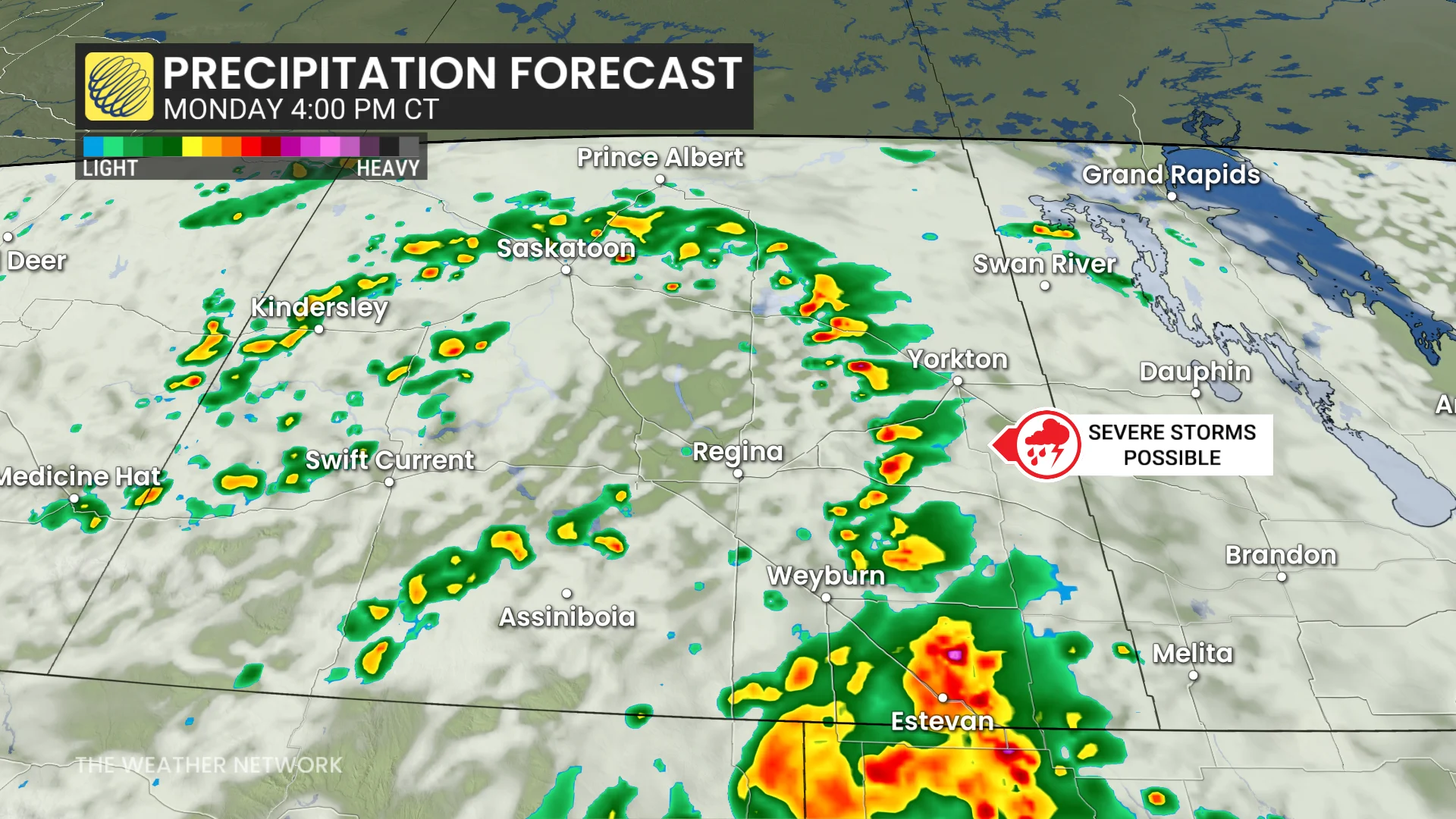
Regions south and east of Saskatoon most at risk: Saskatoon, Regina, Yorkton, Humboldt and south including Weyburn and Estevan. Thunderstorms triggered during this time may produce large hail and heavy rain.
However, there is a slight chance for a weak tornado. It is an uncertain forecast because the area of opportunity is so narrow and brief.
"These types of funnel clouds are generated by weak rotation under rapidly growing clouds or weak thunderstorms. This weak rotation is normally not a danger near the ground. However, there is a chance that this rotation could intensify and become a weak landspout tornado," warned Environment and Climate Change Canada (ECCC) on Monday.
Typically, funnel clouds alone are not dangerous. However, if they are able to extend to the surface, they would become a tornado. In that case, it could cause damage.
Landspout tornadoes do not usually cause significant damage but can still be dangerous. They can be strong enough to topple trees, damage roofs or toss debris short distances.
A non-severe thunderstorm risk is expected Tuesday on the southeast corner of the eastern Prairies as the low slowly tracks into Manitoba.
Thumbnail courtesy of Cindy Cairns.
Stay tuned to The Weather Network for the latest forecast updates for Saskatchewan.