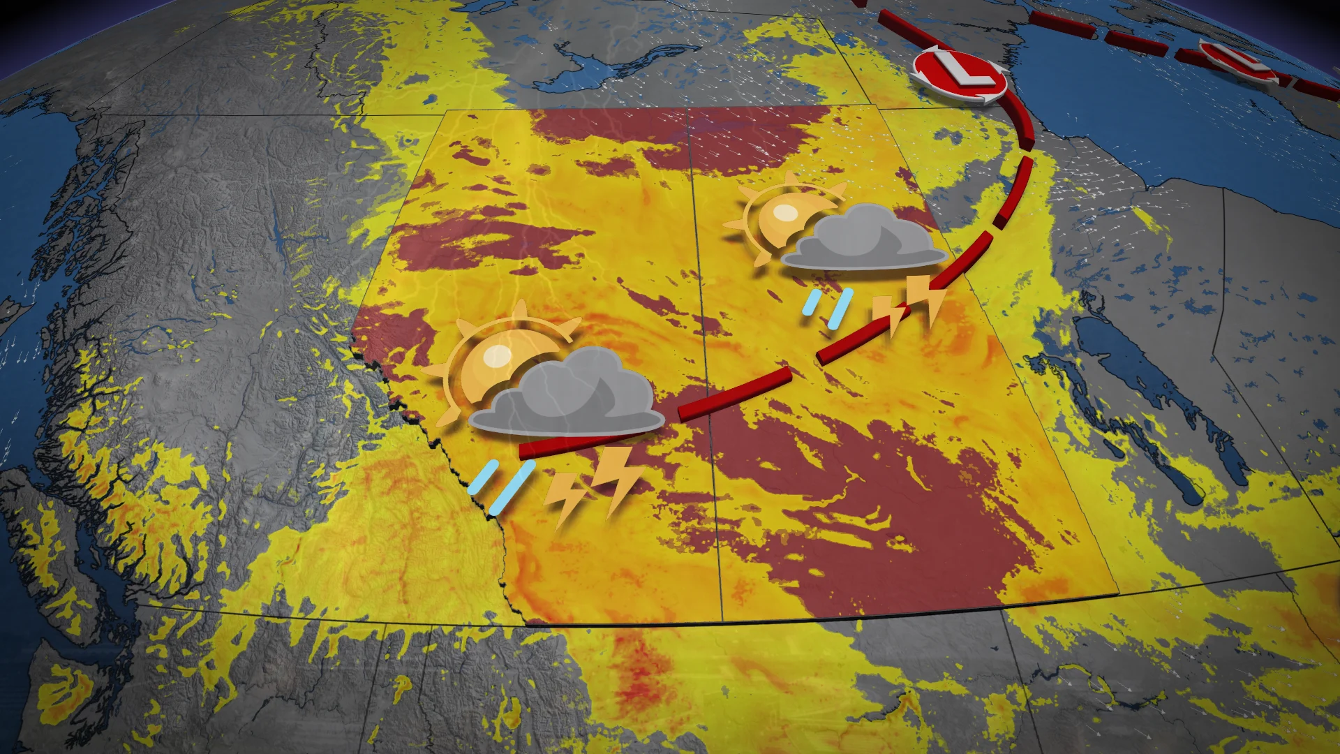
Instability across the Prairies brings severe storm risk to Alberta

Thursday afternoon could bring a mix of severe and non-severe thunderstorms across the Prairies
Rising instability in the Prairies is increasing the risk of severe thunderstorms in Alberta.
READ IT HERE: Alberta experiences a rare wildfire-free August after record-breaking rainfall
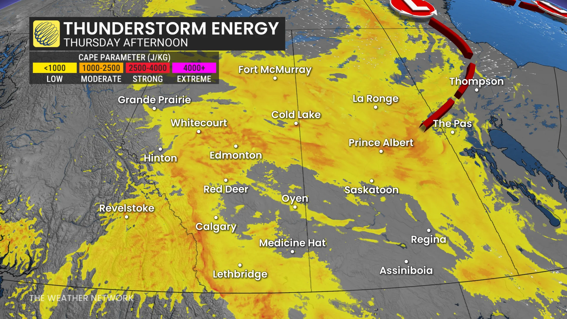
While non-severe thunderstorms are possible from southern Alberta to northern Manitoba, strong convective energy and elevated wind shear are likely to trigger severe storms.
Areas at higher risk include the foothills, as well as Calgary and Edmonton.
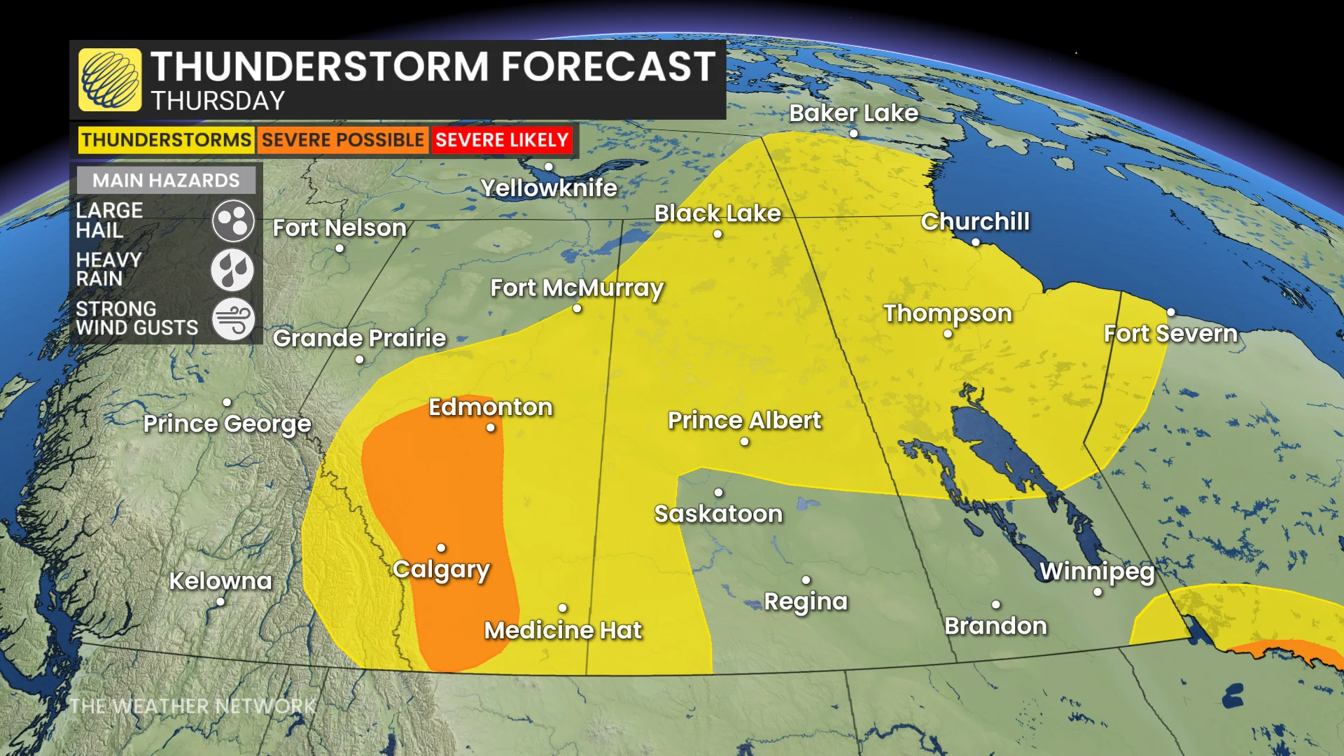
Instability to last until Friday
Expect the weather to be a little unpredictable, with the potential for sudden changes in conditions, compromising any outdoor plans or activities.
Heavy downpours and strong winds are possible with sudden storms, but large hail may pose a bigger threat with any stronger storms that form.
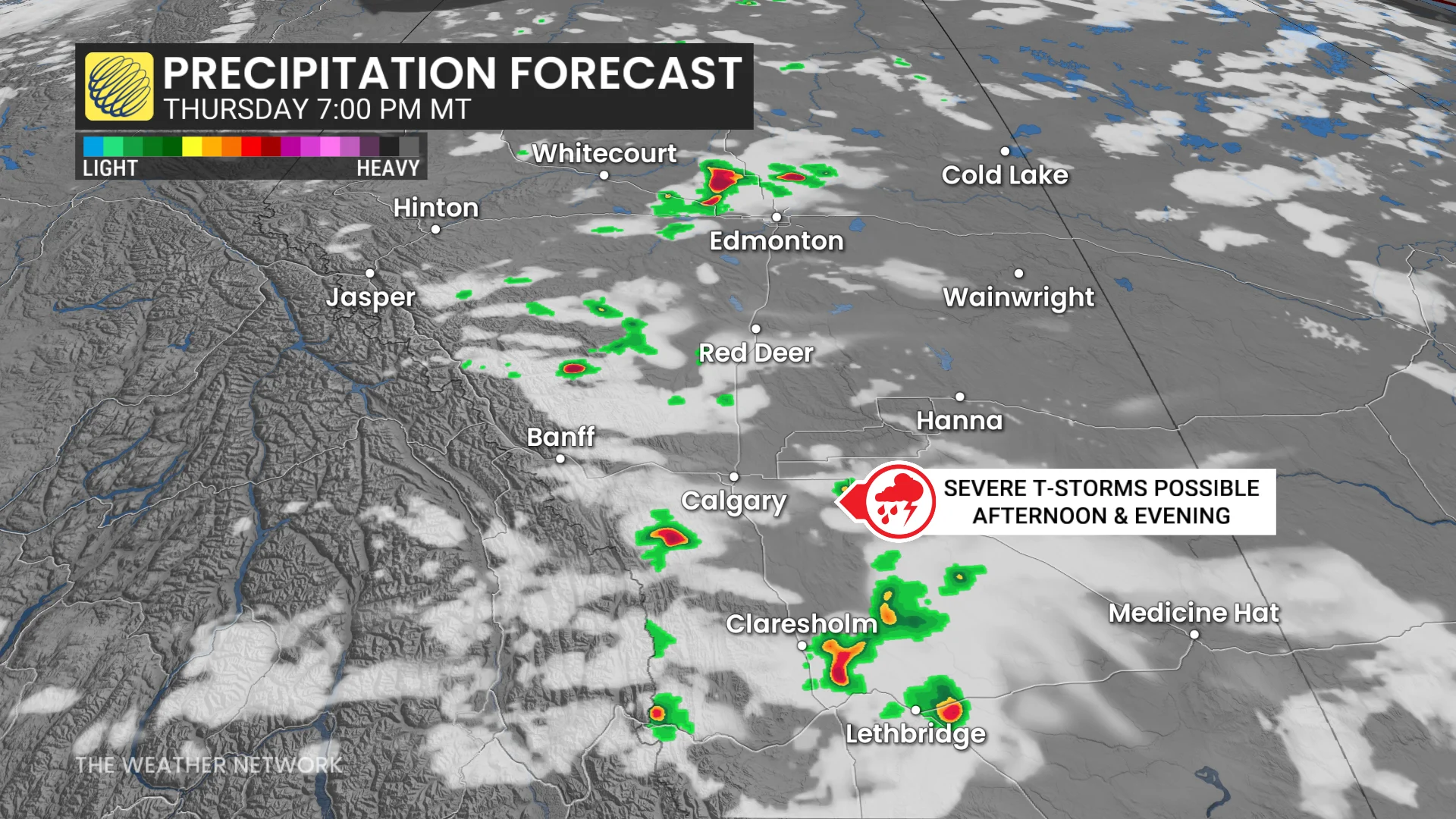
The size of hail could range from a quarter in diameter to ping-pong ball sizes, with large hail able to cause damage to vehicles and injuries to people unable to seek shelter in time.
The moderate-to-high range of thunderstorm energy spread across Alberta makes it harder to pinpoint when storms could form and at what strength.
Showers and the potential storms should bring temporary relief from heat building up in the region. Vertical mixing and precipitation may help to clear out smoke from areas still under air quality warnings, as well.
Instability will become more stable moving into Friday, with storms only expected to be possible during Thursday afternoon and evening. Friday is expected to return to both normal conditions, and the heat trend Alberta has been on.
Stay with The Weather Network for updates on Alberta thunderstorms