50-100 mm: Excessive rainfall threatens flooding in Quebec

With up to 100 mm of rain in the forecast, southern Quebec is on high alert for localized flooding on Sunday
Folks across southern Quebec will contend with a risk for flooding this weekend as a very moist pattern lingers over the region.
Some areas could see 50-100+mm of precipitation through Monday morning, which may lead to localized flooding and ponding.
Remember, never try to drive across a flooded roadway. It’s impossible to tell how deep the water is until it’s too late, and it only takes a small amount of moving water to lift a vehicle downstream.
DON’T MISS: Canada’s August outlook holds shifting heat and wildfire concerns
Heavy rain impacting southern Quebec, flood risk raised
Parts of Quebec have already seen 70-100 mm of rain in the past couple of days, leaving the ground saturated and unable to absorb much additional precipitation.
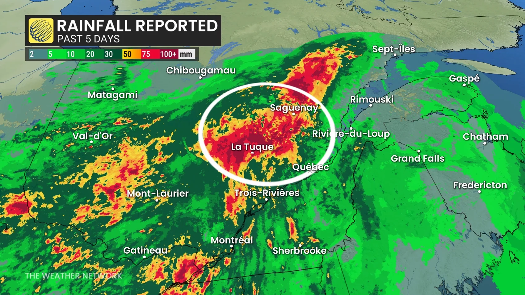
Meanwhile, very high levels of atmospheric moisture streaming in from the south will run against a boundary associated with a stalled low-pressure system near Saguenay.
This setup will increase the threat for significant flooding across Quebec over the next 48 hours.
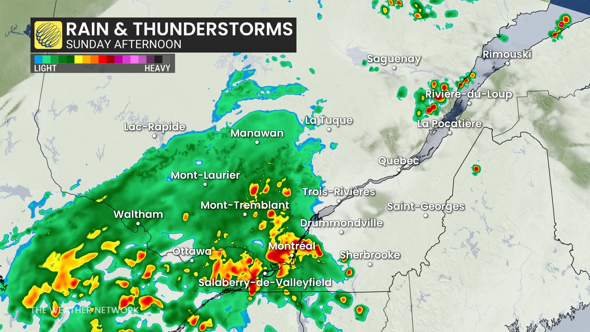
We’ll see heavy showers and thunderstorms move across southern Quebec through the day Sunday, with additional rounds likely to occur Sunday evening.
High moisture in the atmosphere will act like a rich reservoir for showers and storms to tap into, increasing the threat for torrential rainfall and localized flooding.
The heaviest rainfall will be north of the St. Lawrence River.
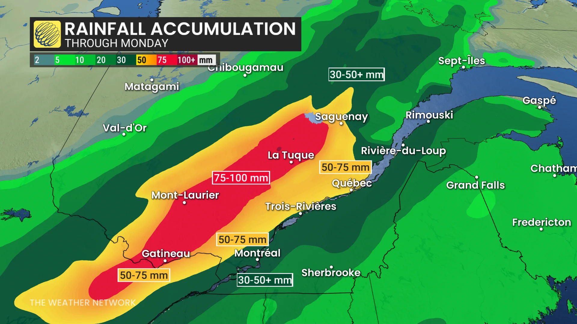
Communities in and around Montreal may see 50+ mm of rain through Monday morning, with 75-100+ mm of precipitation possible farther to the northwest.
The atmosphere will begin to dry out behind a cold front on Monday afternoon.
Beware the risk for urban flash flooding in the Montreal area during and immediately after slow-moving thunderstorms.
Stay with The Weather Network for all the latest on conditions across Quebec.