'Ring of fire' storm potential covers the Prairies amid heat

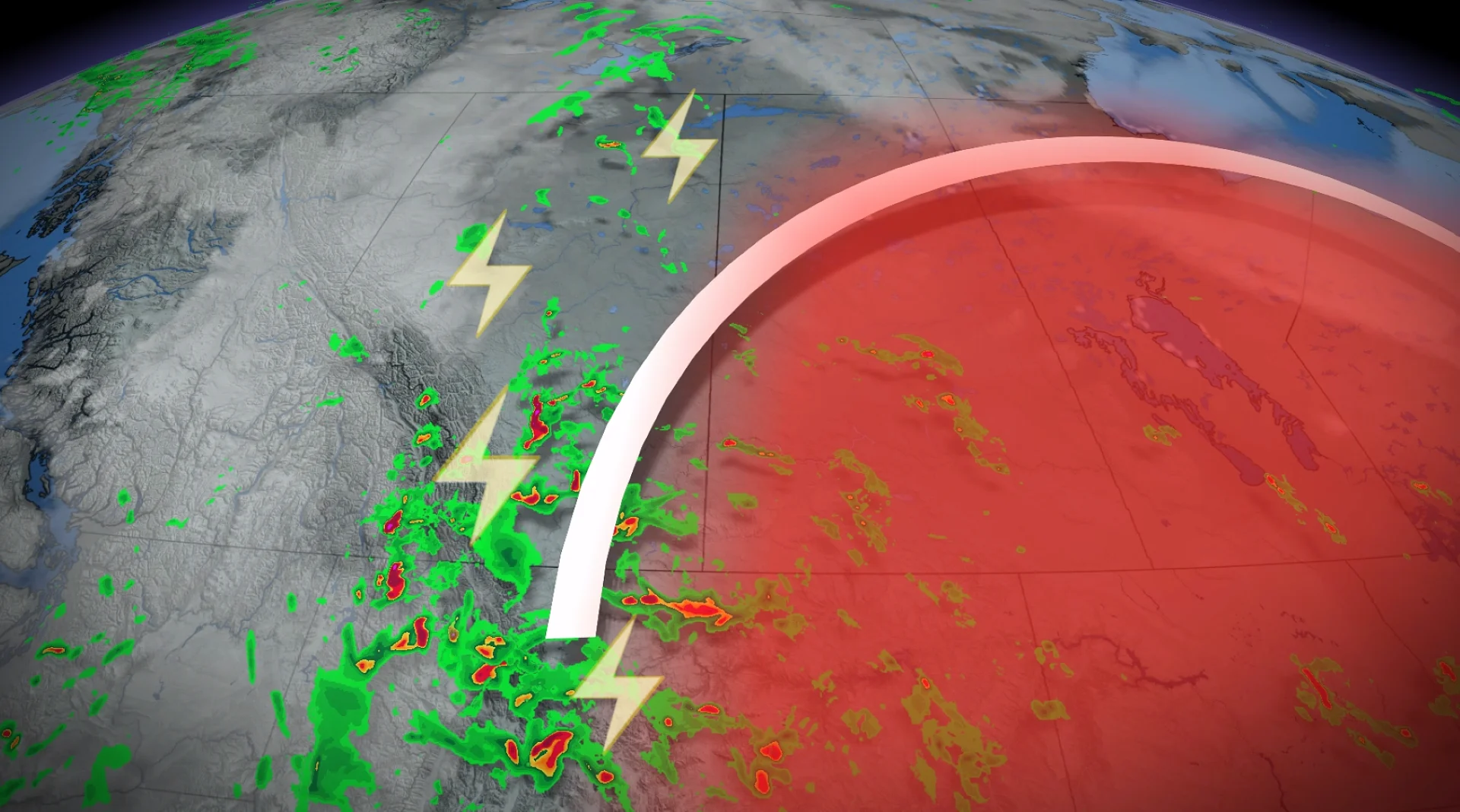
A ring of fire thunderstorm threat sets up on the Prairies this week as the region experiences a multi-day heat wave.
A bout of intense summer weather will take centre stage on the Prairies this week, with multi-day heat and storm threats unfolding.
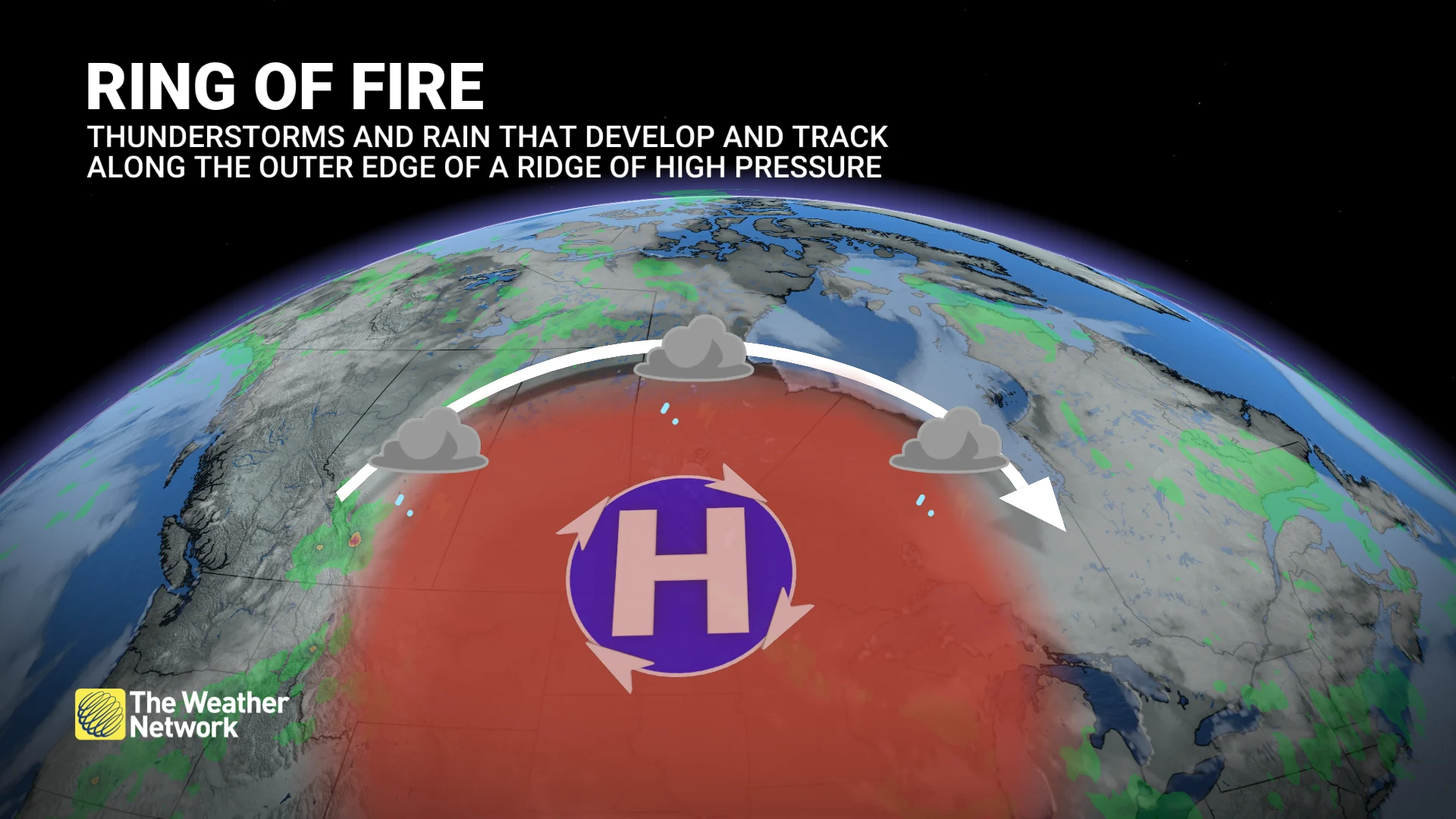
What is referred to as a "ring of fire" of storms, a storm track that brings thunderstorms along the outer periphery of the ridge of high pressure, will be in place.
DON'T MISS: Canada's end to May: Who will get the head start on summer?
Alberta will be the first to see the thunderstorm potential surface on Tuesday.
'Ring of fire' storm risk covers the Prairies amid heat
A large, high-pressure ridge moves onto the Prairies this week, bringing in hot temperatures but also instability.
RELATED: Why extreme heat is one of the world’s deadliest weather disasters
Daytime highs will soar into the low- to mid -30s and remain locked through Wednesday. But Manitoba will reach 30°C through Friday. In fact, a 34°C reading is likely in southern Alberta and southwestern Saskatchewan this week.
The thunderstorm threat begins Tuesday in Alberta.
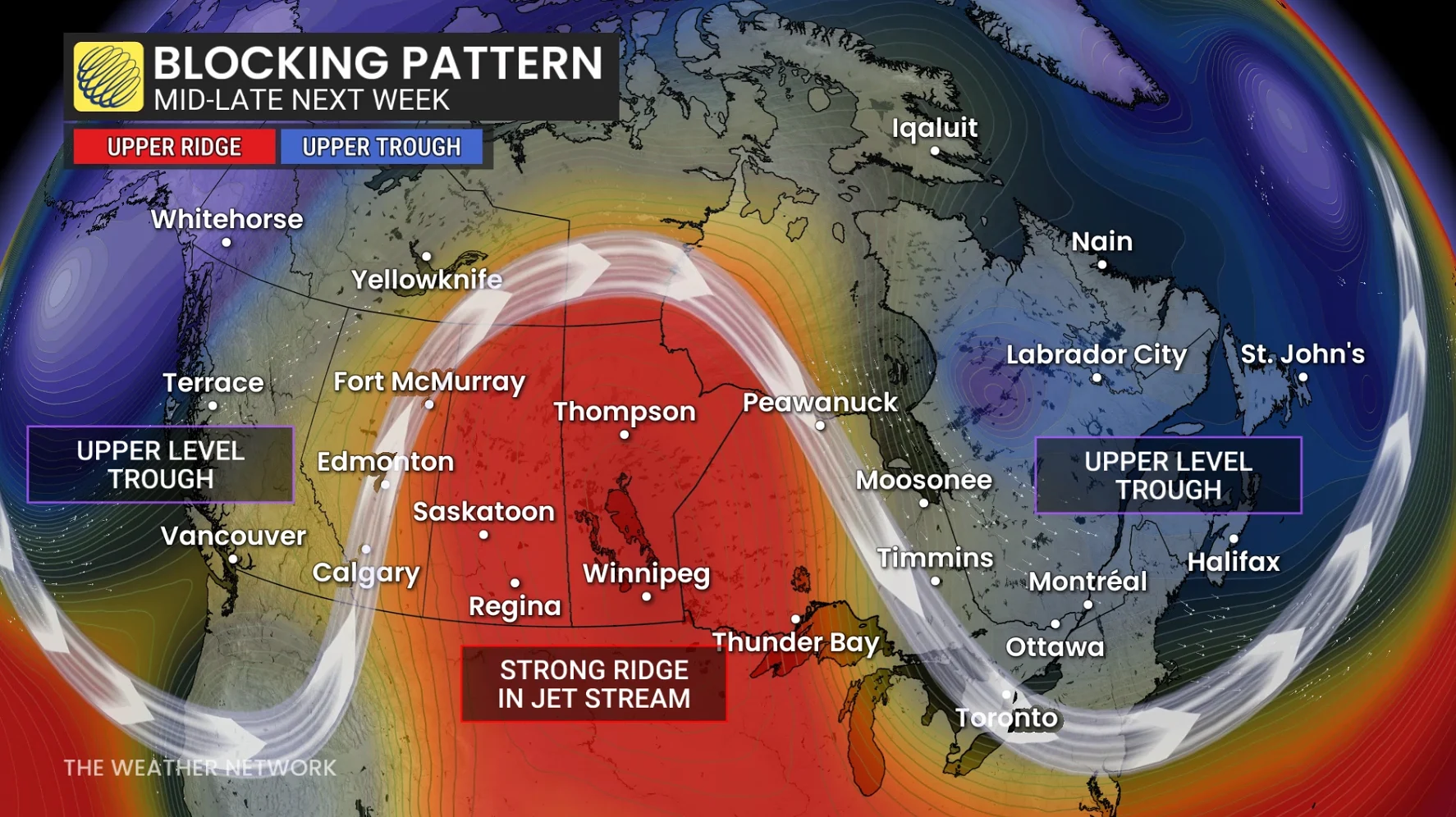
The ring of fire storms refer to a storm track that brings thunderstorms along the outer periphery of the ridge of high pressure.
Under the ridge, it is so warm and dry that clouds can not form as air under high pressure sinks, rather than rises.
However, on the western edge of the heat, cooler air, vertically, allows clouds to form. When the air masses merge, the instability increases due to the gradient.
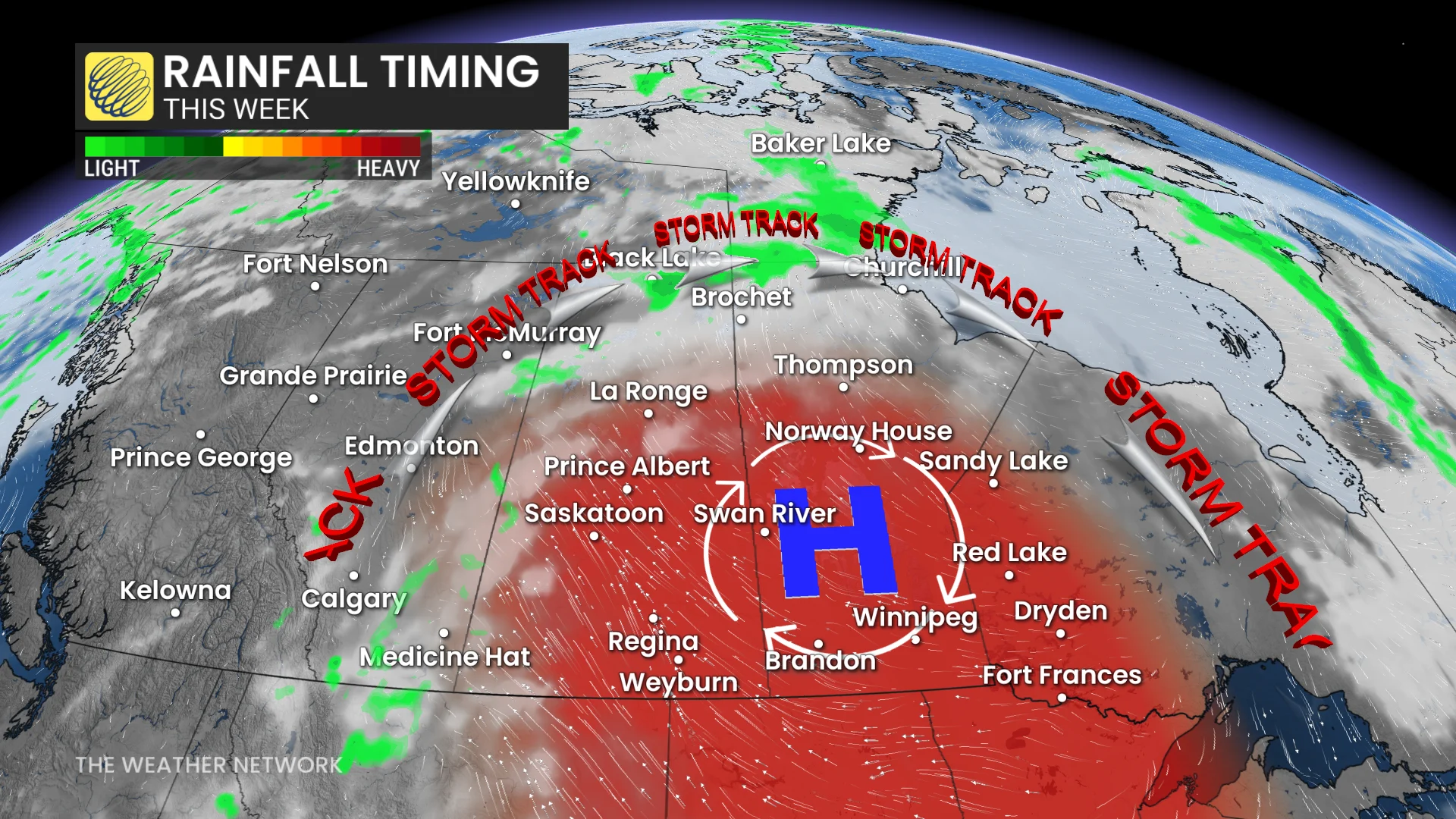
That can also bring the risk of repeated storm threats and rain over the same area, with parts of Alberta at risk of seeing flooding.
That will keep most of Saskatchewan and Manitoba dry throughout this week, underneath the ridge.
Meanwhile, those on either side of the ridge will see volatile storm forecasts on many occasions this week.
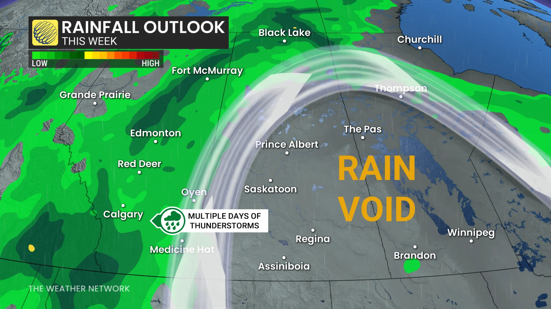
For that setup, we will have to keep a close eye on the northwestern edge of the ridge along Alberta and parts of Saskatchewan.
As of now, there is medium confidence for the exact regions facing a severe storm risk, with greater uncertainty for multi-day storm regions.
Stay with The Weather Network for all the latest on your forecast across the Prairies.