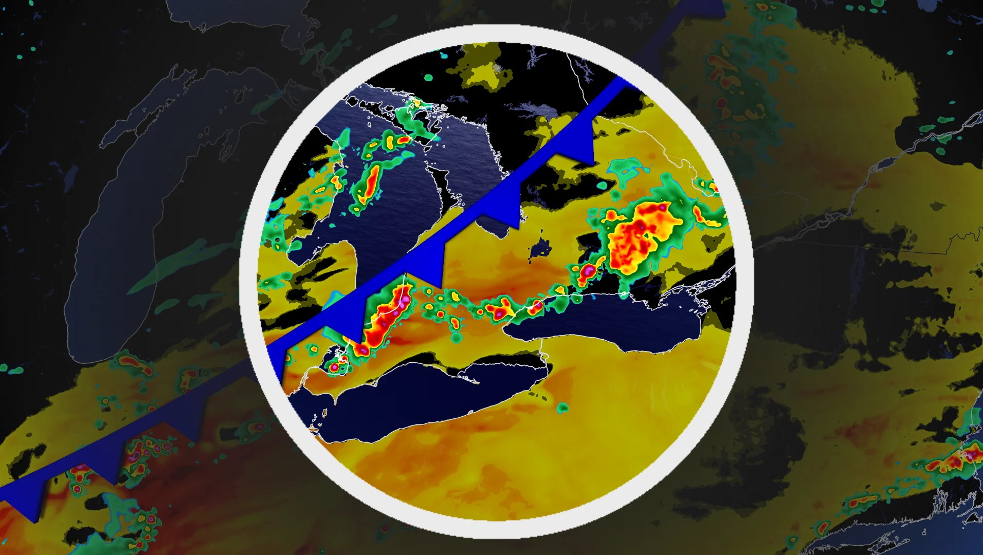
Ring of fire pushes a late-summer humidity surge into southern Ontario

The ring of fire returns to southern Ontario next week with the risk of daily showers amid a sticky September air mass.
Summer may be on its way out, but a warm, humid air mass associated with the season won't in such a hurry to leave southern Ontario, yet.
Visit our Complete Guide to Fall 2026 for an in depth look at the Fall Forecast, tips to plan for it and much more!
Expect cloudy periods with a few rounds of rain and thunderstorms next week as southern Ontario will be included in the ring of fire, with very hot and humid conditions situated over the Mississippi Valley.
Be sure to stay alert to the changing conditions, and check for any weather warnings in your area.
Sticky air mass as summer not ready to depart, yet
A surface high establishes over the southern Mississippi Valley early next week. That means a hot and humid air mass will builds over the valley and the Southern Plains.
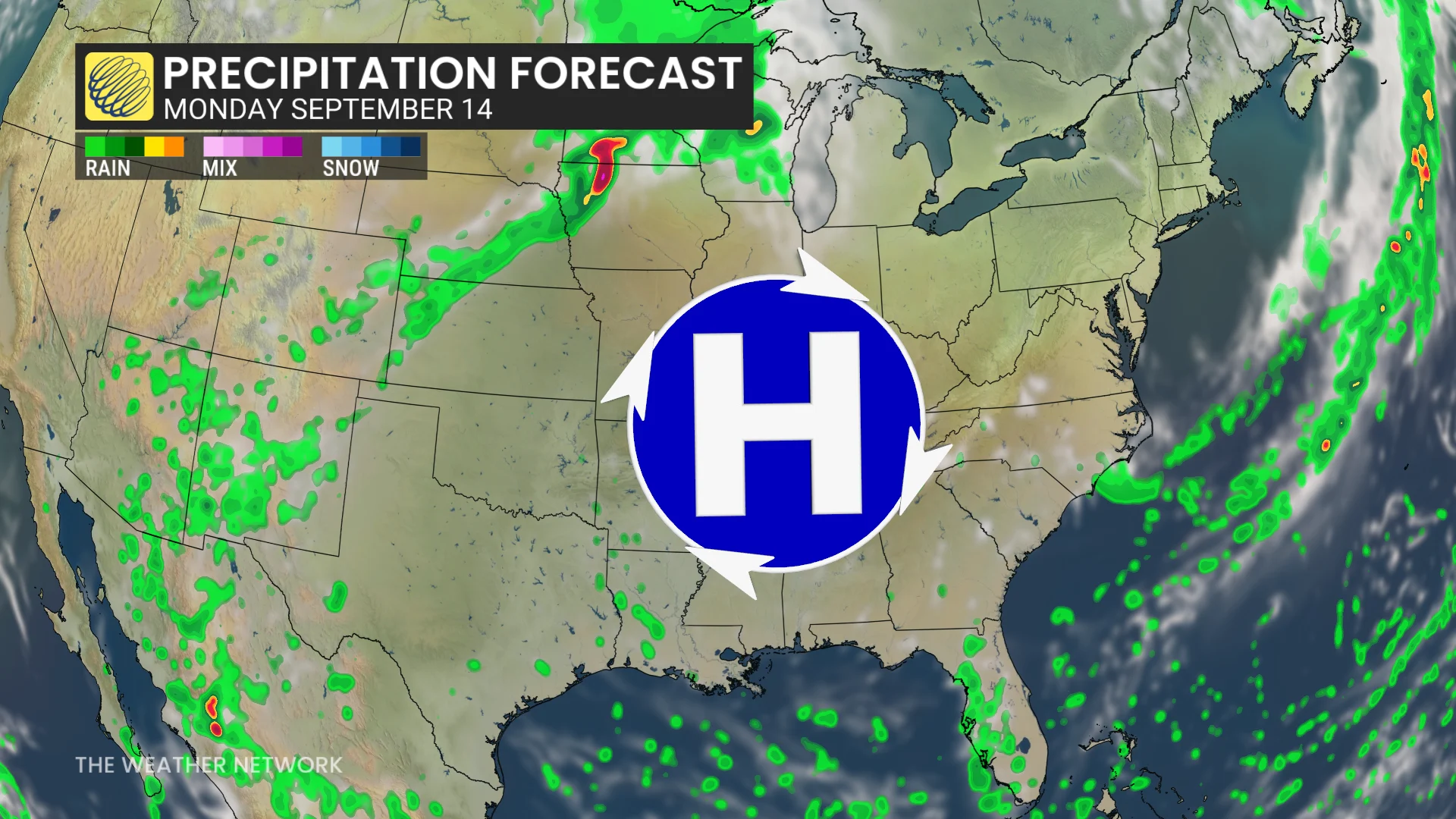
As a result, the muggy and unsettled air mass will be transported into parts of southern Ontario.
With the humid conditions in play, folks stuck with the muggy air mass in southern Ontario may see daily showers and/or thunderstorms through the second half of the work week, and potentially into next weekend.
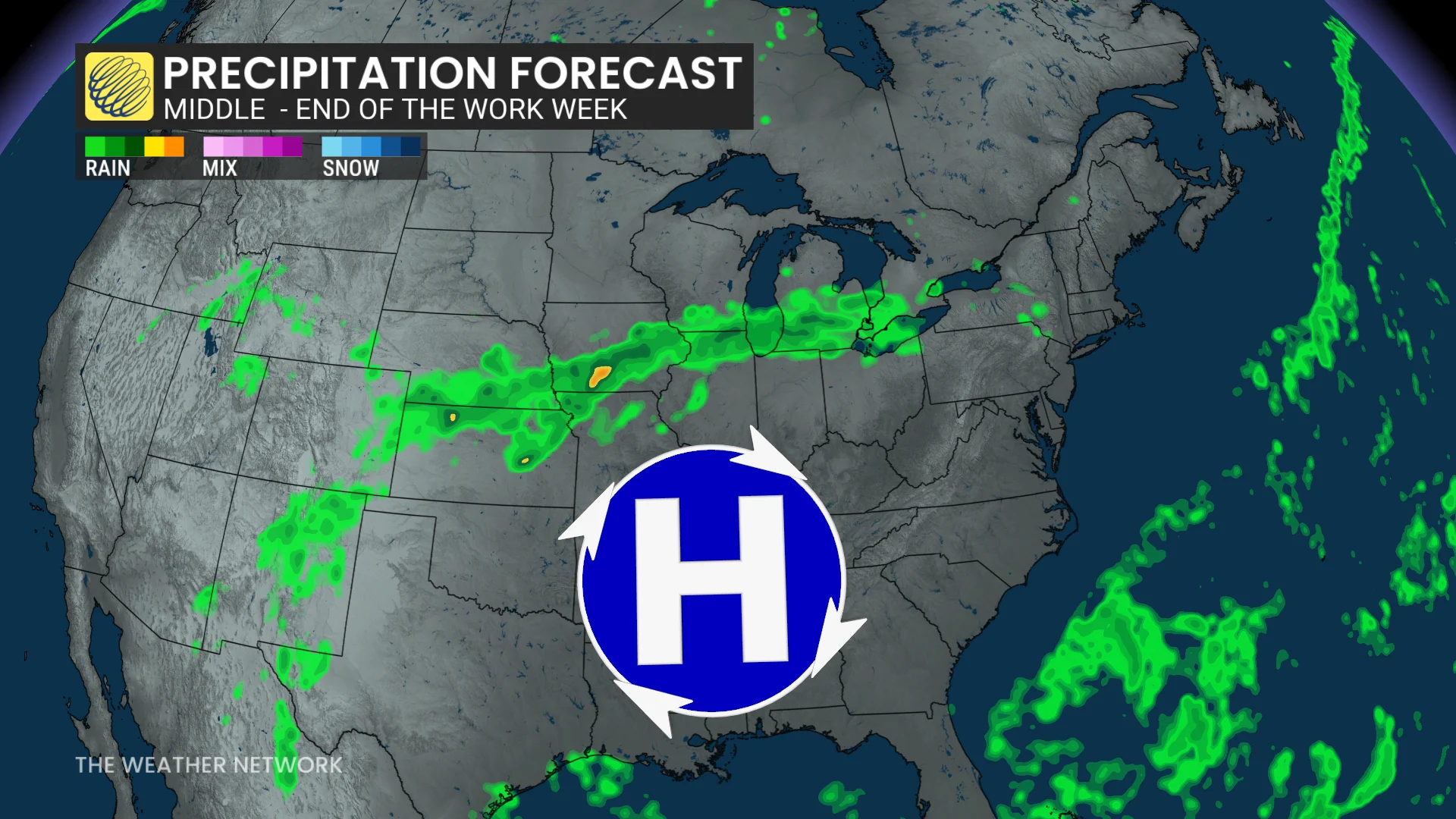
Localized flooding is possible thanks to the moisture laden airmass, especially if you are caught by a thunderstorm.
Daytime highs will generally hit the low to mid-20s across southern Ontario. High 20s and humidex values into the low- to mid-30s are expected in far southwestern Ontario.
How far north will the ring of fire push?
However, there is uncertainty regarding how far north the warmest and muggiest air will travel.
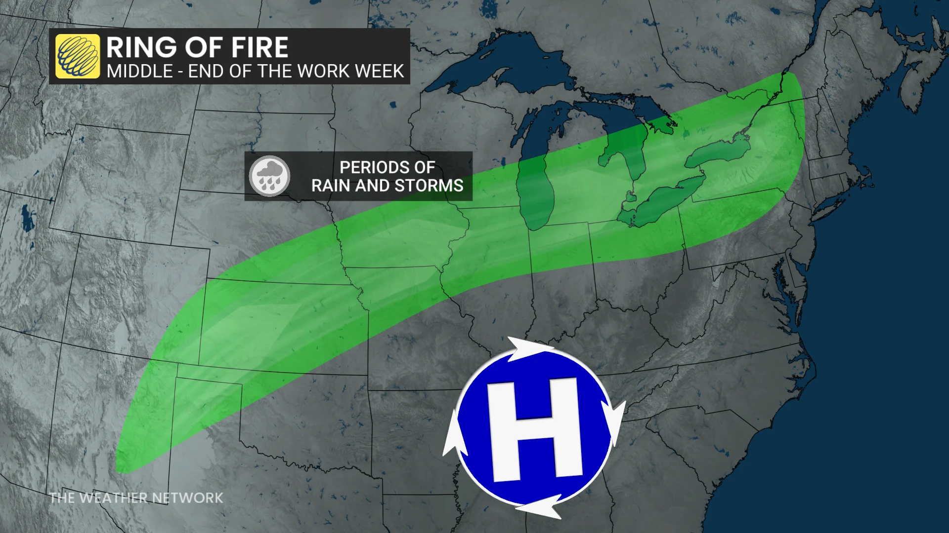
It is unclear where exactly the corridor of persistent shower activity sets up.
Will there be embedded systems or impulses that create more organized waves of precipitation?
That could lead to more organized thunderstorms if an impulse rides the ring of fire.
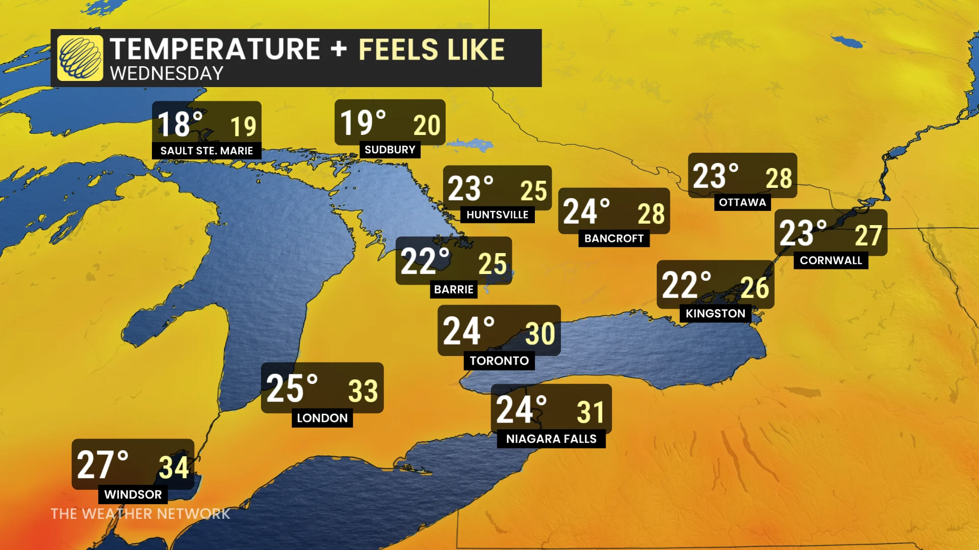
There will be the potential for widespread, heavy rainfall if a low-pressure system rides the ring of fire, but the specifics are stilll unclear if that could happen.
Some models suggest the boundary will then push south of Ontario by Thursday or Friday, while others indicate it will push south on the weekend.
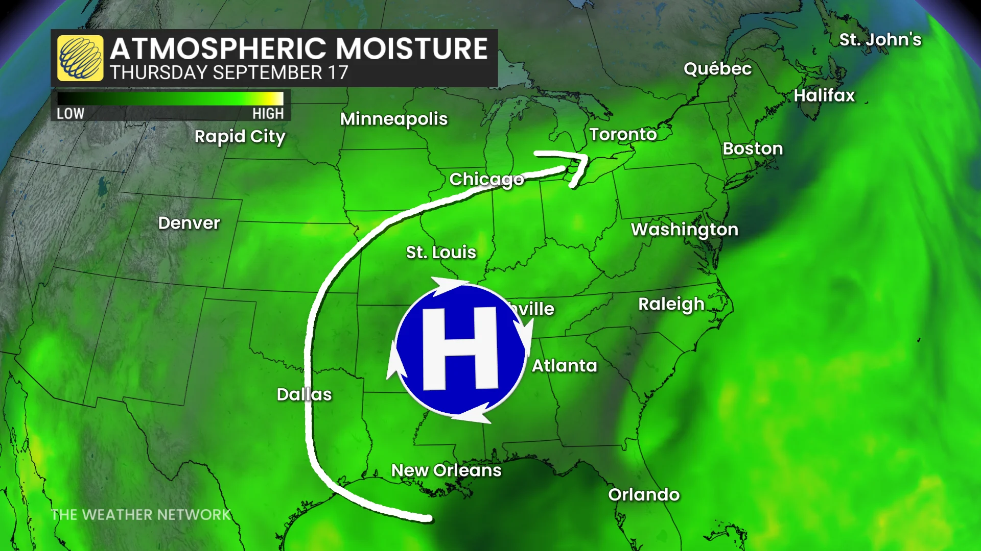
The air mass will be drier and slightly cooler after the boundary exits.
Several days of cooler weather are expected following the exist, especially into the following week for the official start to autumn, but temperatures will just be a few degree cooler than seasonal.
Temperatures should trend warmer again during the final week of September.
Stay tuned to The Weather Network for the latest forecast updates for Ontario.