Newfoundland faces dangerous travel amid 20-30+ cm of wind-driven snow

Expect blizzard conditions along the Trans-Canada Highway in eastern Newfoundland Friday into Saturday. Travel is not recommended
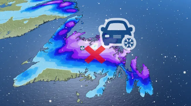
A prolonged period of heavy snow and strong winds are expected to end the week across Newfoundland, with snowfall warnings for much of the province amid the risk for dangerous travel and potential blizzard-like conditions.
A large low-pressure system east of Newfoundland will send plentiful snow crashing over the island’s northern and eastern shores. The heaviest accumulations are expected overnight Friday into Saturday.
Visit our Complete Guide to Spring 2023 for an in-depth look at the Spring Forecast, tips to plan for it and much more!

As much as 20-40 cm of snow is possible along and north of the Trans-Canada Highway -- from Clarenville to Badger. Between 15-25 cm is possible for St. John's and the northern Avalon. The snow may eventually mix with rain or drizzle over some coastal areas before ending later Saturday.

Northerly wind gusts between 60 to 80 km/h are also expected, with the strongest gusts whipping in along the coast.
"A prolonged period of dense, wet snow is expected," Environment and Climate Change Canada (ECCC) said in its snowfall warning for Gander. "Rapidly accumulating snow could make travel difficult over some locations."
MUST SEE: Polar bear warning issued in northern Newfoundland, southern Labrador
WATCH: Daylight Saving can be tough for kids, tips to help soften the change
Be sure to check back for the latest updates across Atlantic Canada.