Renewed flood, severe storm risk in Quebec as training storms possible
Sunday could see a repeat of Saturday's thunderstorms and flooding across parts of Quebec with a favourable, atmospheric setup in place
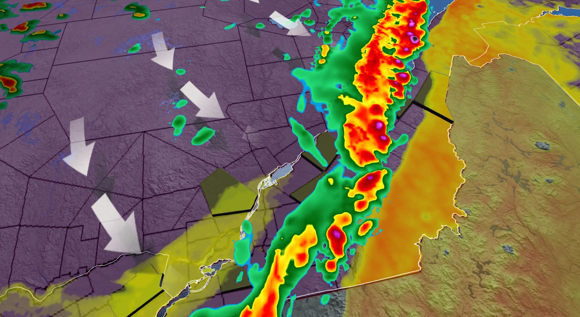
Quebec’s weekend got off to a rough start as a series of intense, slow-moving thunderstorms repeatedly rolled over the same stretch of communities on Saturday, triggering widespread, flash flooding.
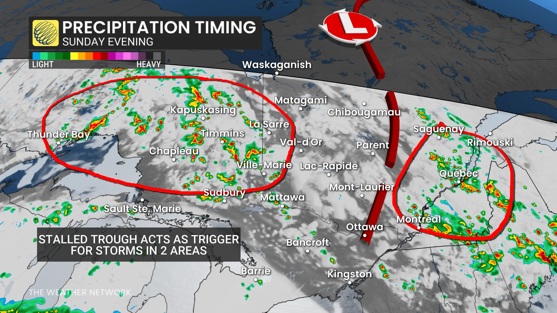
On Sunday, a similar setup could bring heavy rainfall and training thunderstorms once again, potentially leading to more flooding in some areas.
DON'T MISS: Thunderstorm over Montreal leads to flooding, street closures and power outages
Saturday sees high rainfall totals in hours, flooding basements and roads
Locally, some locales saw upwards of 100-170 mm of rainfall in mere hours on Saturday in the Montreal area as storms stalled and trained over the same region for several hours.
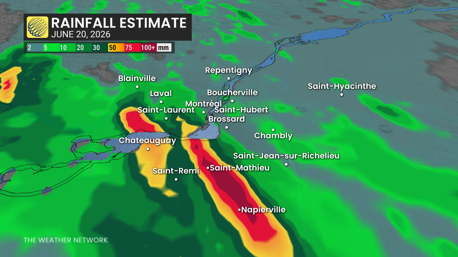
Multiple instances of flooding were reported, along with extensive property damage, including cars trapped in floodwaters, flooded homes and impassable roads. Significant delays were documented at the airport.
As well, there were highway closures and power outages climbing to more than 25,000 at one point.
WATCH: See the intense floods and lightning that hit Quebec on Saturday
Sunday storm and flood risk sets up over southern Quebec
On Sunday, an upper-level trough and a moderate level of thunderstorm energy will stick around.
With the ground already saturated from Saturday’s storm, a region of severe storms will be possible through Sunday afternoon and into the evening.
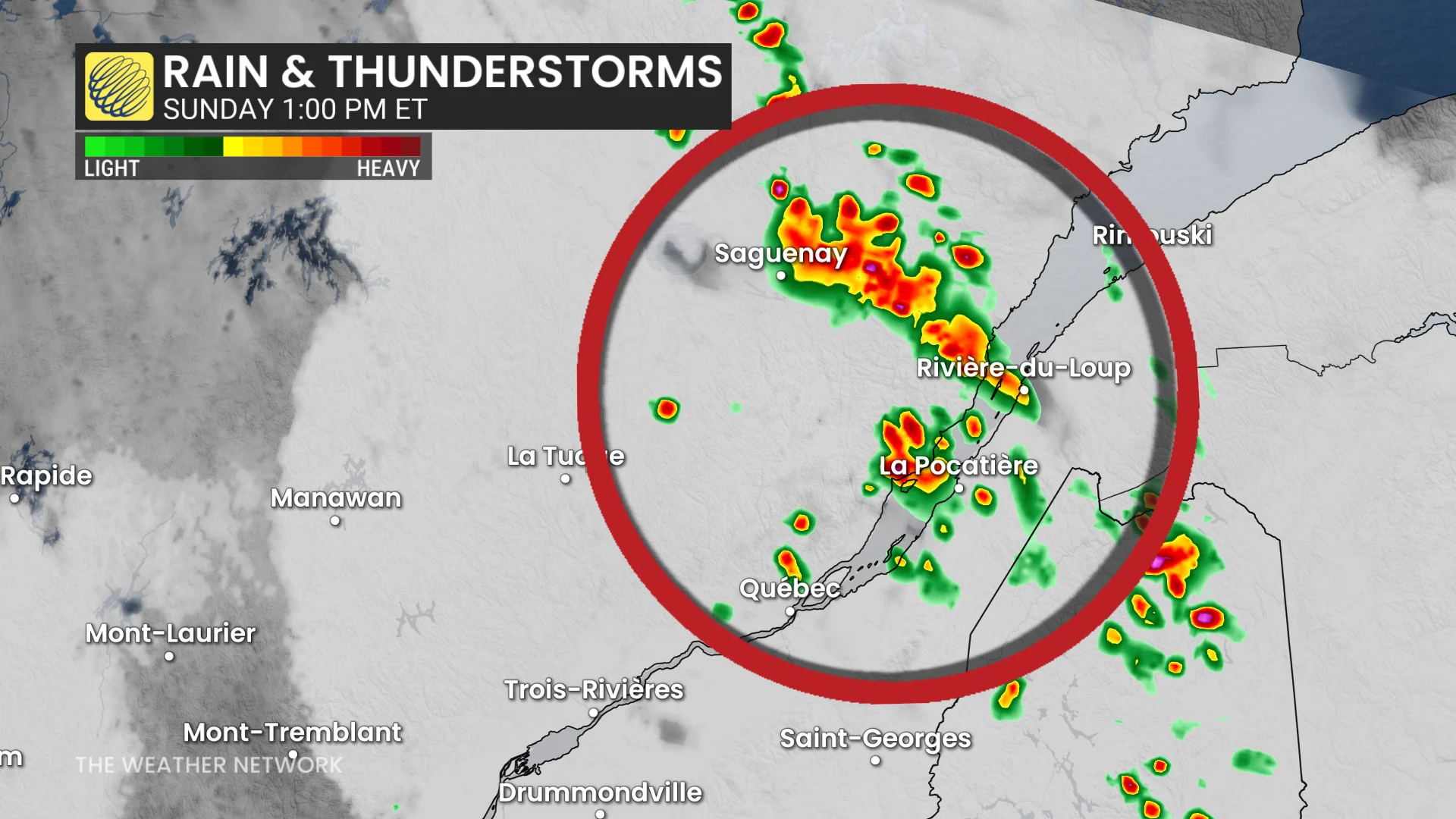
Storms will initiate in the Saguenay area by the early afternoon. Storms will also initiate east and southwest of Montreal by mid-afternoon.
Heavy rainfall and saturated grounds will lead to a flood risk again.
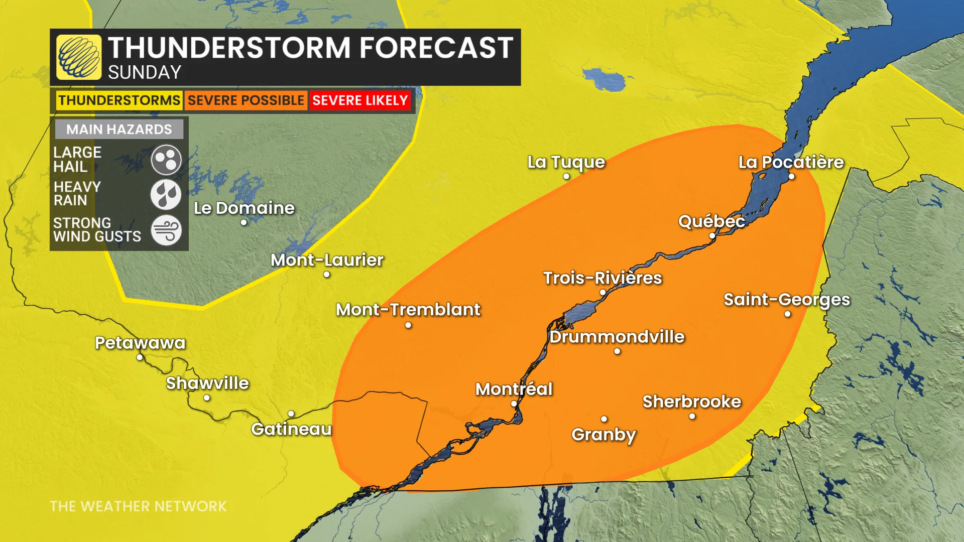
Slow-moving, training storms will be possible again, potentially bringing overland flooding once more on Sunday.
Storms will move southeast across the St. Lawrence through the Eastern Townships where stronger storms are possible through the late-evening period.
Come Monday, unsettled conditions will continue, with several rounds of scattered storms through the day--and possibly beyond.
Stay with The Weather Network for all the latest on conditions across southern Quebec.