Relentless storm parade across Atlantic Canada with Arctic chill to come
Back-to-back storms continue to hit the East Coast, ahead of a blast of Arctic air that finally spills in to end the week
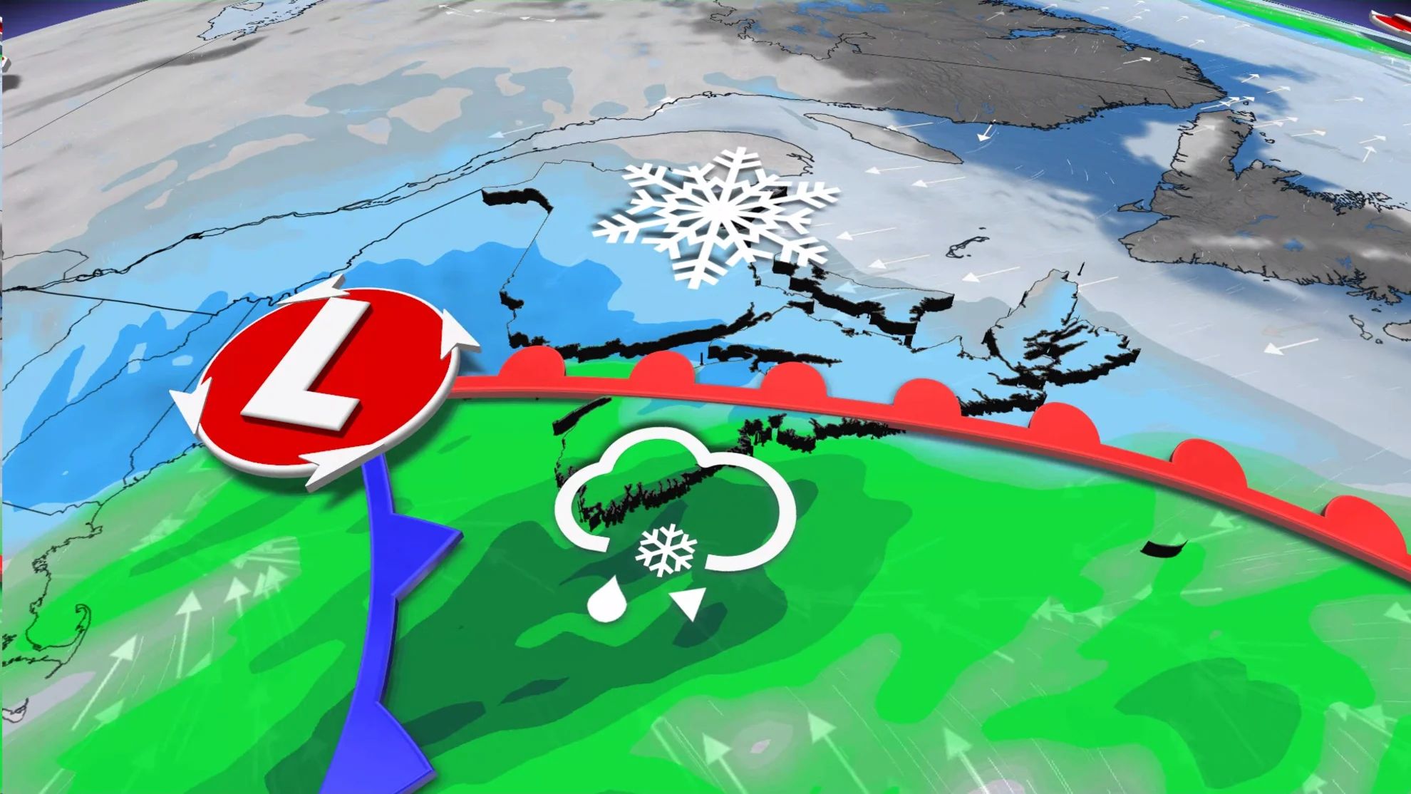
The relentless storm parade will continue across Atlantic Canada, with more heavy snow and rain spreading across the region to start out the week. This tricky system could snarl travel in some areas into Wednesday.
PHOTOS: Powerful snow squalls bury communities with knee-high totals
Arctic air will spill over the East Coast for the latter half of the week, with the coldest air of the season poised to wrap around the back side of the system.
Another messy system on tap through Tuesday
The trough allowing cold air to pour out of Ontario and Quebec will force a broad low-pressure system to develop over New England and track toward Atlantic Canada by the middle of the week.
We’ll watch the low move into the Maritimes by Tuesday evening, spreading a mix of snow to the north, rain to the south, and a mix of all wintry precipitation types somewhere in between.
A widespread 5-10 cm of snow is expected, with heavier amounts likely in central and northern sections of the region.

Through the evening and overnight hours, all of Nova Scotia is expected to transition over to rain, along with the Fundy shores of New Brunswick.
By Wednesday morning, the system will have moved out of the Maritimes and into Newfoundland after dropping a widespread 10-20 mm of rain.

Snow followed by mixed icy precipitation, and a brief period of rain is expected in Newfoundland through Wednesday.
Although exact precipitation types and amounts are still uncertain, special weather statements already cover the province, with road conditions during rush hour Wednesday morning likely to be poor in most areas of the island.

A strong cool down is forecast later this week, bringing some of the coolest weather of the season so far, as the Arctic air finally spills over the East Coast.
MUST SEE: Look around you for these strange events when frigid air arrives
You can expect temperatures at least 5°C below seasonal to finish off the week, with daytime highs forecast to be well below freezing.

The one bright spot is that this push of frigid continental air will also shove the active storm track offshore.
Check back for all the latest on your forecast across Atlantic Canada.