Records may fall as impressive heat wave roasts the Arctic Circle

--
Canada’s next heat wave is going to be an odd one.
If you’re searching for hot weather to kick off your Canada Day weekend, you’ll need to hit the Dempster Highway and head all the way to the shores of the Arctic Ocean.
WATCHING FOR A POTENTIAL ALL-TIME RECORD IN INUVIK
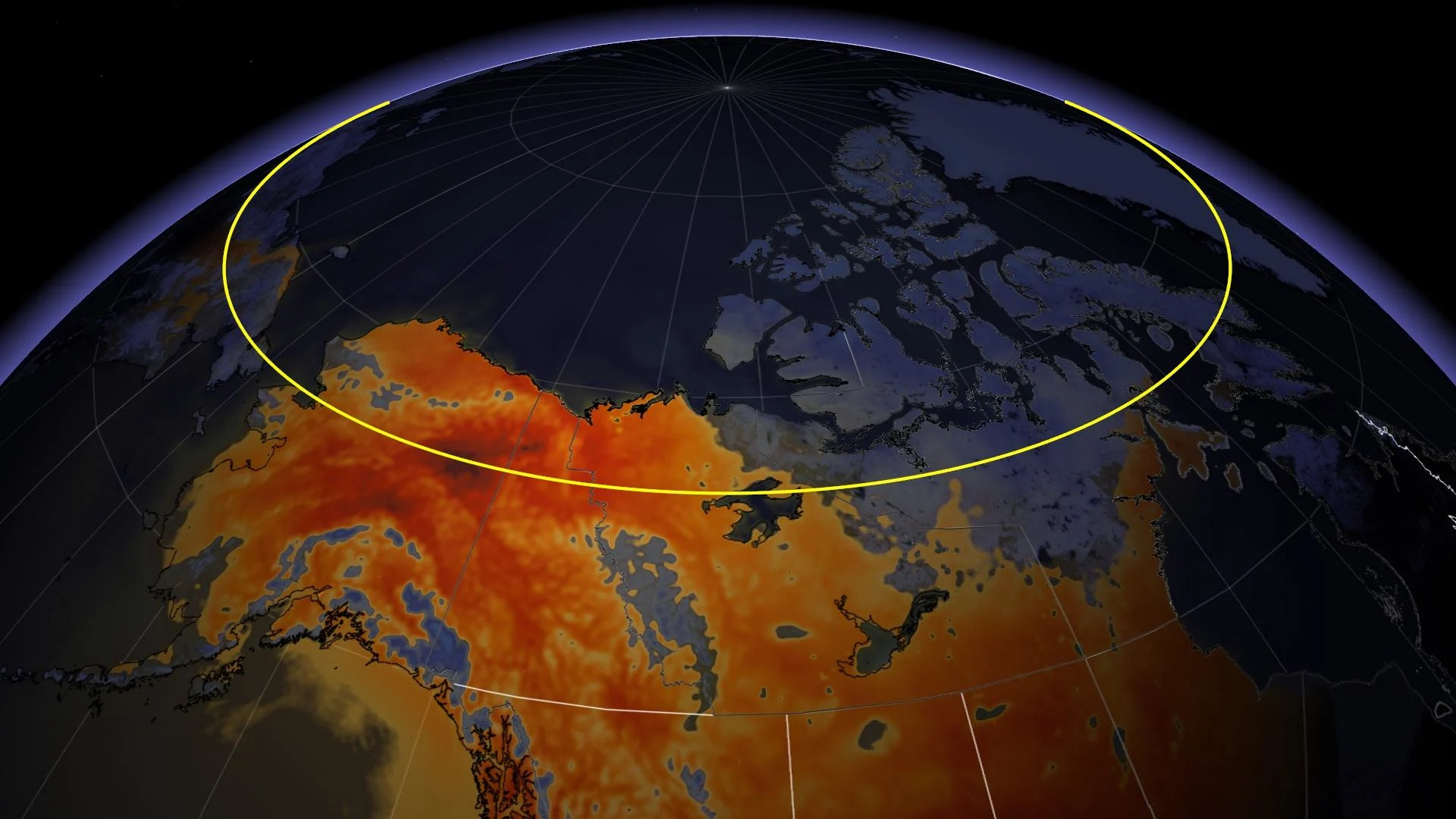
It’s already been a hot month across much of Northern Canada, with temperatures coming in significantly above seasonal for a wide swath of the region. The heat we’ve seen is nothing compared to what might come next week.
Inuvik, N.W.T., could be on track to tie or shatter its all-time hottest temperature on record by Canada Day.
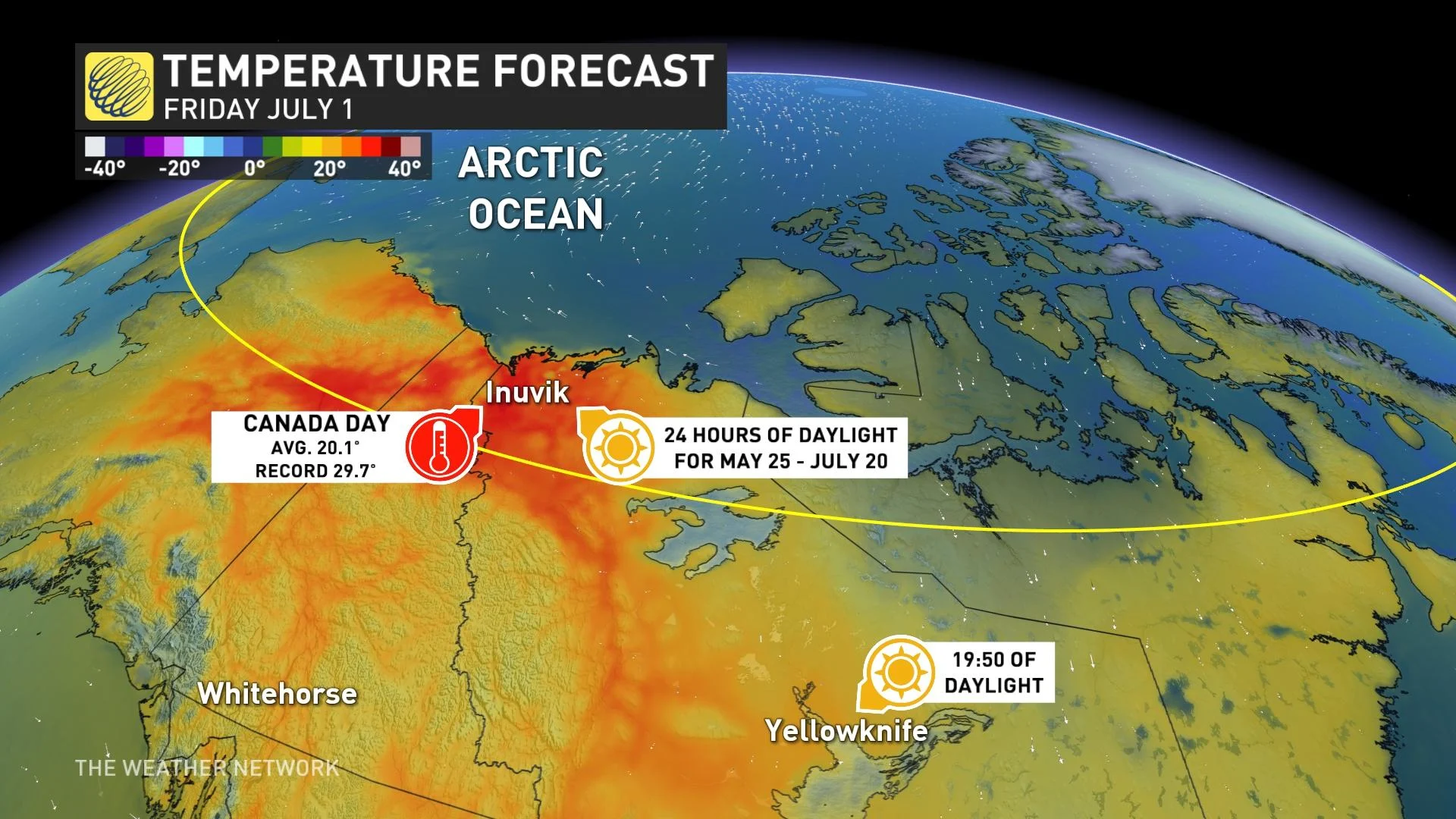
A building ridge of high pressure over Northern Canada will allow the heat to build all week, with temperatures creeping into the upper 20s and low 30s well above the Arctic Circle.
Some weather models are hinting at high temperatures in Inuvik cresting the 30-degree mark by Canada Day on Friday, coming awfully close to meeting or exceeding the community’s all-time high temperature of 32.8°C, a record set twice on June 17, 1999, and again on July 20, 2001.
UNSEASONABLE WARMTH ROASTS YELLOWKNIFE AND MELTS HUDSON BAY
Folks in the Yukon and Northwest Territories have dealt with some impressive heat so far this year. Yellowknife’s average high temperature so far this month is 22.2°C, which is considerably higher than the city’s typical average high of 18.7°C between 1990 and 2010.
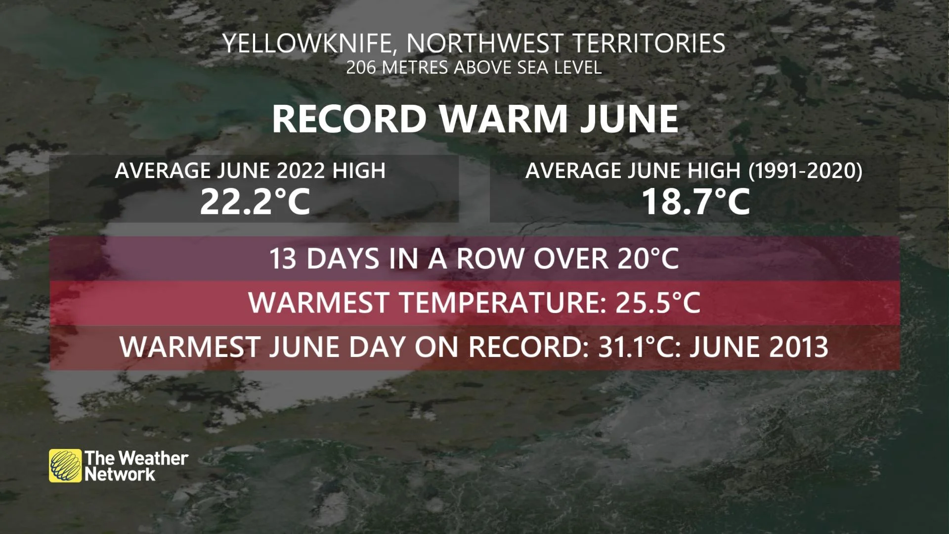
The N.W.T. capital has recorded two formidable streaks of high temperatures of 20°C or warmer so far this month, with the first streak lasting just shy of two full weeks.
How topsy-turvy is this heat? Consider the fact that Yellowknife has achieved a longer streak of temperatures at or above 20°C than we’ve seen down in Calgary so far this month.
WATCH: 30 DAYS OF ICE LOSS ACROSS HUDSON BAY
--
The persistent warmth in the North has had a tangible effect on ice melt across Hudson Bay. Satellite imagery and data both show ice melting across Hudson Bay at a near-record pace so far this year.
Hudson Bay typically reaches ice-free or minimal ice coverage by the end of the summer.
However, the ice on the Bay is receding at an astonishing rate this year. Climate scientist Dr. Zack Labe compiled data from the U.S. National Snow and Ice Data Center and found that the current extent of ice on Hudson Bay is shrinking at a rate that outpaced almost any other year.
This upcoming stretch of unseasonable warmth heading into the beginning of July will further melt the ice.


