Ontario's 20-degree days fizzle out with Tuesday's rain and storm risk
A second day of exceptionally warm late winter weather will come to an end as a cold front brings showers and the risk of thunderstorms into southern Ontario Tuesday
Windows wide open, birds loudly chirping, abundant sunshine -- the start of this week in southern Ontario is certainly feeling more like the middle of spring.
For many, temperatures soared into the low 20s on Monday, setting new records for places like Hamilton. It was the earliest 20-degree value in the year that has been documented in the city, just sneaking by the previous record that occurred on March 8, 2000.

For perspective, Hamilton airport normally sees daytime highs of around 2°C at this time of year.
DON’T MISS: Ontario’s exceptionally warm February landed in the records
Despite inching even closer to the official start of spring, don't get your hopes up that these rare conditions will stick. The early tease of pleasant golf weather will soon fizzle out with the passing of a cold front.
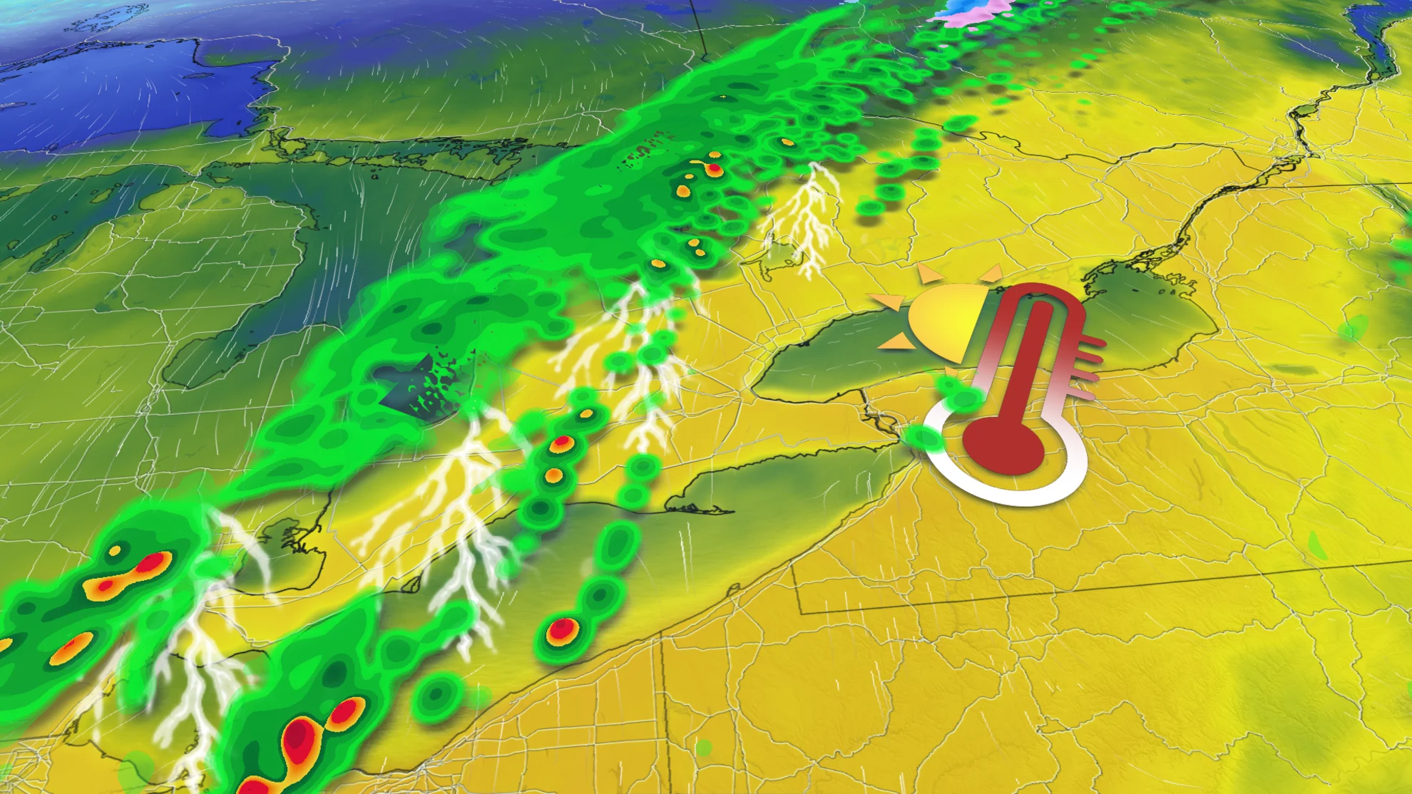
Temperatures will climb once again on Tuesday, though not quite reaching Monday's 20-degree highs. Readings in the mid-teens are likely throughout the entire region, which could challenge daily records for a few communities.

MUST SEE: Expect a turbulent March across Canada as the seasons duke it out
Expect a period of rain to accompany the cold front's arrival later Tuesday, with 5-15 mm likely for most of southern Ontario, and higher totals possible in central sections. A bit of instability creeping across the border may even lead to a risk for thunderstorms across southwestern sections as the front pushes through.
Any thunderstorm activity on Tuesday wouldn’t come close to matching the intensity or coverage of the tremendous late-February storms we saw last week, but rumbles of winter thunder are a conversation-starter either way.

Considerably cooler conditions will sweep into southern Ontario behind the front, but readings will likely remain on the milder side of seasonal for the remainder of the week.
Forecasters are watching the potential for unsettled weather to return to the region heading into this weekend. However, there is low confidence in the storm track. Regardless, southern Ontario should see primarily rain, with substantial totals, but there is some potential for rain to change to wet snow before ending.

A trickier forecast for cottage country and eastern Ontario, with rain changing to wet snow. Snow totals will depend on the storm track and elevation.
Stay with The Weather Network for all the latest on your forecast across Ontario.