
Record-breaking November warmth sweeps over Ontario ahead of cooldown

Northeastern Ontario is expected to experience the warmest temperature anomaly in North America this weekend, while some Ontario cities are on track for their warmest November on record.
Ontario's second November warm stretch will continue into the weekend with daytime temperatures in the mid- to high teens across the province, with the exception of northwestern Ontario.
High pressure locked over the Eastern United States will keep the skies clear and temperatures warm into the weekend.
Saturday is expected to be the warmest day across northeastern Ontario thanks to a Colorado low tracking into the north with a strong warm front in the lead. As the warm front ushers in the warmer air mass from the south, temperatures around the Timmins area are forecast to reach 15°C.
SEE ALSO: How will a strong El Niño impact lake-effect snow season?
This should also be the second time this month that northeastern Ontario experiences the warmest above-seasonal temperatures in North America.
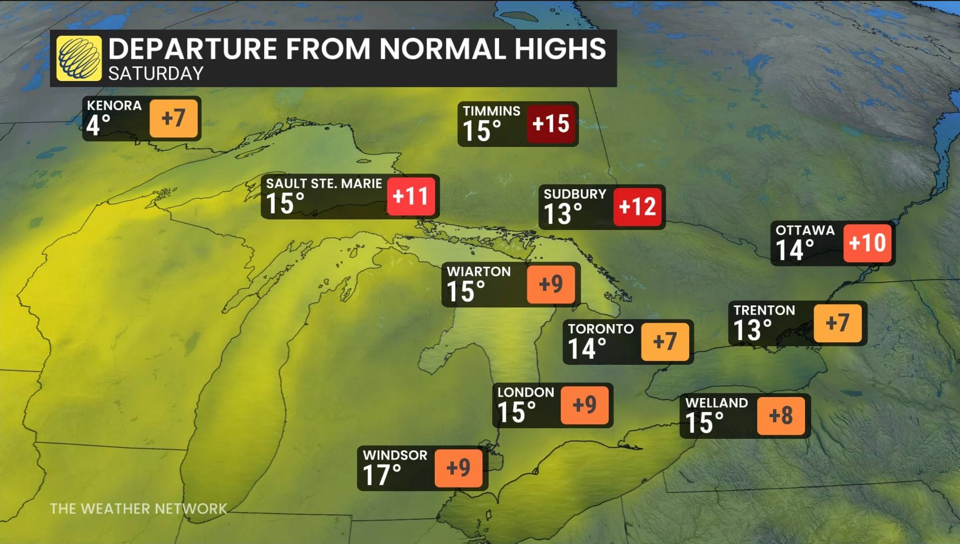
In southern Ontario, temperatures into and through the weekend are expected to be 5-10 degrees above seasonal.
Temperatures in Toronto, specifically, could even be a degree or two higher than forecast due to the urban heat island effect.
Cities on track for warmest November on record
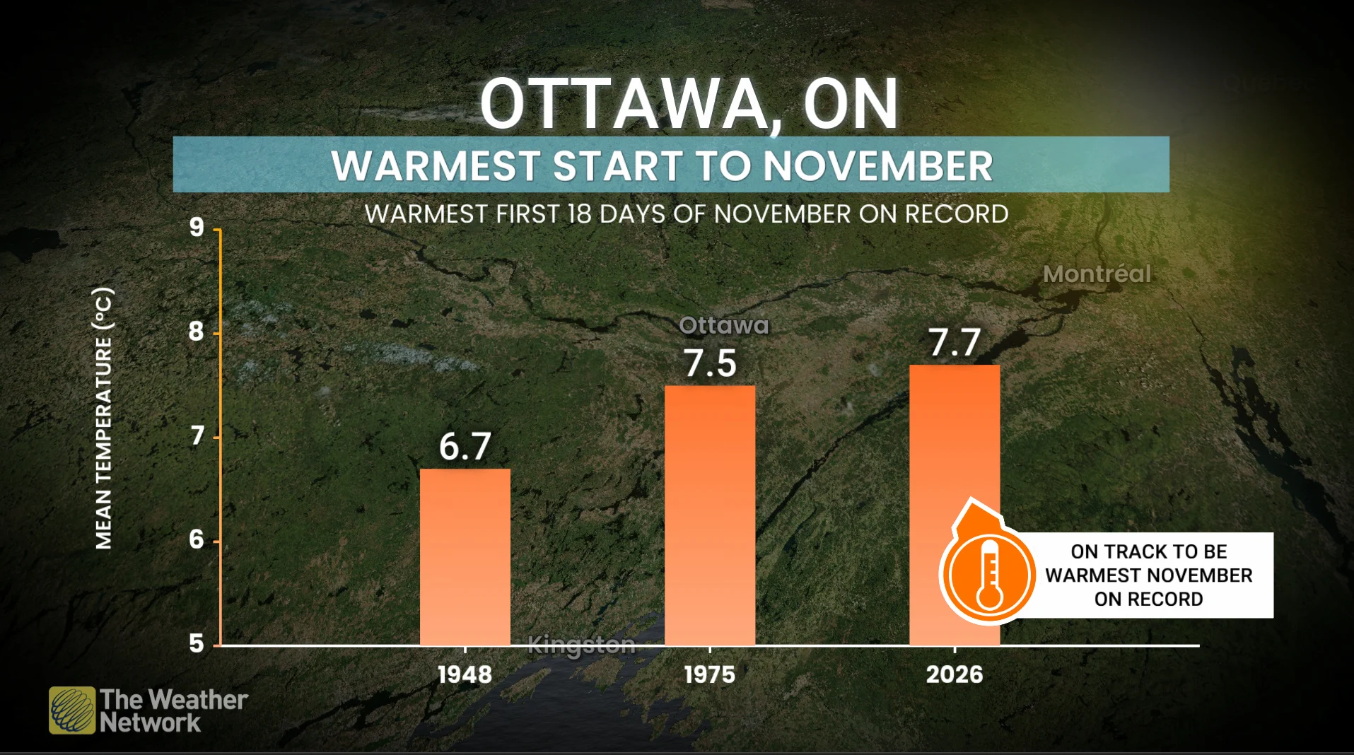
The first three weeks of November are forecast to be the warmest on record for Toronto, Ottawa, and Timmins.
The average temperature in Toronto from Nov. 1-18 was 8.91°C, which is the warmest mean temperature for that period since 2016.
In Ottawa, the average was 7.72°C, beating the previous record of 7.48°C set in 1975.
Warmest November on record:
Ottawa: 4.98°C in 1948
Toronto: 7.1°C in 2001
Timmins: 1.79°C in 2009
DON'T MISS: Could El Niño save you money? How your utility bills may be impacted
Temperature flip on the horizon
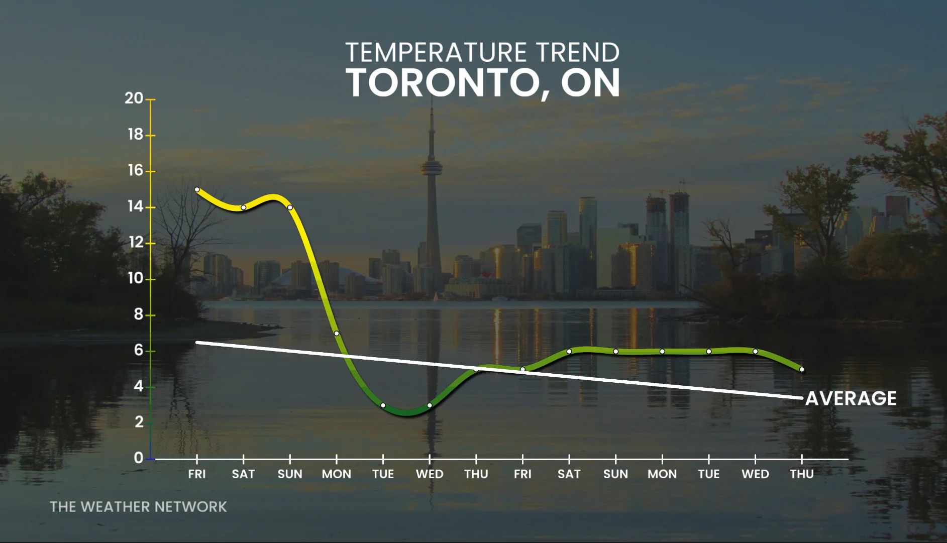
November is set to end with a major temperature flip beginning early next week. Temperatures will sink back to seasonal levels thanks to a cold front associated with another Colorado low tracking across northwestern Ontario late Sunday.
Parts of the Trans-Canada Highway could see significant snowfall, as well as around the Timmins area.
With the cooler temperatures, parts of southern Ontario could see some lake-effect snow and flurries early in the week before temperatures rise to slightly above-seasonal once more.
Stay with The Weather Network for more information and updates on your weather across Ontario.