
Tornado watch issued in Alberta and Saskatchewan amid severe storm threat

Residents across parts of Alberta and Saskatchewan are advised to monitor the forecast closely as severe weather, including the potential for a tornado, is expected to continue through Monday evening. Check back regularly for updates.
Saskatchewan
3:59 p.m. CST: A low-pressure system moving through western Saskatchewan this afternoon and evening may cause severe thunderstorms with the potential to produce tornadoes.
Main threats: Tornadoes, Large hail and damaging wind gusts
Alberta
3:04 p.m. MDT Conditions are favourable for the development of severe thunderstorms which may produce tornadoes. Strong winds, large hail and heavy rain are also possible.
The greatest risk for tornadoes will be through 7 p.m. local time.
Any storm with the potential to produce tornadoes will be accompanied by hail up to the size of baseballs.
Current tornado watches
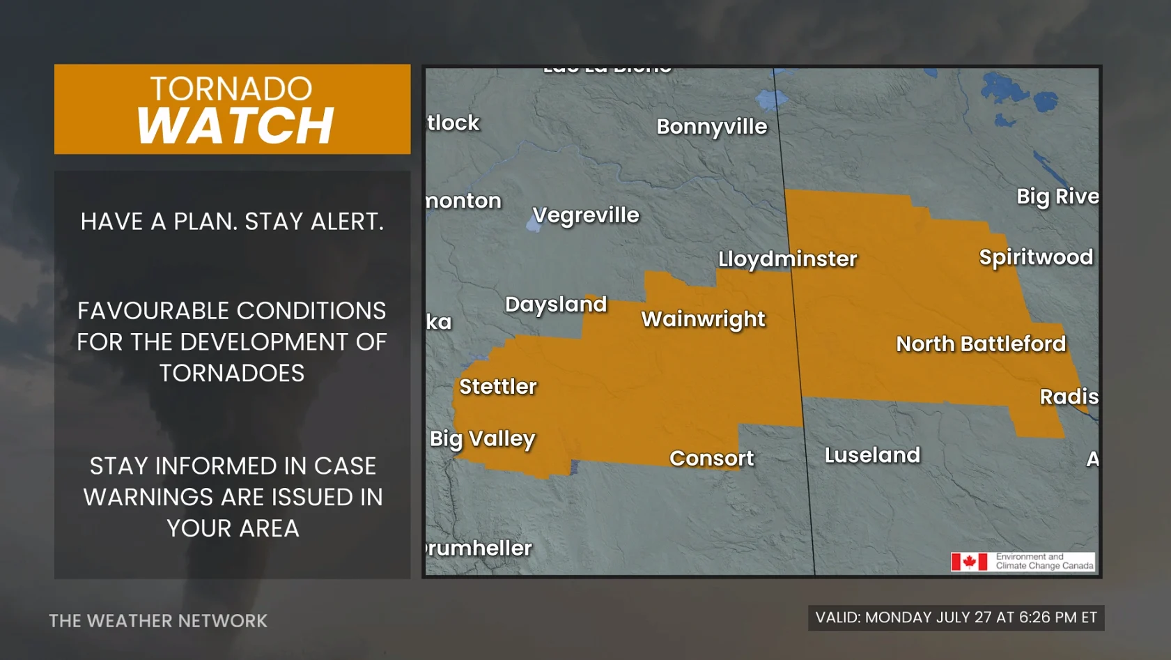
Tornado watches are issued when conditions are favourable for the development of severe thunderstorms capable of producing tornadoes.
For the current weather alerts in Alberta, click here.
For the current weather alerts in Saskatchewan, click here.
The full forecast details can be found below.
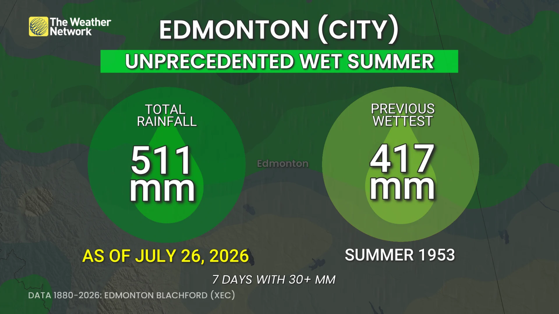
Another round of severe weather is possible to hit areas of Alberta on Tuesday, not-so-good news for Edmonton, which has seen its wettest summer on record.
Severe weather becomes more intense and widespread on Tuesday. The Alberta threat will include the chance of damaging wind gusts, downpours large hail and a tornado or two in some areas of the province.
DON'T MISS: Benefits of forest bathing and why you should try it
Keep up with the latest watches and warnings in your area. Take immediate action if a tornado warning is issued for your location.
Weather pattern fuels Alberta storm, tornado risk
Record-breaking rainfall in central Alberta means there’s ample excess moisture, increasing the threat of tornadoes and severe thunderstorms.
With the ground waterlogged, the region can’t support more run-off, so the region remains highly susceptible to flooding.
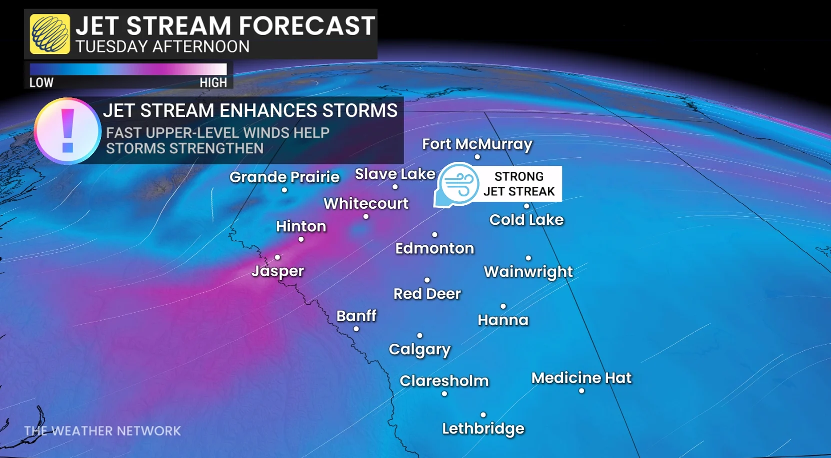
A strong jet stream lifts across central Alberta late Tuesday afternoon, creating a textbook pattern to develop severe storms.
A developing trough and surface low push across central Alberta, boosting storm coverage across north and central Alberta.
Storms begin in the afternoon along the northern foothills near Grande Prairie and Edson, maturing and intensifying by the early evening as they track towards Edmonton to Slave Lake.
Will move northeast through the evening, persisting overnight towards Fort McMurray and Cold Lake with continued damaging wind risk with squall line features.
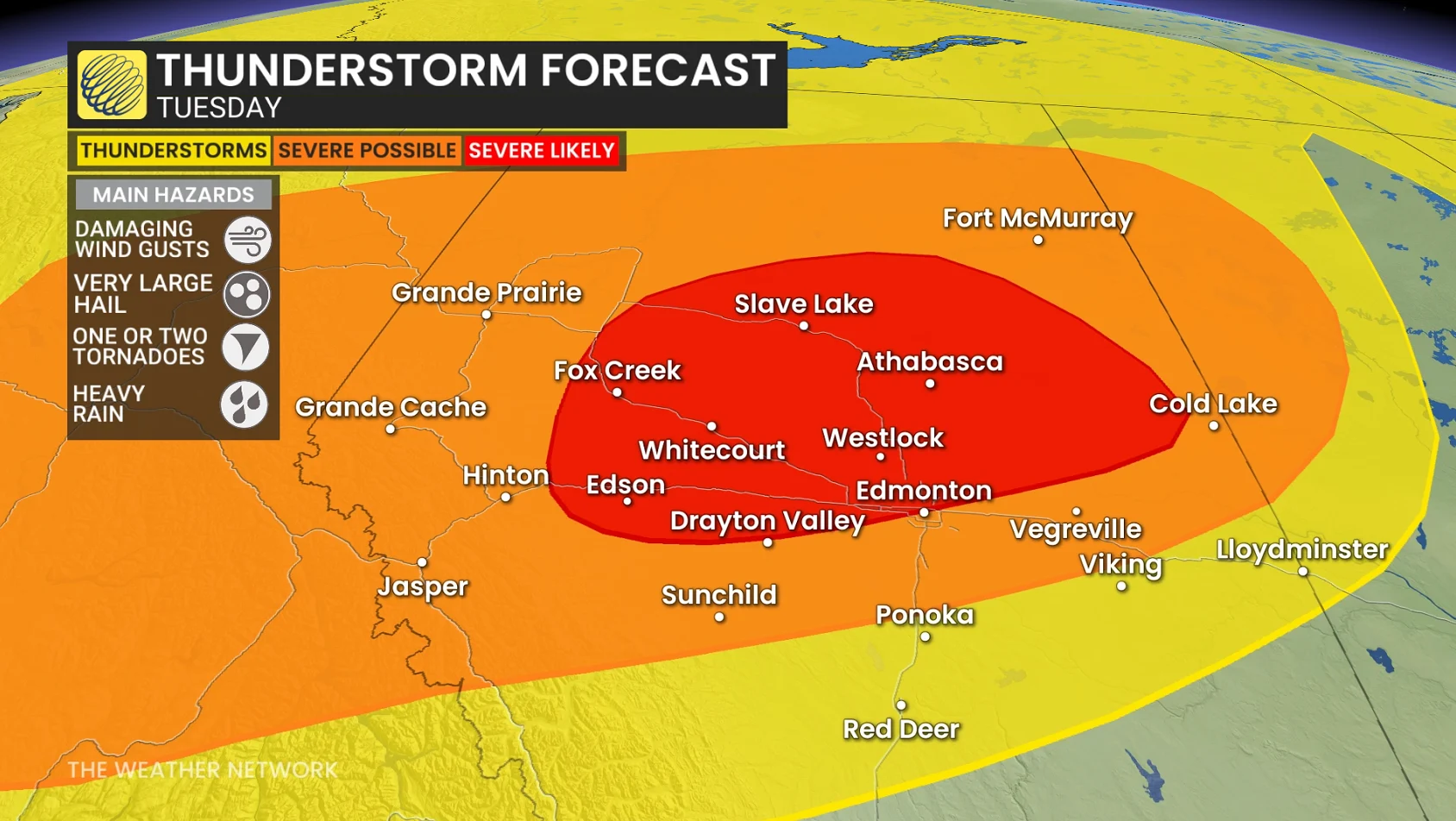
Main risks for very large hail (4-6 cm), heavy rain and strong to damaging winds (110+km/h).
A couple of tornadoes are increasingly possible in the red risk area as dynamics and low-level moisture support their development through early Tuesday evening.
Stay with The Weather Network for the latest across Alberta.