Ready or not: Wintry weather unfolds across the Prairies this week

This will be the first snowfall of the season for many, including all of southern Saskatchewan.
After a round of widespread snow across Alberta and the first major snowfall event of the season for the northern Prairies, more flakes are forecast to fly this week. This time, though, it will be the first for many, including southern Saskatchewan.
A snowy Friday across much of Alberta, including Calgary, resulted in numerous vehicles sliding on roads and highways, with some ending up in the ditch. Highway 63 in northeastern Alberta had to be closed due to the dangerous conditions causing multiple collisions.
SEE ALSO: Canada's polar vortex wild card is waking up much earlier than expected
Since it's only the end of October, many folks don't have their winter tires on yet, which means any snowfall will reduce traction on the roads. Use extreme caution while driving during these bursts of fall snow, even if you do have winter tires on.
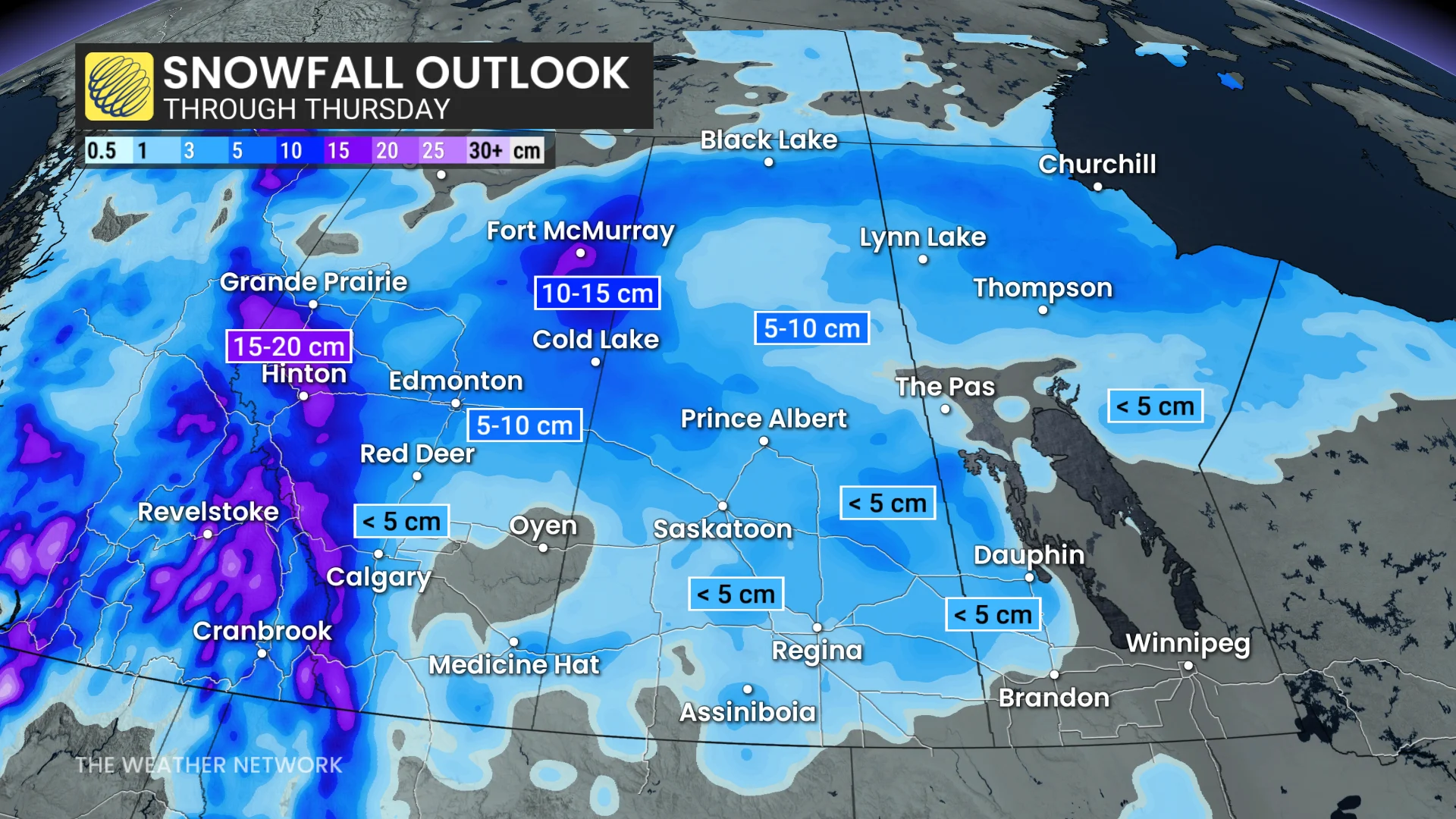
This next round of snow will stay mainly in Alberta and Saskatchewan, but parts of northern and western Manitoba could also see some accumulation.
Snow begins Tuesday but picks up Wednesday
A Montana low will make its way into Canada on Tuesday morning, bringing a mix of rain and snow across the Prairies throughout the day.
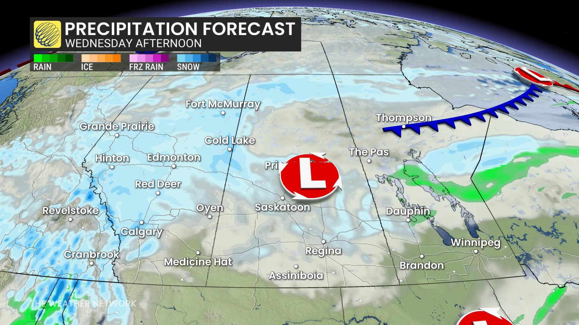
But that won't be all, as a high-pressure system over Eastern Canada will keep this low from moving east very fast, and a northerly flow is forecast to set up around the snowy system on Wednesday. This should result in an extended period of snowfall from central Alberta to central Saskatchewan.
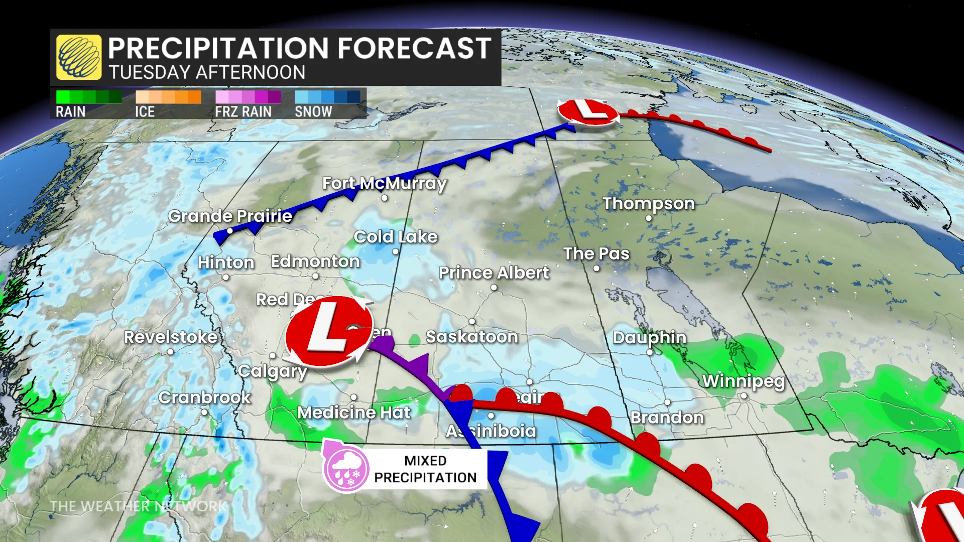
A secondary surface low sitting stateside will draw in Pacific moisture over the Rockies, resulting in additional snowfall accumulation across parts of southern Alberta.
DON'T MISS: Permanent summer time could make your winter commute dangerous
While Calgary is forecast to see less than 5 cm of snow, much higher totals are forecast just west of the city, into the Rockies. Temperatures are also forecast to drop below freezing for the first time since April on the back end of the system.
Further north, Edmonton could see accumulations of 5-10 cm. This will likely be the heaviest snowfall the city has seen so far this season.
Luckily, this won't be a wet snow event, although travel will still be hazardous along the Yellowhead Highway and QE2 through Wednesday.
Manitoba will likely get out of this event mostly snow-free, with only a few centimetres forecast north of Brandon and around Dauphin.
Stay with The Weather Network for more information and updates on your weather across the Prairies.