
Ready or not, a threat for snow arrives on Sunday
Some areas see the risk for accumulating snow on Sunday as an unusually cold pattern settles over the region
Someone forgot to tell the atmosphere that it’s the middle of May.
A slug of snow is expected to build across portions of Saskatchewan on Sunday. Slick roads and sidewalks are possible in areas that pick up accumulation from this fresh burst of wintry precipitation.
DON'T MISS: Latest forecast warns a very strong El Niño could emerge soon
Snow to arrive on Sunday
The western half of Canada is in the midst of an unsettled pattern as an upper-level trough swings through the region. These patterns tend to bring below-seasonal temperatures, clouds, and precipitation to nearby communities.
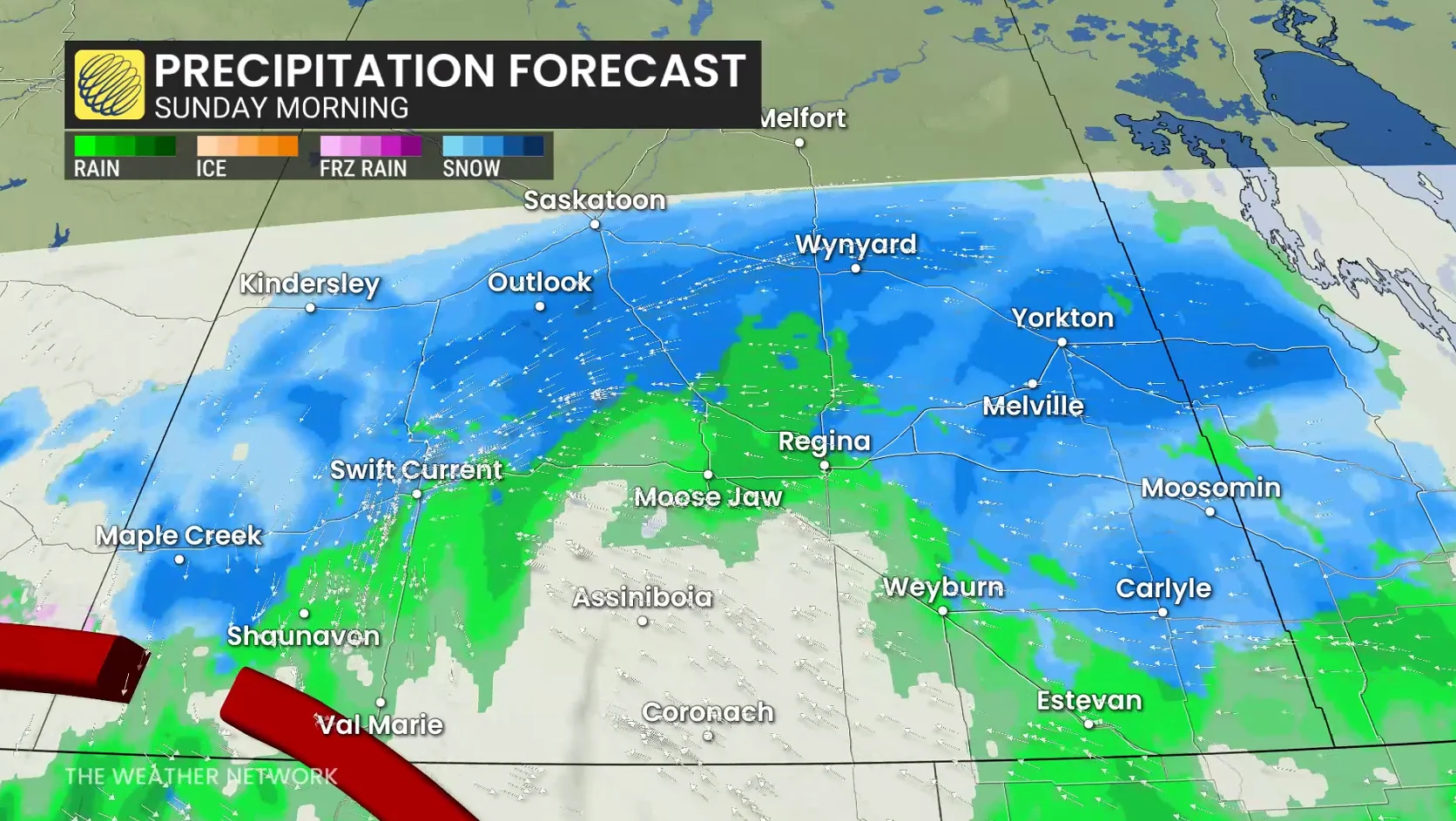
Temperatures in southern Saskatchewan will struggle to climb out of the single digits through the day Sunday, just chilly enough to bring a risk for wet snow through the day.
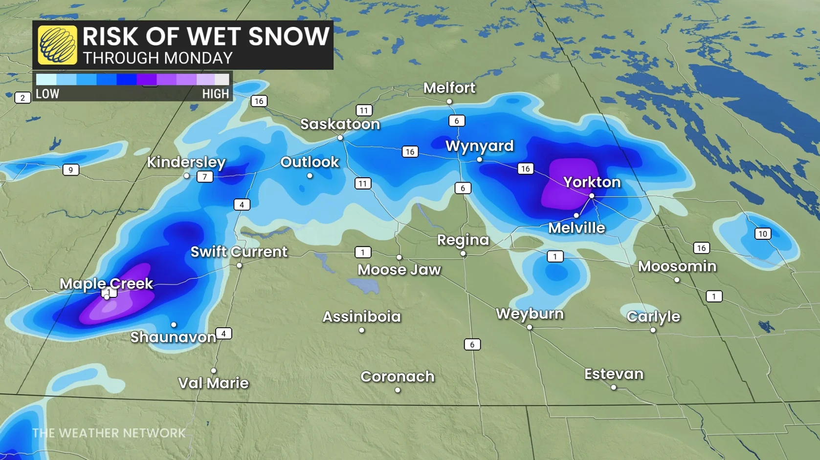
The best opportunity for wintry precipitation is in the southwest corner of the province, as well as along the Yellowhead Highway between Saskatoon and Yorkton.
Steady rains will fall across the southern one-third of Saskatchewan through Monday, with gauges locally picking up as much as 30 mm of additional precipitation through Monday.

How unusual is snow here in the middle of May?
Saskatoon, Regina, and Yorkton all average a couple of centimetres of snow during a typical May, according to the latest 1990-2010 climate normals. Kindersley reported 2.6 cm of snow in the midst of unseasonably cold weather on May 20, 2021.