Ready or not, Canada expecting high-impact weather to finish June
June is set to end with widespread unsettled weather in Western Canada while high heat and humidity build for parts of the east
A dramatic finish is in store across Canada as we round out the final days of June.
Conditions will remain unsettled and stormy across the west, where more flooding rains are possible in hard-hit communities. An expanding heat dome south of the border will bring hot, muggy conditions to the Great Lakes.
DON’T MISS: Beware: Flood insurance isn't guaranteed, and the type you have can vary
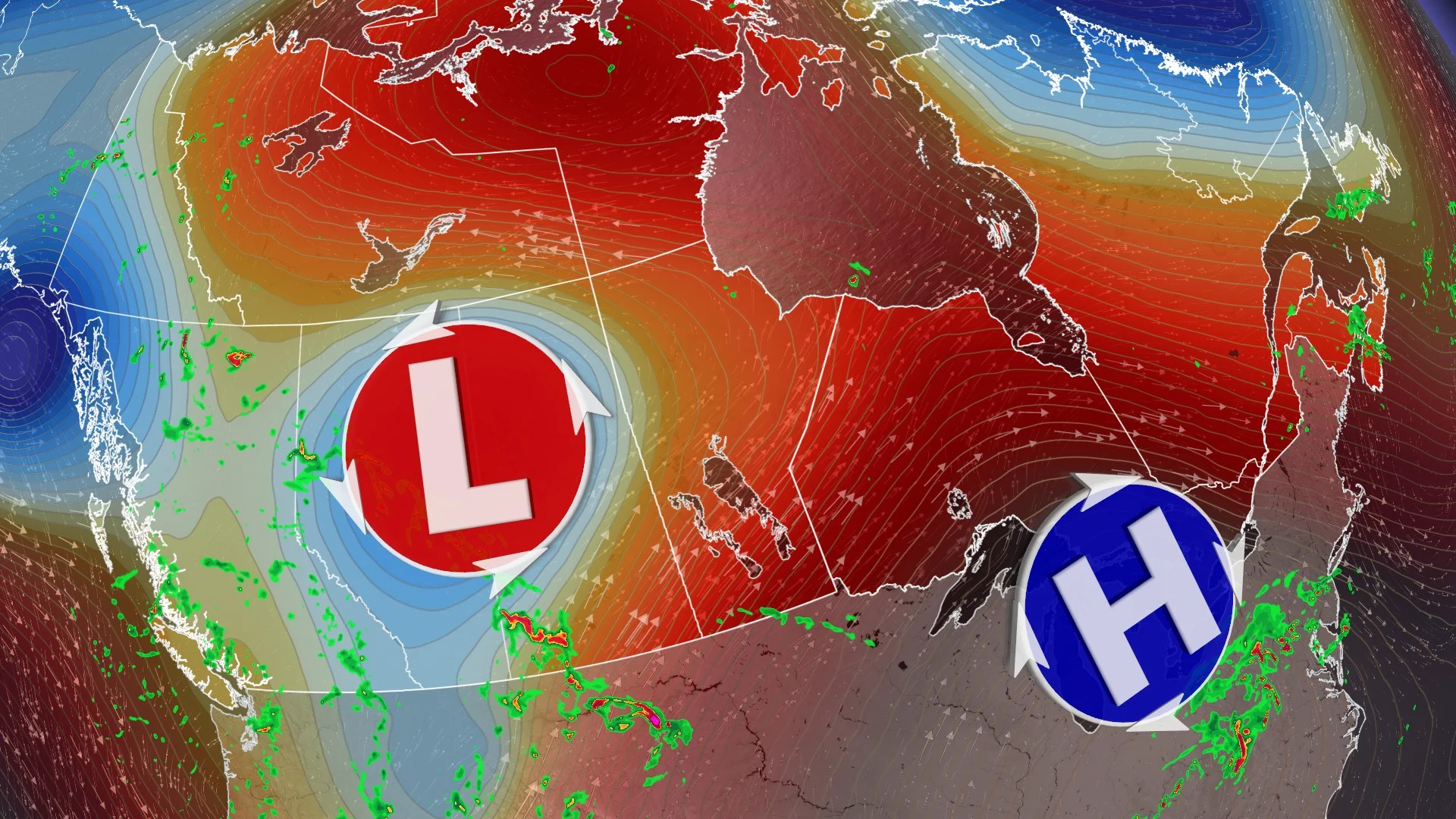
June set to end on a busy note from coast to coast
A major pattern shift will unfold heading into next week as we approach Canada Day on the first of the month.

Starting in the west, an atmospheric traffic jam known as a Rex Block will keep conditions cooler and unsettled throughout the region to end June and kick off July.
A system approaching the B.C. coast will bring widespread showers and thunderstorms to the province through the weekend, offering beneficial precipitation for the region.

Alberta is in line for yet another impactful low-pressure system that will send a multi-day heavy rainfall event to areas hit hard by flooding rains just last weekend. Some areas could see an additional 50-100+ mm of rainfall from this system.
Severe weather is also possible in southern portions of Saskatchewan and Manitoba into the weekend, including the potential for one or two tornadoes. Keep an eye on this evolving threat as it draws closer in time.

Farther east, expect hot and humid weather to build as a significant ridge of high pressure develops south of the border. The outer edge of this U.S. heat dome will send very warm temperatures and tropical humidity spilling into Ontario and Quebec next week. The humidex may approach or exceed 40 at times.
Some uncertainty remains surrounding the extent of the high temperatures in Ontario and Quebec, as clouds, precipitation, and even a recurving typhoon in the Pacific could influence our region’s pattern.

We’ll also have to watch the potential for organized clusters of thunderstorms to ride around the edge of that high-pressure system, which could bring heavy rain or severe weather to the Great Lakes into next week.
Fluctuating conditions are in the cards for folks throughout Atlantic Canada, where temperatures will likely wrap up the month around normal for this time of year.