Rare nighttime storm risk to target Vancouver and Victoria
Stay alert through the overnight hours for a risk for strong to severe thunderstorms across southwestern British Columbia
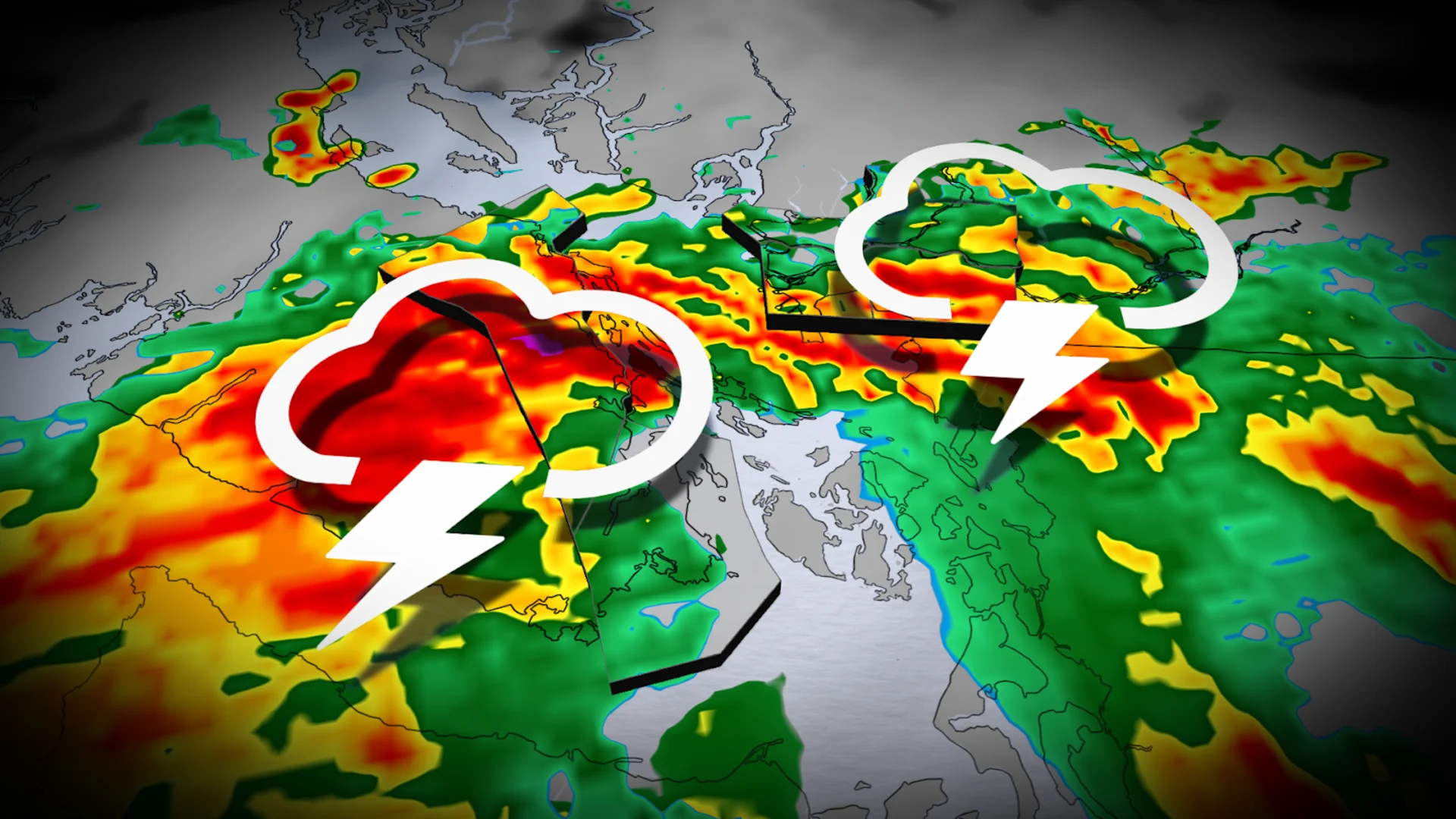
A rare setup building over the West Coast will bring parts of southern British Columbia a heightened risk for thunderstorms through the overnight Saturday into early Sunday morning.
Some of the thunderstorms could turn severe. Nocturnal thunderstorms are especially dangerous as folks can miss warnings as they tune out and head to bed for the evening.
Keep an eye on the radar through the late evening hours and make sure you have a way to get warnings even when you’re tuned out from the weather.
DON’T MISS: How severe weather alerts are issued, and potentially save lives
Beware a risk for overnight thunderstorms into Vancouver
An upper-level trough swinging into the Pacific Northwest late Saturday will provide the lift needed to kick off a widespread round of thunderstorms south of the border. These stateside thunderstorms will move north through Saturday evening and eventually cross into B.C.

Expect storms to push across the Greater Victoria Area and the Lower Mainland—including the Fraser Valley—late Saturday night and into the wee morning hours on Sunday. A chance for thunderstorms also covers the Sunshine Coast and eastern Vancouver Island.
There remains some uncertainty with how far up the Strait of Georgia these storms will travel. The highest confidence exists in storms covering the southern half of the island.
RELATED: Why nocturnal thunderstorms can be particularly dangerous

Any of the storms that push through the area could pack frequent lightning, heavy downpours, and wind gusts up to 90 km/h. This places a risk for severe thunderstorms across an area that rarely sees such potent storm activity.
Many injuries during severe thunderstorms occur as a result of trees falling into homes and vehicles. It’s incredibly important to remain alert for potentially hazardous weather approaching your location. Take shelter in a safe part of your home if severe thunderstorms threaten.
Storm risk continues into Sunday for some
Heavy showers and embedded thunderstorms will linger across Vancouver Island and the Mainland to start the day.
Additional thunderstorm activity will develop over southern Vancouver Island by late Sunday afternoon and into the evening hours. These storms could contain frequent lightning, gusty winds, and downpours. Forecasters can’t rule out a storm or two reaching severe limits.
Any of the storms that develop on Sunday could result in power outages, localized flooding, and ferry delays.
Another pocket of severe weather is expected into B.C.’s central Interior on Sunday, where storms could bubble up near Prince George and Williams Lake.
Stay with The Weather Network for all the latest on conditions across B.C.