Rare May nor’easter may approach record territory over East Coast
The system spinning into the East Coast late this weekend could come close to breaking records in some spots
It’s rare to see a full-fledged nor’easter on the East Coast this late in the season.
Folks throughout Atlantic Canada are expecting heavy rain, high winds, and possibly even some snow as the early-May storm arrives late Sunday into Monday.
This is such a formidable storm that it may threaten records in some locations.
DON’T MISS: Snow, wind, and rain: Rare May nor'easter targets Atlantic Canada
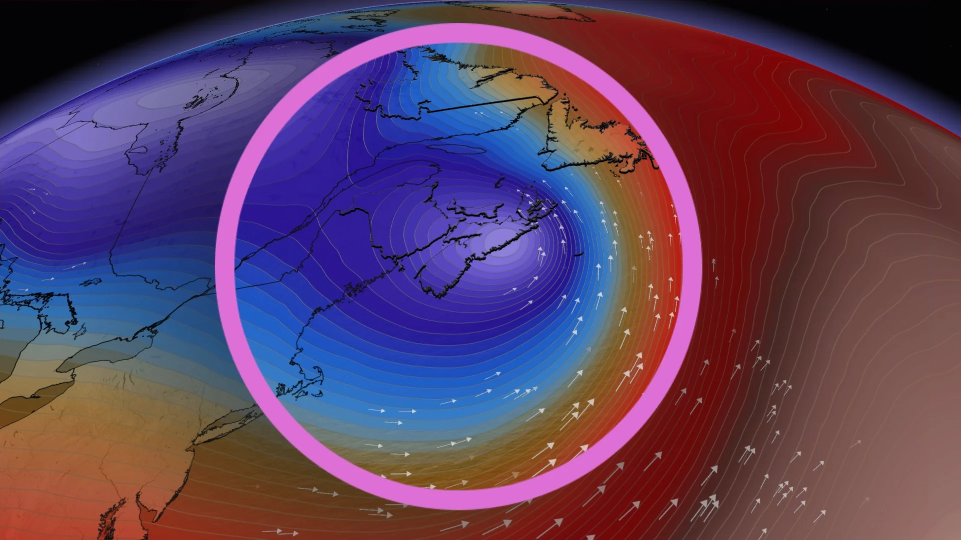
Winds in the jet stream high over the western Atlantic Ocean are roaring along at more than 200 km/h. These winds are spreading out as they blow near the Maritimes, leaving a void in the upper levels that air from the surface has to rush upward to fill.
This vast evacuation of air from the surface is responsible for the formation and rapid deepening of the low-pressure system that will serve as our nor’easter over the next day or so.

Forecasters expect a minimum central pressure as low as 975 mb as the centre of the low passes near Cape Breton on Sunday night, making for some of the lowest barometric pressure readings ever observed in this region in the month of May.
Here’s a look at some existing low-pressure records for May:
St. John’s: 977.8 mb
Stephenville: 979 mb
Sydney, N.S.: 974.6 mb
Halifax: 982.5 mb
Charlottetown: 980.8 mb
Sydney may come within one or two millibars of its all-time monthly low pressure record. Otherwise, most of those records are safe barring a sudden shift in the storm’s track.
Powerful low-pressure systems are less common in the late spring and summer months as the jet stream pulls north and hotter temperatures rule the roost. We’ll soon begin looking toward the tropics for powerful centres of low pressure in the weeks and months ahead.