Rapid El Niño may force the slowest hurricane season in years

El Niño conditions are rapidly setting in, which may help the Atlantic basin see its quietest hurricane season in years
A growing and potentially historic El Niño in the Pacific Ocean will have a significant impact on this year’s Atlantic hurricane season, experts announced this week.
NOAA’s latest outlook reveals a rapidly strengthening El Niño heading into the heart of summer, with increasing odds of one of the strongest events ever observed.
DON’T MISS: Climate change forces experts to change how we measure El Niño
El Niño rapidly strengthening in July
The monthly update from the U.S. Climate Prediction Center (CPC) pulls no punches about the rapidly strengthening El Niño across the eastern Pacific Ocean.
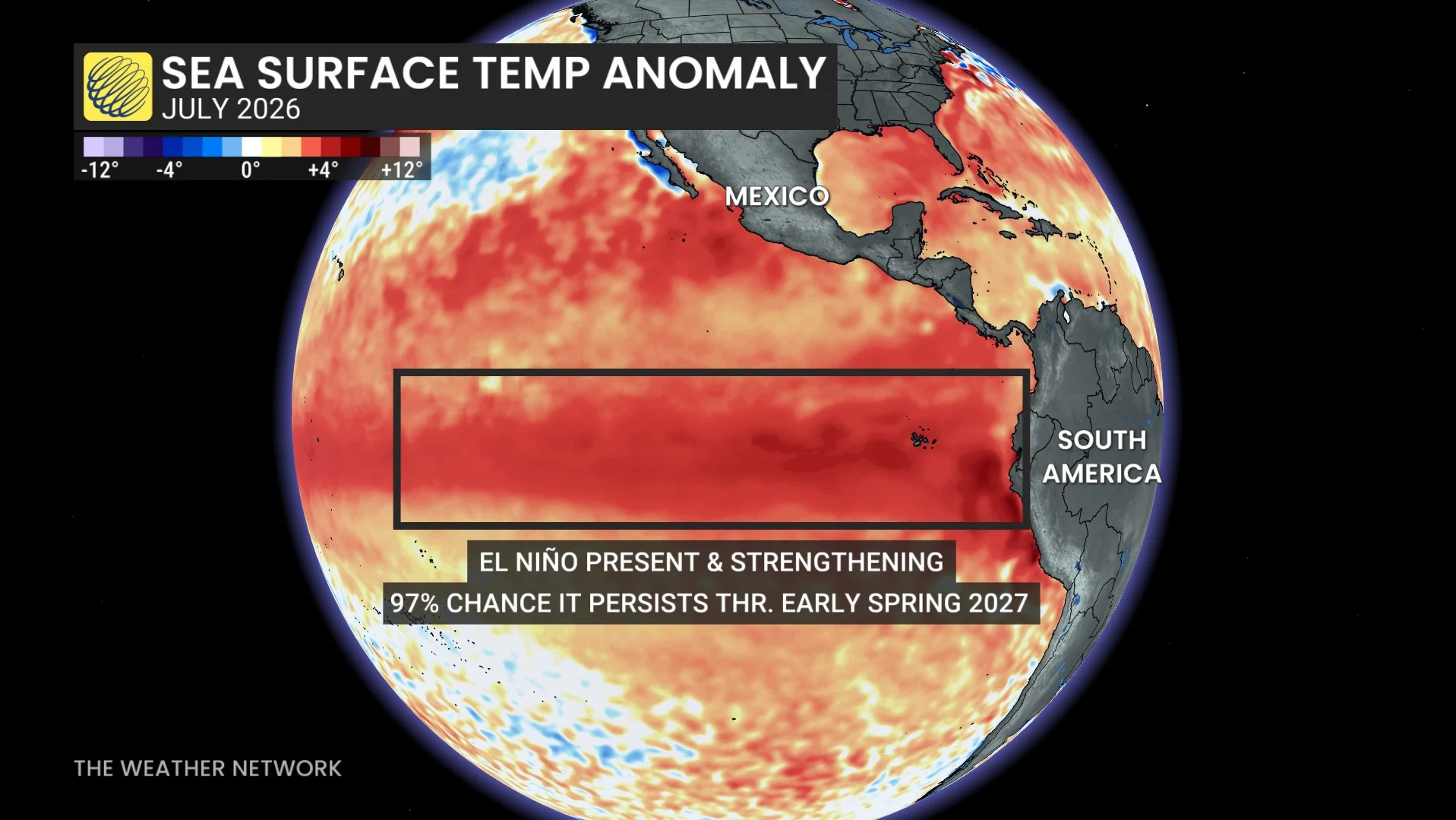
Water temperature anomalies in a key region around the equator are already running more than 1.0°C above average, with no signs of the warming pattern slowing down.
As this trend continues, our ongoing event “would rank among the largest El Niño events in the historical record going back to 1950,” according to the CPC.
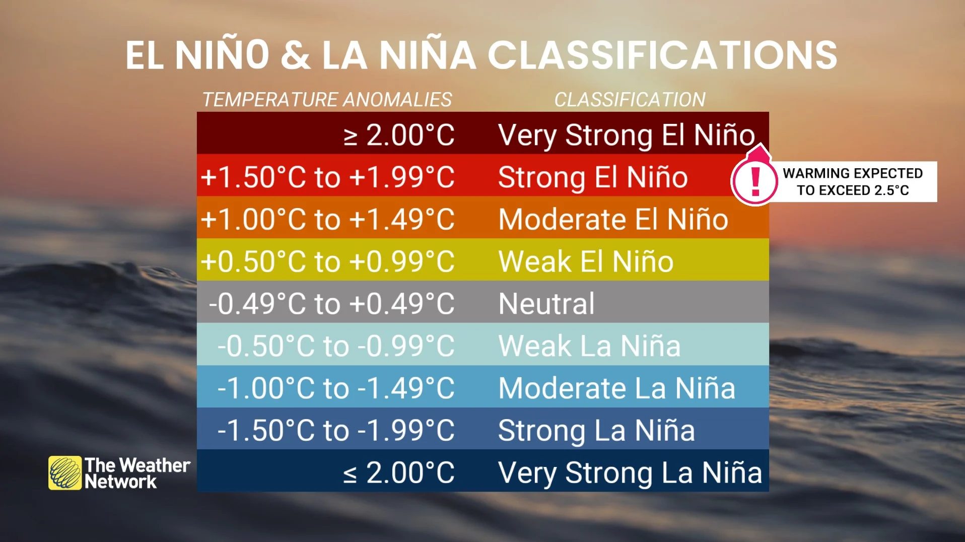
Forecasters anticipate that ocean temperatures in this region will continue to warm through the end of the year, and we have a 97 per cent chance of a strong El Niño through at least next spring.
Atlantic hurricane outlook revised downward
Meanwhile, the team at Colorado State University (CSU) released their revised Atlantic hurricane season outlook on Wednesday, calling for even fewer tropical systems than initially expected.
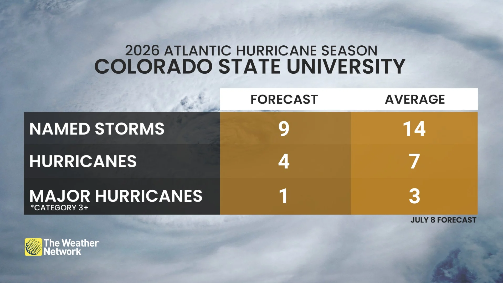
The latest forecast calls for just nine named storms, four of which may grow into hurricanes, and one of those hurricanes may have an opportunity to reach Category 3 status or stronger. This is significantly below the Atlantic's average of 14 named storms.
RELATED: ACE is the best way to measure a hurricane season’s ferocity
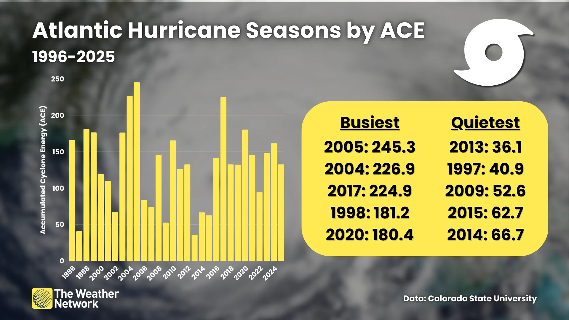
Additionally, the CSU outlook calls for less than half of the basin’s usual Accumulated Cyclone Energy (ACE), which is a measure of both the longevity and intensity of storms that form.
A typical Atlantic hurricane season produces an ACE of 123. This year’s outlook calls for an ACE of just 50, which would make this the least productive season since 2013.
“We anticipate the powerful El Niño being the dominant factor for the upcoming hurricane season, driving high levels of tropical Atlantic vertical wind shear,” the experts at CSU said this week.
Significant levels of Saharan dust are also serving to quash any tropical systems across the Atlantic’s main development region through the middle of July.
Meanwhile, interests along Mexico's western coast, the U.S. Southwest, and Hawaii should watch for above-average tropical activity across the eastern and central portions of the Pacific Ocean.