Storm threat lingers, torrential rain swamps parts of Ontario

Line of thunderstorms produce flooding rains and damaging winds over parts of southern Ontario and Quebec on Sunday. Storm risk remains as we kick off the new work week.
Rainfall warnings and special weather statements are in effect for parts of southern Ontario as slow-moving storms push through, with Environment and Climate Change (ECCC) warning of up to 50 mm of rain or more on Monday with the sluggish nature of the storms. Localized flooding is possible. More on the timing and impacts, below.
Monday into Tuesday: Heavy rain threat continues after localized downpours and flooding
The thunderstorm threat lingered over parts of southern Ontario and Quebec over the weekend, with some areas reporting severe conditions and heavy torrential rains.
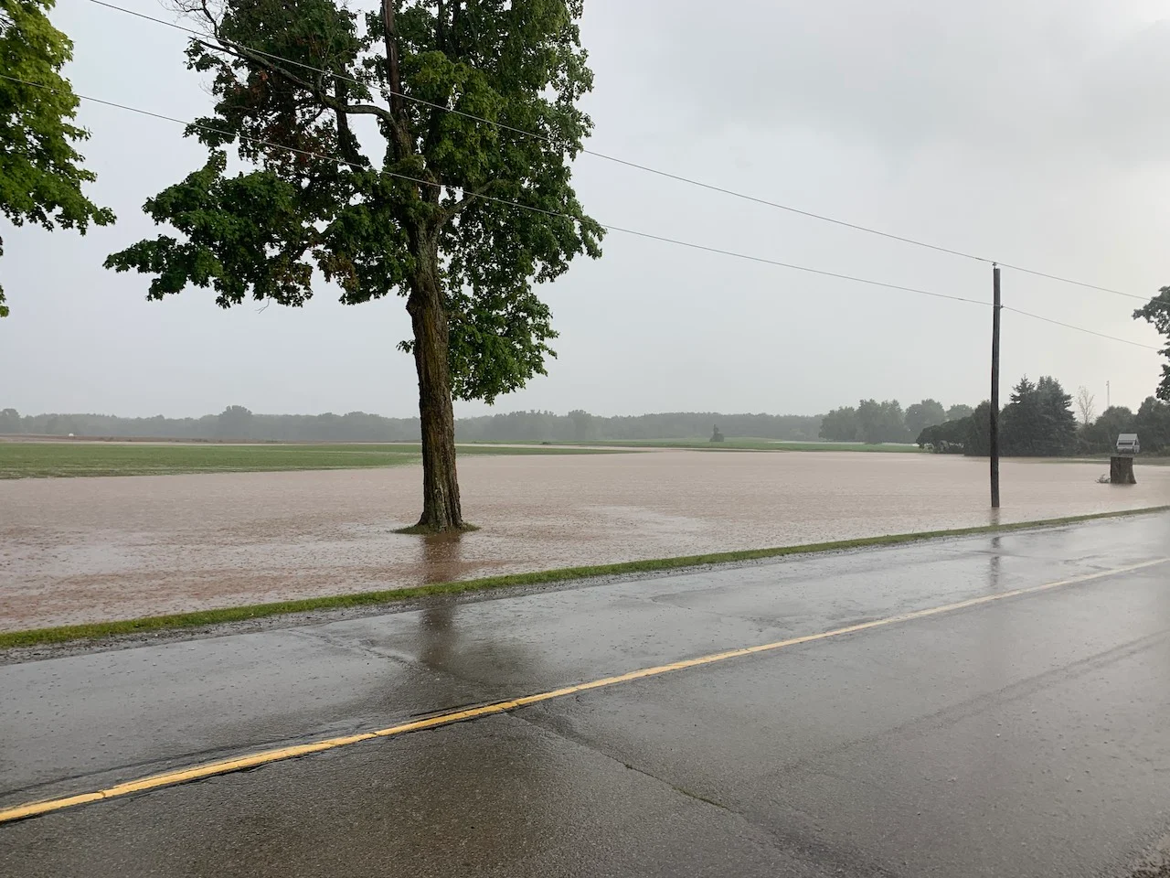
Localized flooding was reported in both Brampton and Barrie, Ontario, with 120+ mm of rain that fell, and even some radar estimates of over 150 mm locally. Between both Saturday and Sunday, as much as 250+ mm of rain was recorded. Some thunderstorms in southern Quebec even caused wind damage due to the strong wind gusts at the time.
"Monday is not going to be any different in terms of the threat for thunderstorms and locally heavy rain," says Matt Grinter, a meteorologist at The Weather Network.
Storms that popped up Monday afternoon have been slow-moving, which will keep the threat for heavy rain or the same region for a longer period of time compared to normal. Strong wind gusts will accompany the storm potential once again, as well.
"Some creeks and rivers will be running fast and high due to the rain, so is best to avoid as the storm threat lingers," Grinter adds.

The Credit Valley Conservation (CVC) released a flood outlook, which will remain in effect through Aug. 22 or until further notice.
"While no flooding of the Credit River and its major tributaries is expected, there is a possibility of localized flash floods and water pooling on the roads, and in flood-prone and low-lying urban areas," the CVC said in the flood outlook.
The Toronto and Region Conservation Authority (TRCA) also advised that rivers within the Greater Toronto Area (GTA) could experience higher flows and water levels.
Rainfall warnings are in effect for Halton region and Hamilton, with an area of slow-moving thunderstorms located from Hornby to north Burlington, moving south at 15 km/h. Radar indicates that near 50 mm has fallen, according to ECCC.
Meanwhile, special weather statement is in effect for parts of eastern Ontario with 30-50 mm of rain likely with the sluggish nature of the storms.
WATCH: Line of storms hits southern Ontario with flooding rains
The chance for rain shower and thunderstorms will continue into Tuesday, as well, though mainly for eastern sections of the GTA and through Quebec city.
Although daytime temperatures will continue to be around seasonal with the cloud cover and upper trough into Monday, the overnight temperatures will continue to be well above normal for this time of the year.

Warm temperatures within a few degrees of seasonal are expected during the middle of this week. There will also be a potential for another period of active weather later this week during the final days of August.
Thumbnail image courtesy: Barrie, Ont.
Be sure to check back for the latest weather updates across Ontario and Quebec as we move through August.