Rain and thunderstorms return to southern Ontario Thursday, summer heat follows
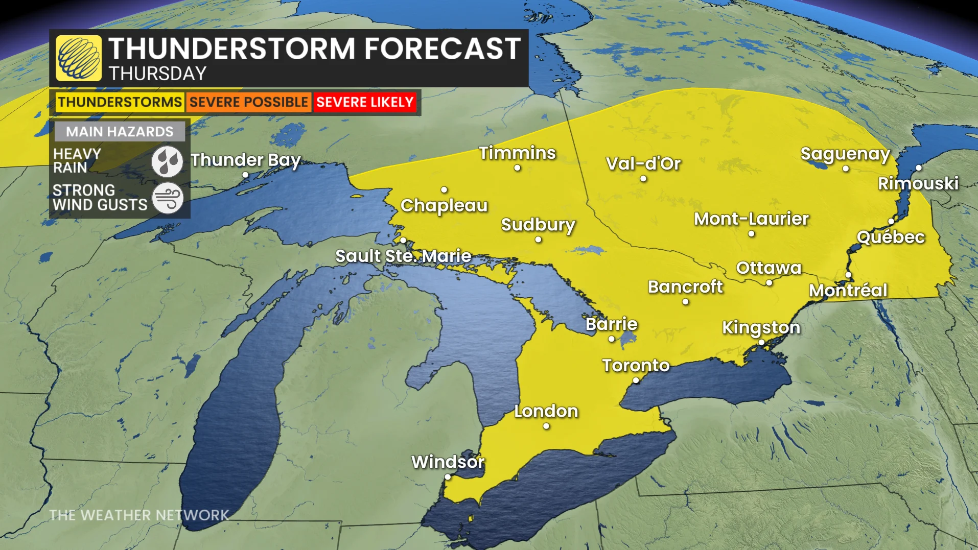
Widespread thunderstorm threat stretches across southern Ontario Thursday
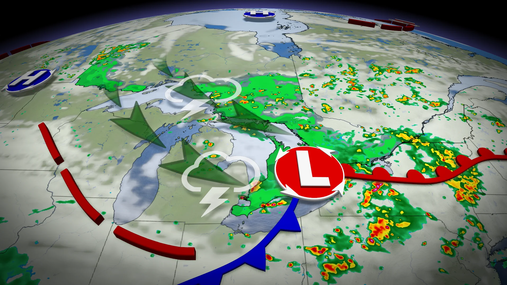
A low pressure system moving over the Great Lakes will bring widespread rain and scattered thunderstorms to southern Ontario on Thursday.
DON'T MISS: Visit our complete guide to Summer 2026 for an in-depth look at the Summer Forecast, tips to plan for it and much more!
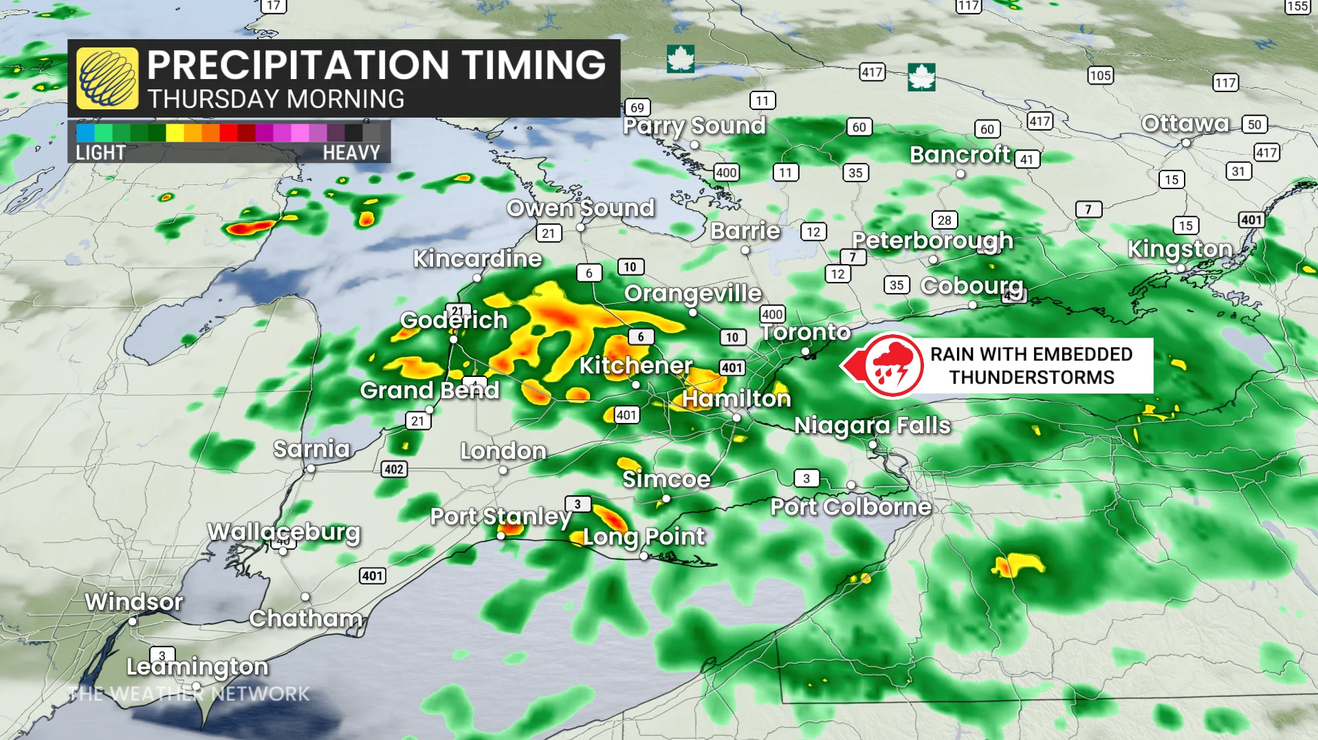
Rain will develop in the morning, accompanied by isolated thunderstorms along the warm front, making for a potentially wet and slow morning commute in the Greater Toronto Area (GTA).
Showers are expected to return in the afternoon and evening, with heightened instability creating more favourable conditions for thunderstorms to develop.
Threat for thunderstorms Thursday afternoon and evening
Southern Ontario can anticipate 5-15 mm of rainfall, with the potential for higher localized amounts in areas impacted by thunderstorms.
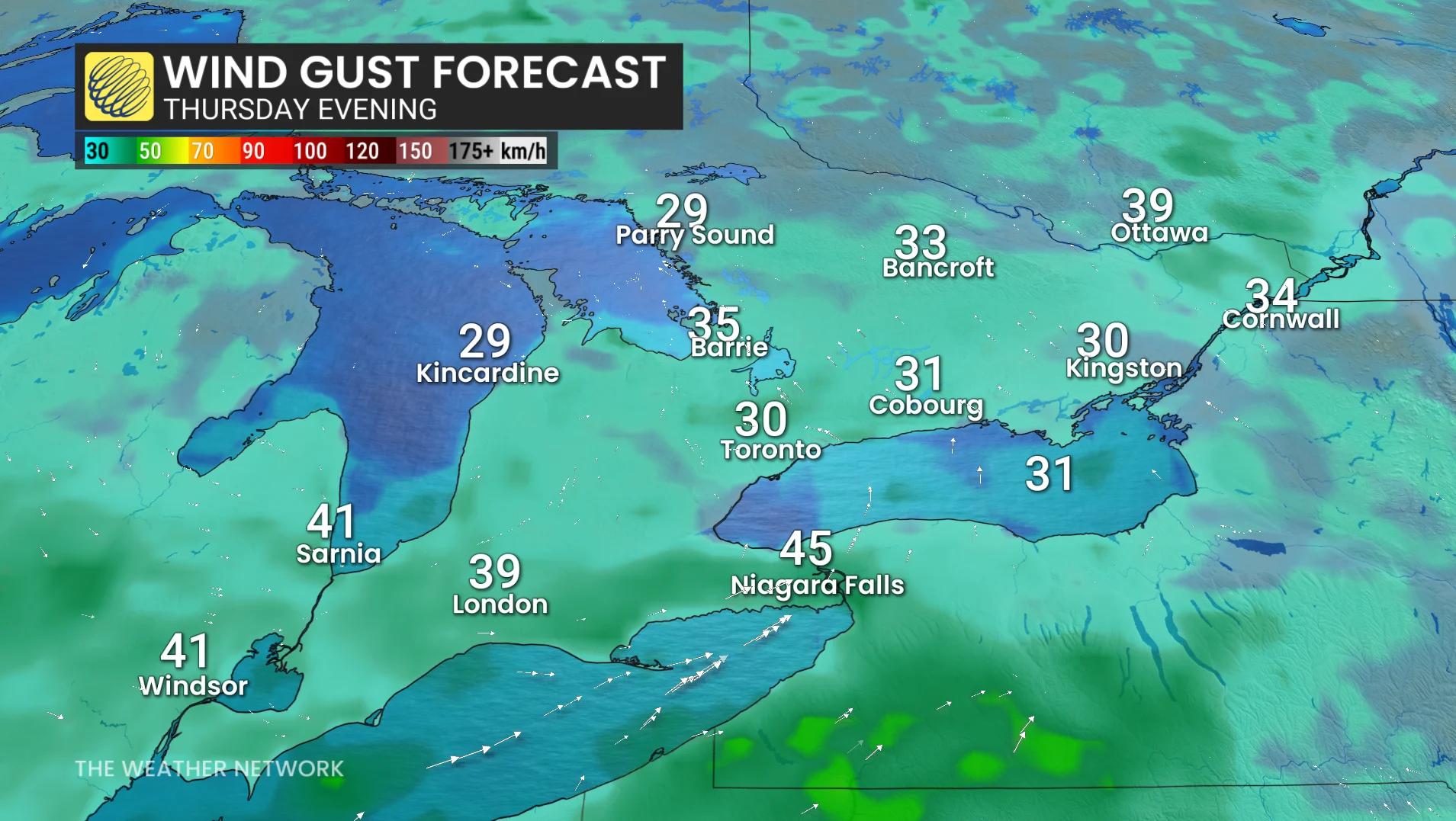
In addition, wind gusts of 30-50 km/h are expected from late morning through early evening, with stronger gusts possible during thunderstorms.
Higher confidence exists regarding morning rainfall, while the evolution of late-afternoon to evening showers and thunderstorms remains less certain due to variable conditions.
A reminder: water-laden roads and reduced visibility could create challenging travel conditions. Stay updated on weather alerts throughout the day.
Rainfall levels this June have already approached or surpassed monthly normals in several regions, including Toronto, Hamilton, and Wiarton, making this another active month for southern Ontario.
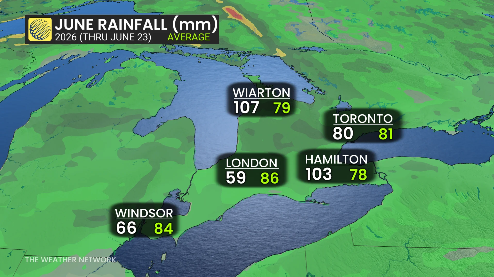
Toronto has picked up 80 mm so far, and the monthly normal average is 81 mm. In Hamilton, 103 mm has fallen so far, and the June normal is 78 mm.
Rising heat and humidity next week
After rain on Thursday, southern Ontario will see partly to mostly sunny skies this weekend, with a low chance of an isolated shower. Highs will reach the mid-20s on Saturday and the mid- to upper-20s by Sunday.
DON'T MISS: Summer 2026: El Niño may make Canada’s summer simmer instead of sizzle
Next week will definitely feel like summer, with temperatures ranging from seasonal to above seasonal for several days. Humidity levels will also rise, with the humidex potentially exceeding 40. However, there is some uncertainty regarding daytime highs as thunderstorms and cloud cover from upstream systems could moderate the heat. Warm and humid nights are likely regardless.
By the second week of July, temperatures are expected to trend back to seasonal or slightly below, with a shift toward a cooler pattern expected for mid- to late July.
Be sure to check back for the latest weather updates across Ontario.