Thunderstorm risk resurfaces in Ontario ahead of looming heat, humidity
The potential for severe thunderstorms will pop up in parts of southern Ontario on Saturday. Heat and humidity are set to intensify across the region next week
After an extended dry period, southern Ontario finally saw some rain, and could see more stormy weather this weekend.
DON'T MISS: Visit our complete guide to Summer 2026 for an in-depth look at the Summer Forecast, tips to plan for it and much more!
Residents should be prepared for potential thunderstorms that may bring heavy rainfall and gusty winds.
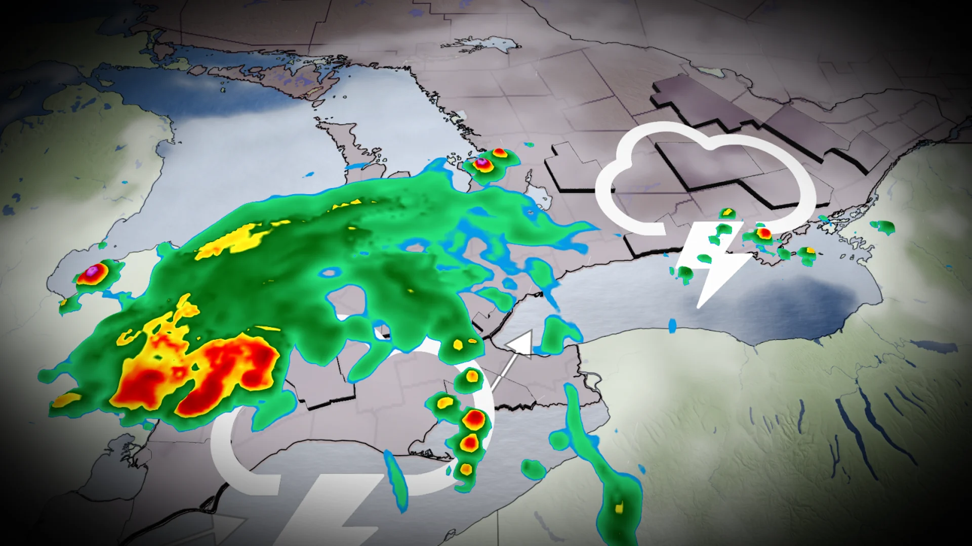
Weekend begins with rain and thunderstorm chances
Although drier weather is anticipated Saturday, parts of cottage country and eastern Ontario could see scattered thunderstorms in the afternoon.
Some of these storms may intensify, bringing hail and strong wind gusts.

Isolated storms may also develop near Lakes Erie and Ontario later in the day. Monitoring local weather alerts is advised.
Conditions will stabilize on Sunday, bringing more settled weather and extended sunshine hours across the region.
Ridge builds next week bringing more sunshine and heat, humidity
Looking toward next week, a building ridge is set to bring widespread heat and humidity across Ontario, including the north with ongoing wildfire concerns.

SEE ALSO: The pros and cons of an El Niño summer across Canada
Highs may reach the upper 20s to low 30s, with humidex values pushing into the upper 30s or low 40s in southern regions.

Scattered mid- to late-week thunderstorms are also possible. Prepare for much stickier and uncomfortable conditions compared to the recent dry weather.
Be sure to check back for the latest weather updates across Ontario.