Quebec: Thunderstorm risk in the south, heavy snow up north

The St. Lawrence could see between 5 to 15 mm of rain through Friday, which could cause localized flooding as some of the ground is still frozen.
An incoming Colorado low will make for a messy end to the week for Quebec, bring widespread rain and the chance for non-severe thunderstorms on Friday across much of the south, while areas to the north will see snow to usher in the weekend. Details and timing, below.
WEATHER HIGHLIGHTS:
10-20+ cm of snow for northern regions, widespread rain in the south
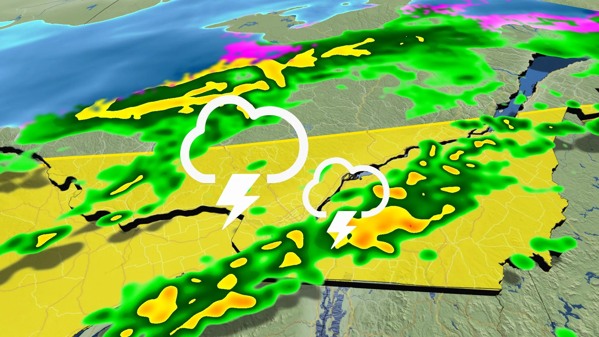
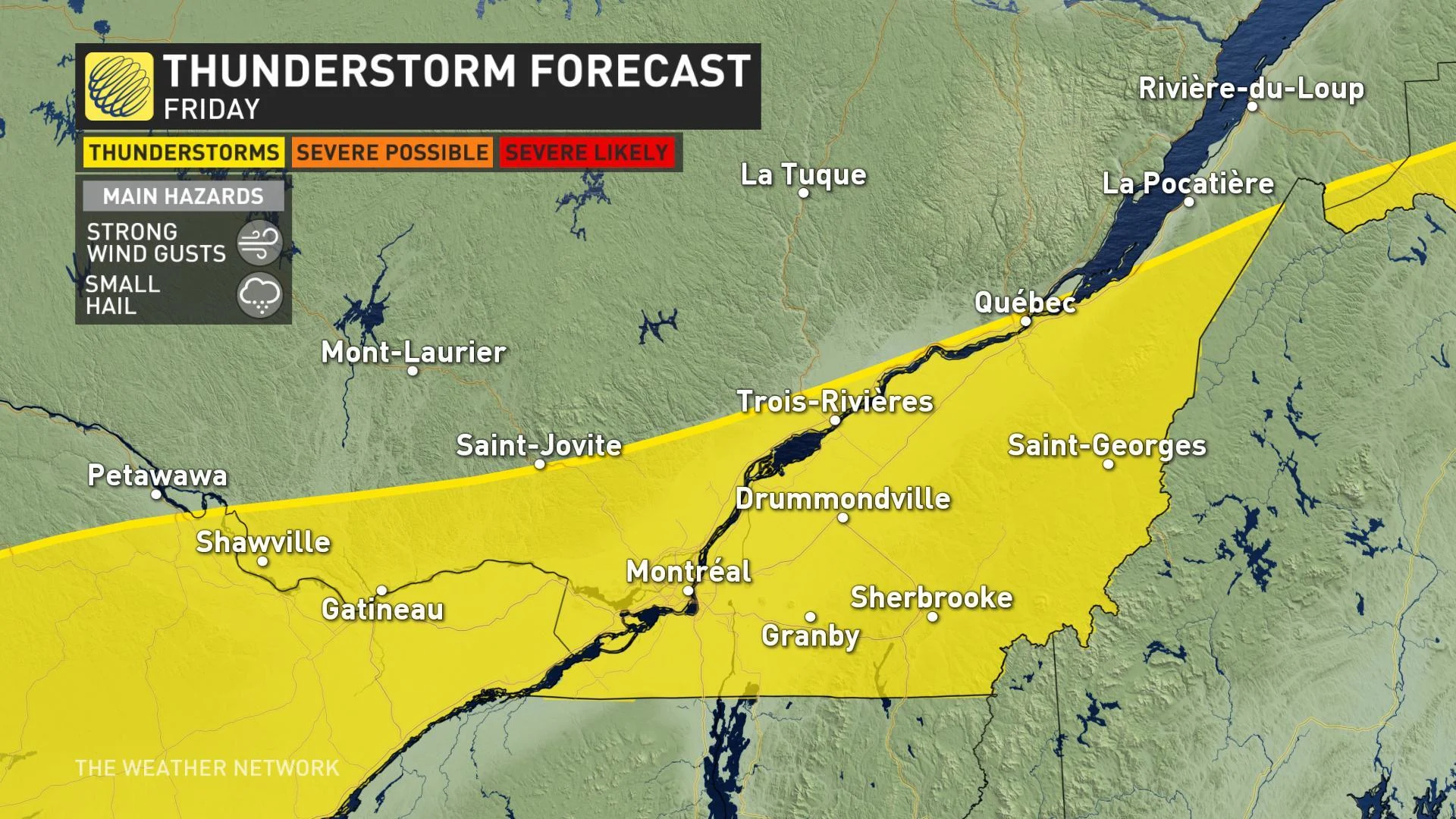
Risk of non-severe thunderstorms on Friday
Keep on top of active weather ALERTS for your area
FRIDAY: RAIN IN THE SOUTH, SNOW UP NORTH
The rain will be steady in Montreal through the afternoon hours before tapering off but will linger into the evening for Quebec City where a rainfall warning has been issued. Southern Quebec can expect to see 10 to 15 mm of rain with higher amounts moving farther east.
This region will also see a taste of spring this afternoon as temperatures will climb above the 10-degree mark for many, with both Montreal and Gatineau expected to reach 13°C.
A cold front will then race through with strong winds across the Saint Lawrence and will bring powerful wind gusts between 60-80+ km/h.
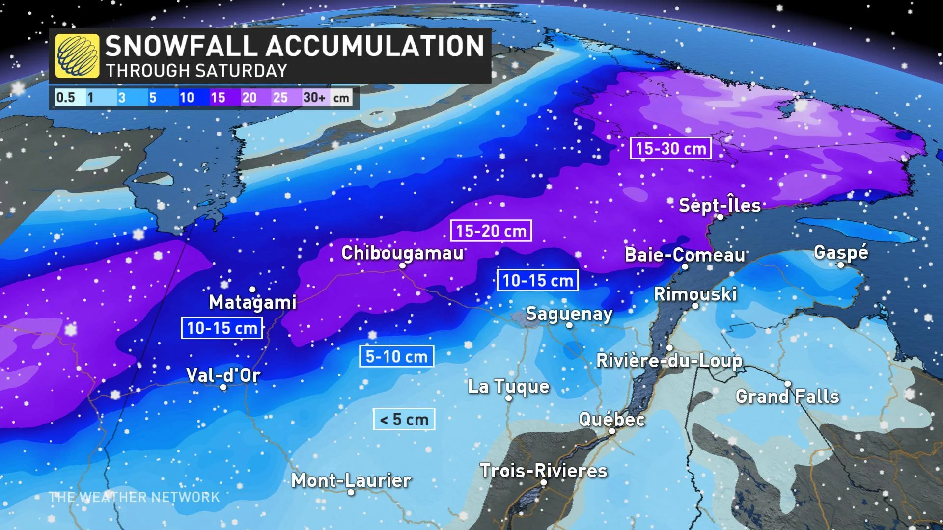
Northern regions can expect 10-20+ cm of snow, which has prompted Environment Canada to issue both snowfall and winter storm warnings for some regions.
With enough instability and mild temperatures, a non-severe thunderstorm risk will be present widespread across southern parts of the province through the morning and afternoon hours.
THE WEEKEND
The winds will ease through the pre-dawn hours of Saturday as the precipitation clears out of the province. Daytime high temperatures will between 5 to 10 degrees lower compared to those that were seen on Friday.
Weekend conditions are expected to be clear and cool across the entire province. Milder weather will then return next week with a warming trend through the middle of the week.