Quebec faces days of frigid air and even a lake-effect snow risk
The bulk of our weekend winter storm is wrapping up in Quebec, but the impactful weather is far from over
Gone are the days of record warmth and historic winter rains—the chill is here, Quebec, and it’s planning to stick around for an extended visit.
Our departing winter storm left behind a healthy 20+ cm of snow north of Montreal with lower totals in the south where rain stubbornly mixed in.
That’ll likely be the last rain we see in Quebec for quite a while as Arctic air flooding in from the west sends temperatures far below freezing through next weekend and beyond.
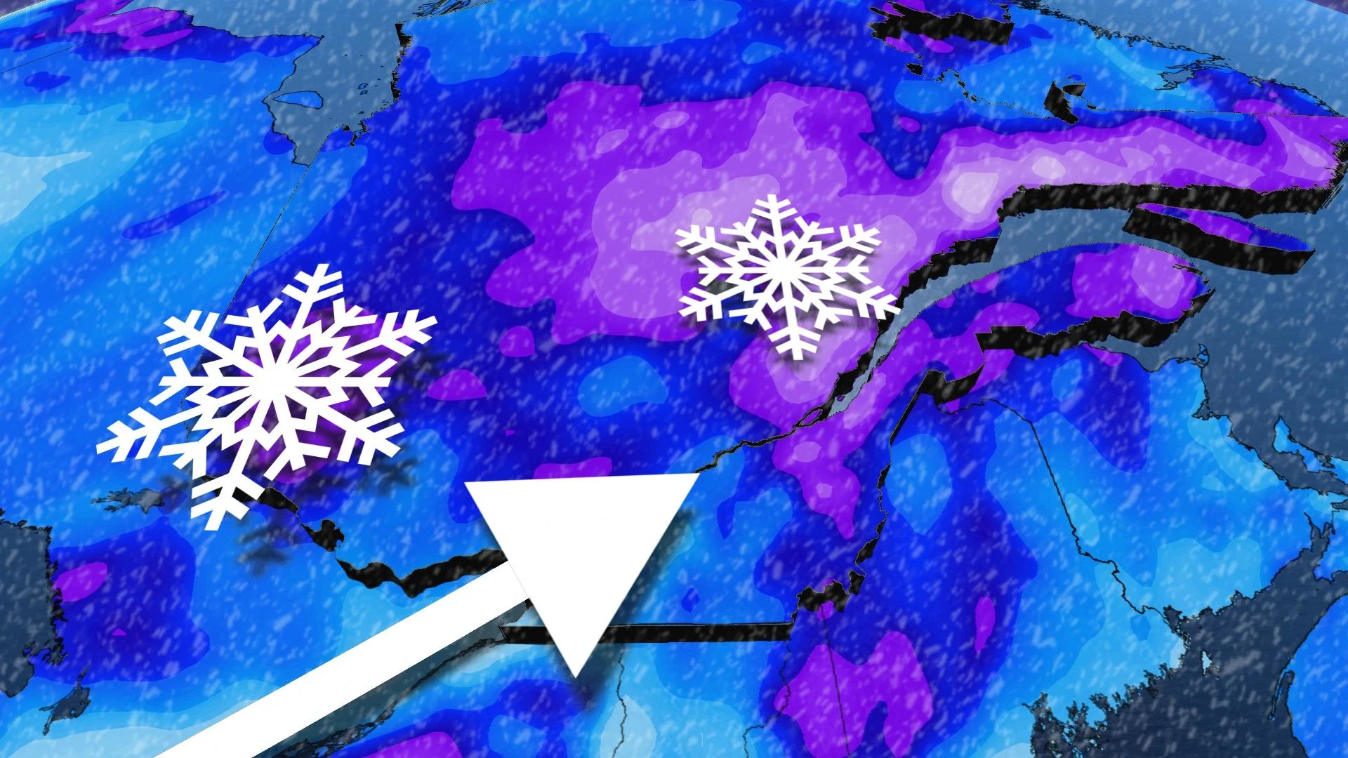
We’re even watching the risk for lake-effect snow—really!—across portions of southern Quebec to end the weekend.
DON’T MISS: Why some hearts can't handle the cold
Gusty winds whip up fresh snow, then temperatures plunge
Quebec isn’t quite done with our waning winter storm. Gusty winds in excess of 60 km/h will continue throughout eastern sections of the province, including Quebec City, allowing freshly fallen snow to take flight and reduce visibility.

This blowing snow risk will continue into Sunday afternoon as the storm makes its way east out of the region.
Behind the storm, we’re watching a surge of Arctic air advance out of the Prairies. This intense cold snap brought some of the region’s coldest temperatures in a generation. Just in the past day or so, we’ve seen some of the lowest temperatures ever recorded at Edmonton Airport, as well as Vancouver’s lowest wind chill since 1968.
Strong winds carrying those frigid temperatures will give rise to bands of lake-effect snow off the Great Lakes through Sunday.

MUST SEE: Why the Great Lakes produce some of the world’s heaviest snow
Winds are blowing in just the right direction to allow a thick band of lake-effect snow to develop along the lengths of Lake Erie and Lake Ontario, which will be responsible for blizzard-like conditions for Buffalo and knee-high snow accumulations in spots.
This band could grow strong enough that it extends far beyond the northwestern shores of Lake Ontario, potentially extending up the St. Lawrence River into southern Quebec.
A period of light snow is possible for communities near and east of the St. Lawrence during the day Sunday. Prepare for reduced visibility and slippery roads if this band of snow reaches the area. Any light snow associated with this band should end by late Sunday afternoon.
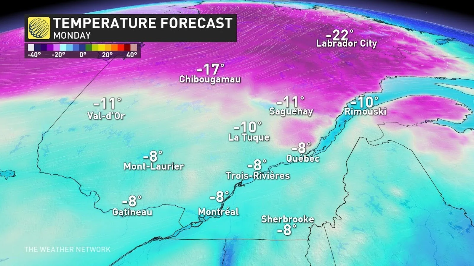
We’ll see a stretch of below-seasonal temperatures sticking around in Quebec through the upcoming week, with daytime highs in the double-digits below zero possible by next weekend.
Forecasters are monitoring the potential for another storm toward the latter half of next week.
Stay with The Weather Network for all the latest on your forecast across Quebec.