Prolonged snowfall will create travel troubles in Alberta as totals add up
A system and the upslope effect will team up to give Alberta a healthy dose of snowfall over the next few days, with some areas along the foothills possibly seeing as much as 40 cm
Many Albertans may not embrace it, but a dose of April snowfall will be sticking around for the next few days as the weather takes a hard left from what the province experienced earlier this week.
After days of warmth, the ridge of high pressure responsible for it has been replaced by a cold front and upsloping snowfall. Several days of accumulating snow is expected, even lingering through the weekend.
REALITY CHECK: Snowfall is normal in April for Canada. Here are the averages
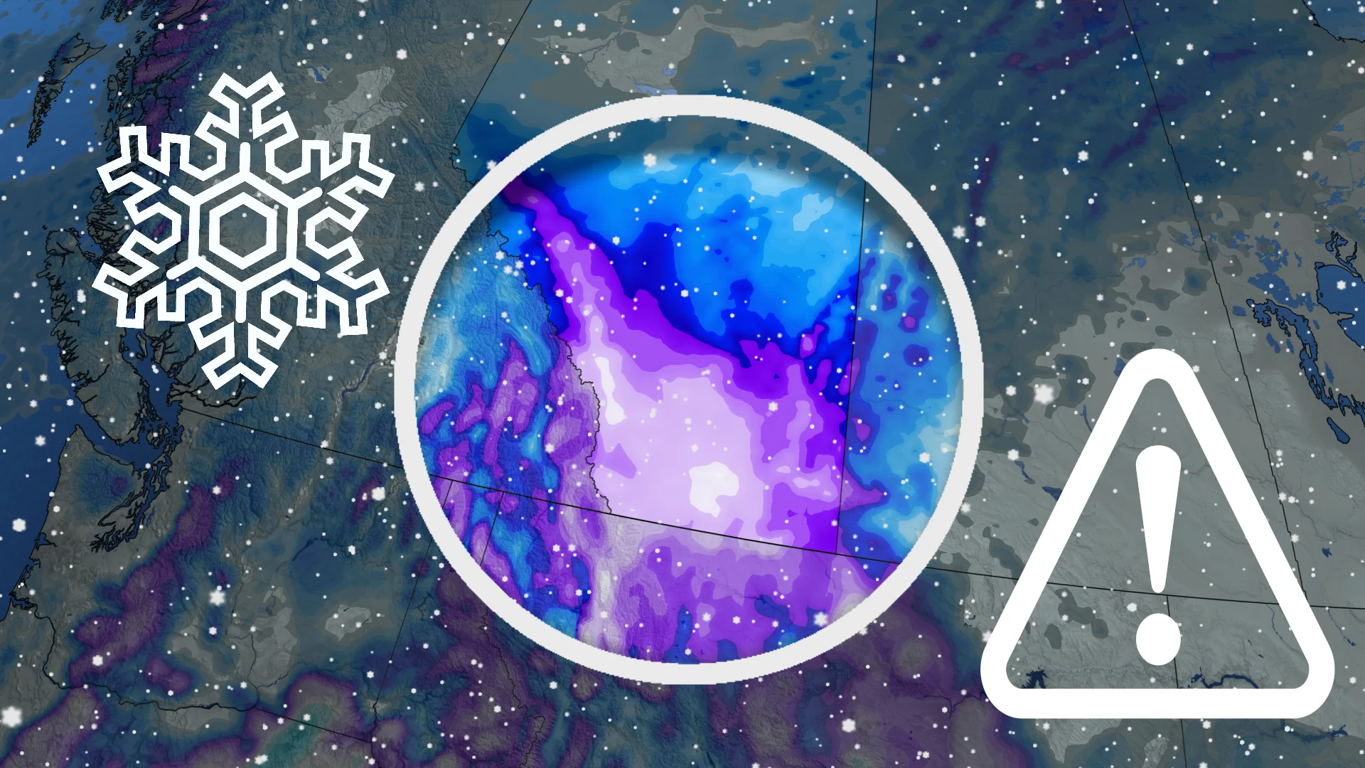
Some areas along the foothills could see 20-40 cm of snow through Friday, with Calgary and areas just to the south sitting in the 10-20 cm range. Expect difficult travel throughout the duration.
Thursday: Dangerous travel as snowfall increases
System and upsloping snow will then fill into the southern foothills by early Thursday morning as some regions in the southeastern section seeing rain to start.

Colder temperatures mean a transition into all snow across the south, falling heavy at times by the late morning or early-afternoon hours on Thursday.
DON'T MISS: How to experience the eclipse, and score some cool glasses, in Calgary
Snowfall totals will be steeply higher west of Calgary, especially along the foothills.
As much as 30-40 cm of snowfall is expected for areas along the foothills through Friday. Calgary and areas just to the south won't see quite as much, but will still get a hefty dose for April, sitting in the 10-20 cm range.

Expect difficult travel throughout the duration, especially in Calgary, and along the southern QE2 and Trans-Canada Highway.
MUST SEE: How the tropics help produce big springtime snows on the Prairies
The snow will briefly lighten in intensity Thursday evening before another round of moisture fills in through the overnight period.
Friday and beyond: Another round of moisture
On Friday, snowfall will affect the southern and central sections, and areas along the Saskatchewan border.

However, the snow will be beneficial for the ongoing drought conditions, so if there is any consolation prize with the wintry weather, that is it.
There will be more precipitation to come, too.
Periods of rain and wet snow are expected this weekend for southern Alberta, including the southern Rockies, so more of the much-needed moisture will be of great news for agriculture in a region that has long-term drought conditions.

There is uncertainty with snowfall totals for additional weekend rounds. Some banding could lead to locally higher totals.
Stay with The Weather Network on all platforms for all the latest on your forecast across Alberta.