Damaging, tornadic storms threaten parts of Ontario and Quebec Tuesday
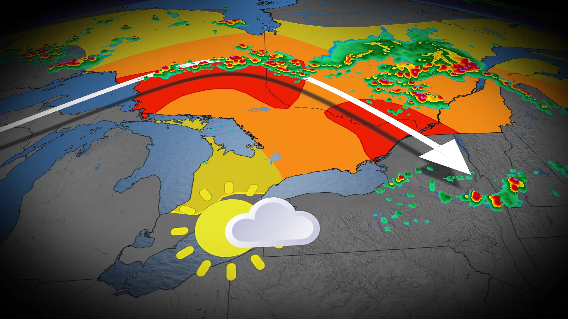
A strong line of storms may travel across Ontario on Tuesday, with severe impacts moving east into southern Quebec. Large hail, heavy downpours, strong winds and a tornado or two can't be ruled out
The heat is on in southern Ontario and Quebec this week, as are the chances for severe weather.
With daytime highs approaching or surpassing the 30-degree mark, the heat will help to fuel a risk of thunderstorms in Ontario and Quebec on Tuesday. A risk of a tornado or two cannot be ruled out on Tuesday as well.
DON’T MISS: Why extreme heat is one of the world’s deadliest weather disasters
Many folks have outdoor plans for Canada Day, which will also feature a threat of thunderstorms in both provinces. Residents should remain weather-aware Tuesday and into Wednesday, and have a plan to take cover if/when severe weather strikes.

Tuesday carries a tornadic risk in parts of Ontario and Quebec
The building heat in Ontario and Quebec is expected to create an increasingly unstable atmosphere, which will provide plenty of fuel for thunderstorms.
The first round of storms will lift northeast on Tuesday morning along a warm front from northwestern Ontario, where we saw tornado watches on Monday.
Strong to damaging wind gusts, heavy downpours and large hail are the main threats. Embedded rotation within the line of storms may produce an isolated tornado. The severe risk stretches from Lake Superior's eastern shores to Timmins and western Quebec.

Meanwhile, ahead of the line of storms, a separate cluster of storms may move across cottage country and east of the Greater Toronto Area (GTA). Locally heavy rain and large hail is possible within these storm clusters. Otherwise, the rest of the day across the GTA looks to be mostly sunny and humid.
SEE ALSO: Ontario's first extreme heat event of the summer will invade this week
In the early afternoon on Tuesday, the storms will track into the Ottawa Valley from cottage country, where we could see some turn severe around the Bancroft-Kingston-Ottawa-Montreal corridor.
By the late afternoon, a severe environment peaks over eastern Ontario and southern Quebec, including Cornwall, Ottawa-Gatineau and Montreal. The main threats forecasters are keeping a close eye on are damaging winds up to 110 km/h, large hail, and a tornado or two.
There is, however, some model disagreement about the exact timing and location of the storms throughout the day.

Tuesday night, a new cluster of storms develop near Sault Ste. Marie, and may track into southern Ontario by early morning Wednesday.

We may also see another storm cluster bubble up near Ottawa-Gatineau, as well as along Highway 417 into the Montreal area later in the evening and overnight.
Stay alert for any lingering storms on Wednesday as the intense heat and humidity continue across the provinces. Even with all the excitement and festivities going on, remember to NEVER leave children or pets in a locked vehicle. It only takes 20 minutes for temperatures to reach 40 degrees inside of a vehicle on a 25-degree day.
Drink plenty of water and stick to shaded areas when you can. Watch out for signs of heat exhaustion and heat stroke in yourself and those around you.