Prime ingredients arise for severe storms in Ontario and Quebec
A strong line of storms may travel across Ontario on Tuesday, with severe impacts moving east into southern Quebec. Large hail, heavy downpours, strong winds and a tornado or two can't be ruled out
The heat is on in southern Ontario and Quebec this week, as are the chances for severe weather.
With daytime highs approaching or surpassing the 30-degree mark, the heat will help to fuel a risk of severe storms in southern Ontario and Quebec, especially on Tuesday. A risk of a tornado or two will be present in eastern Ontario and Quebec.
DON’T MISS: Why extreme heat is one of the world’s deadliest weather disasters
Many folks have outdoor plans for Canada Day, which will also feature a threat of thunderstorms in both provinces. Residents should remain weather-aware Tuesday and Wednesday, and have a plan to take cover if/when severe weather strikes.
Tuesday carries a tornadic risk in parts of Ontario and Quebec
The building heat in Ontario and Quebec is expected to create an increasingly unstable atmosphere, which could provide plenty of fuel for thunderstorms (with the right trigger).

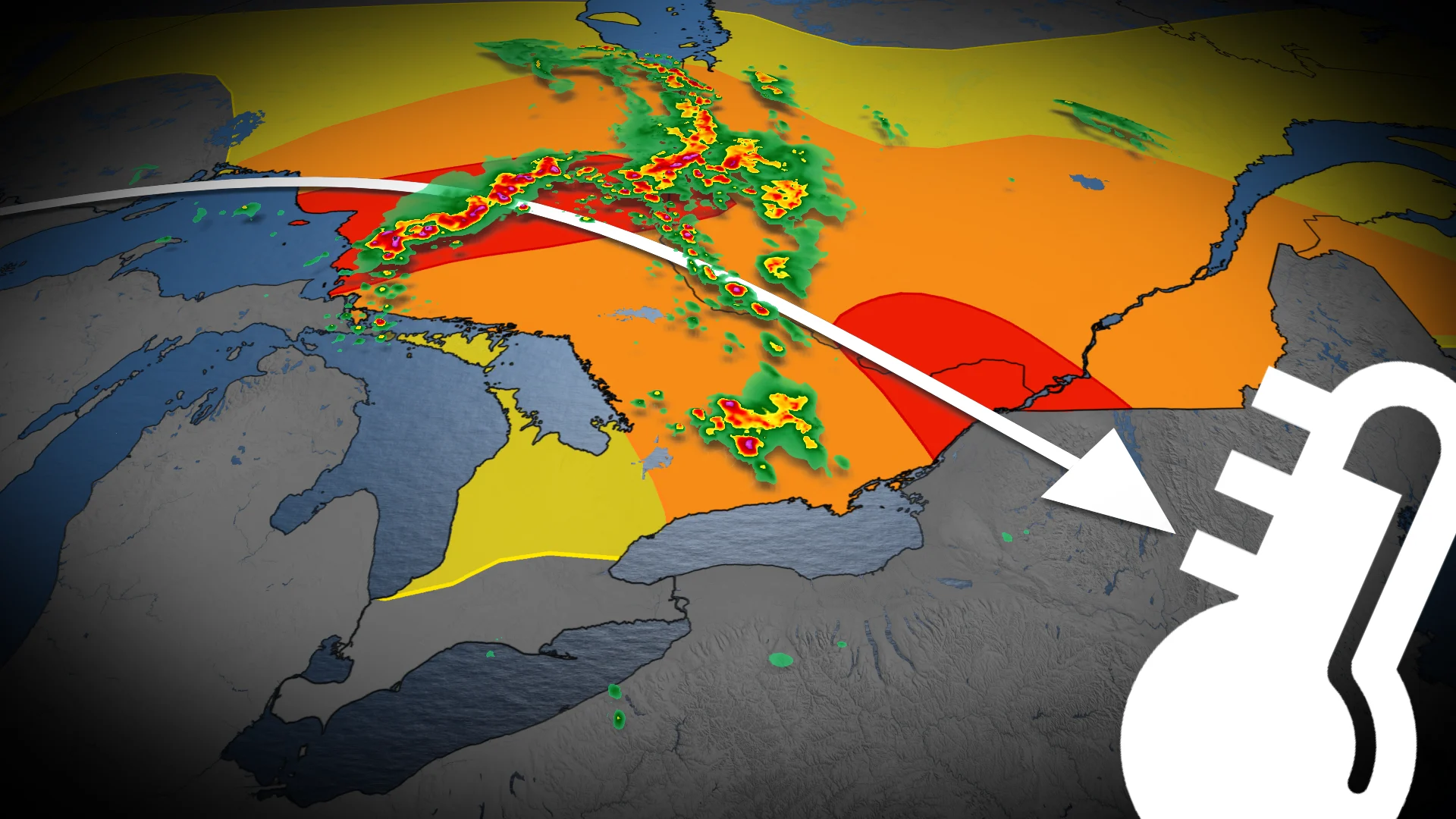
Monday overnight thunderstorms, which may form a MCS (mesoscale convective system), will track east into northeastern Ontario early Tuesday morning.
Strong to damaging wind gusts, heavy downpours and large hail are the main threats. Embedded rotation within the line of storms may produce an isolated tornado. The severe risk stretches from Lake Superior shore to Timmins at about 9 a.m. EDT, and onwards.

Meanwhile, ahead of the MCS, a separate cluster of storms may move across cottage country and east of the Greater Toronto Area (GTA).
Locally heavy rain and large hail is possible.

In the early afternoon on Tuesday, MCS storms lift towards Sudbury, Ont., to Val-d'Or, Que. There will be a chance for them to weaken slightly.
By the late afternoon, a severe environment peaks over eastern Ontario and southern Quebec, including Cornwall, Ottawa-Gatineau and Montreal. The strong MCS line of storms track in from approximately 3 p.m. to 5 p.m. EDT.

Damaging winds to about 110 km/h, large hail, and a tornado or two cannot be ruled out.
Tuesday evening, a new cluster of storms develop near Sault Ste. Marie, and may track into southern Ontario by early morning Wednesday.

Some uncertainty exists in the strength and exact location of the MCS, with weather models being quite variable.
Best chance for the severe storms will be for the Ottawa region.