Prairies: Heavy rainfall threatens 40+ mm for some on Monday

The developing low in Western Canada will bring widespread rain across the Prairies through Monday and many will see between 10 to 20 mm by the end of the day.
The developing low in Western Canada will bring widespread rain across the Prairies through Monday and many will see between 10 to 20 mm by the end of the day. While there is the risk for thunderstorms that could bring powerful wind gusts, the main hazard will be the heavy rainfall that could bring over 40 mm of rain, which could cause localized flooding in low-lying areas. Details on the timing of this heavy rain, below.
Balmy or brisk? We look at Canada's winners and losers for the final weeks of summer. See where your region lands, here.
WEATHER HIGHLIGHTS:
Storm risk continues Monday, expected to remain non-severe
Some regions could see between 30 to 40 mm of rain
Stay on top of ALERTS in your area
WATCH BELOW: TIMING OF RAIN ON MONDAY
On Monday the threat for thunderstorms will linger for the foothills in Alberta and southern Saskatchewan, but they are expected to remain non-severe in nature.
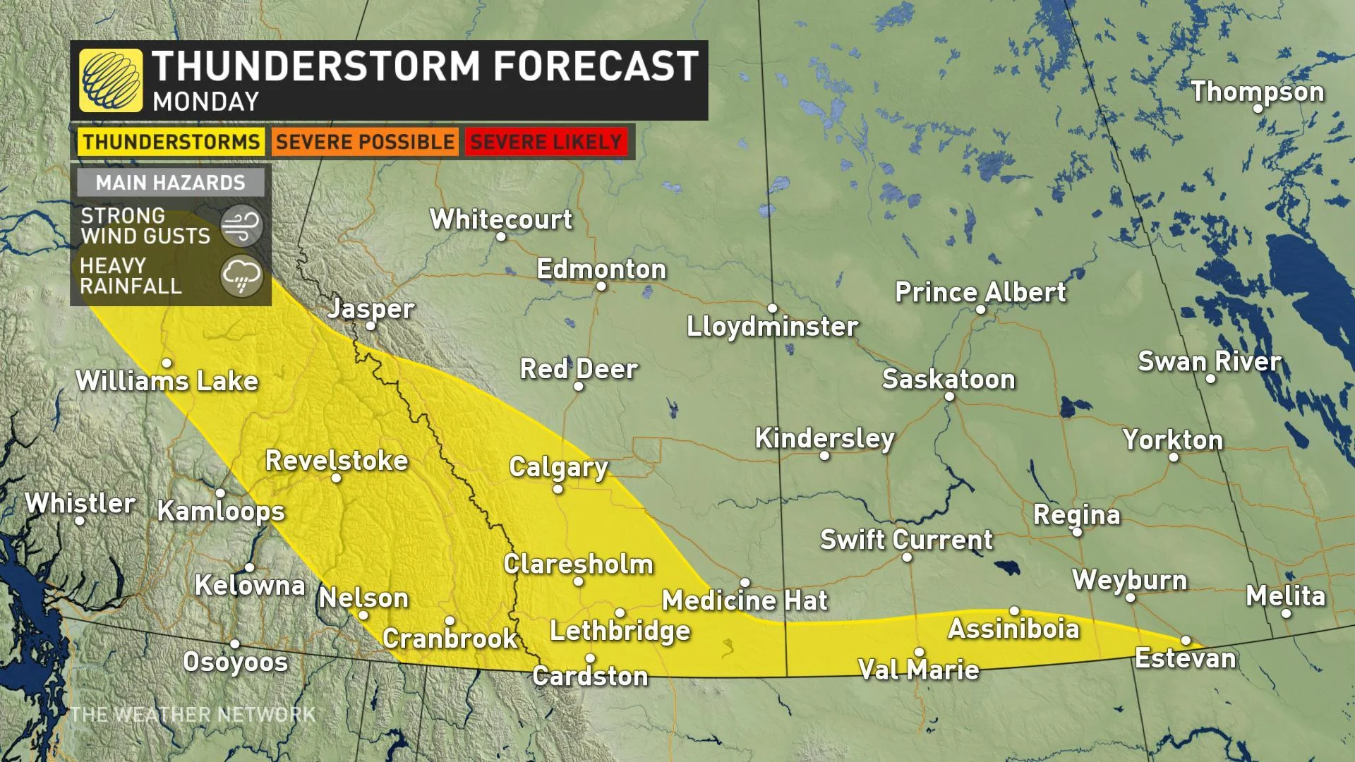
The bigger story for Monday will be the rain tracking across southern Saskatchewan and into Manitoba, as the low pressure centre tracks east along the border.
Some of this rain will fall in slow-moving thunderstorms, and that could create localized flooding and ponding on roads in intense downpours.
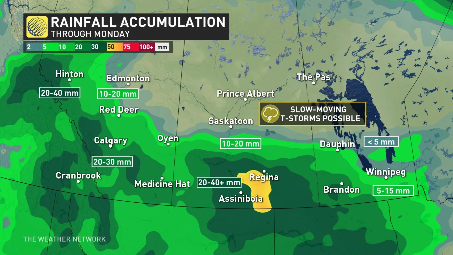
Most of the southern regions of the Prairies will see between 10 to 30 mm of rain, and isolated parts of southwestern Saskatchewan could see between 30 to 40+ mm of rain through Monday.
That low drifts south on Tuesday, bringing an end to much of the active weather over the Prairies for the week, though another system crossing the Rockies should generate some storms along the foothills and rain for the north mid-to-late week.
"Warmer weather will attempt to surge north into at least the southern Prairies at times this week, but the cooler pattern will be much more dominant," says Weather Network meteorologist Dr. Doug Gillham.