Snowy system with a tropical twist eyes the Prairies through Saturday

A widespread snowfall aiming for the Prairies through this weekend will bring a touch of the Pacific to the heart of Canada.
A snowy system with a tropical infusion will eye the Prairies through this weekend, bringing 20+ cm of snow to some areas by Saturday.
We’re looking forward to a pattern flip bringing some warmer air back to the Prairies next week, but we have to get through this widespread snowfall before that bit of relief arrives.
Visit our Complete Guide to Spring 2023 for an in-depth look at the Spring Forecast, tips to plan for it and much more!
A low-pressure system pushing into the Prairies from the south will bring a swath of snow across the three provinces through the first half of the weekend.
Much of that snow will be fueled by an atmospheric river aimed at western North America. While most of the moisture along the atmospheric river will bring flooding rain and heavy snow to California, some of it will hitch a ride on a low that's been meandering off the B.C. coast.
The greatest impacts look to target parts of Alberta and Saskatchewan, where 10-20+ cm of snow is possible.
Atmospheric rivers hitting western North America are a rich moisture source for low-pressure systems rolling into the Prairies in the spring months.
Snowfall this time of year often has a tropical connection—and it’s part of the reason March and April are traditionally Calgary’s snowiest months of the year.
DON'T MISS: How the tropics help produce big springtime snows on the Prairies
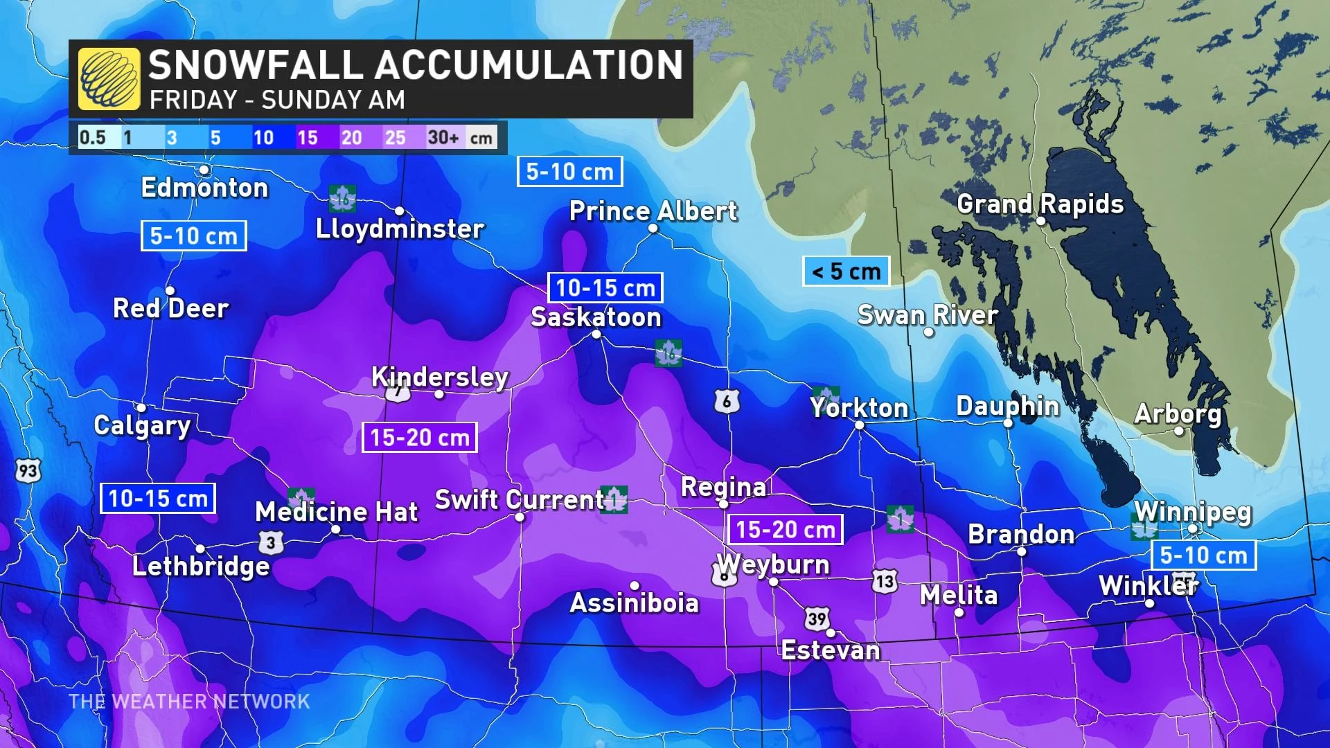
Snow looks to push into Alberta on Friday morning, spreading across Saskatchewan and Manitoba later Friday and Saturday night. The snowfall is expected to be widespread from the B.C. interior all the way to Manitoba.
The snow is expected to intensify as it spreads northwards into the province, reaching as far north as Edmonton and the Elbow region. By Friday afternoon and evening, all major routes across the province will be snow covered.
By the time the snow winds down and the system pushes eastwards later Saturday, there's likely to be a widespread blanket of at least 10 cm, and up to 20 cm for southern and eastern sections of Alberta. Edmonton looks to be on the receiving end of 5-10 cm, while Calgary could see 10-20 cm fall.
WATCH: See the unbelievable 'megabanks' in California as atmospheric river looms
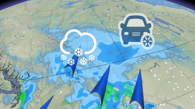
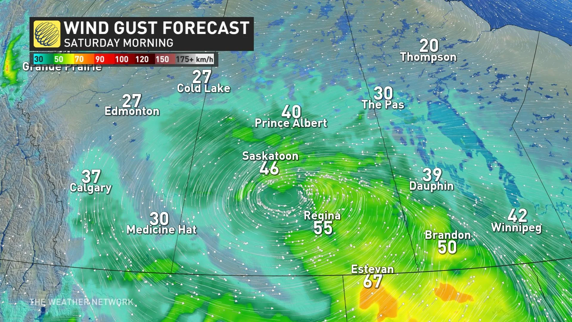
Travel routes towards the border of Saskatchewan and eastwards can also expect blowing snow and reduced visibility with gusty winds. This could lead to periods of difficult travel through the weekend.
Be sure to check back for the latest weather updates across the Prairies.