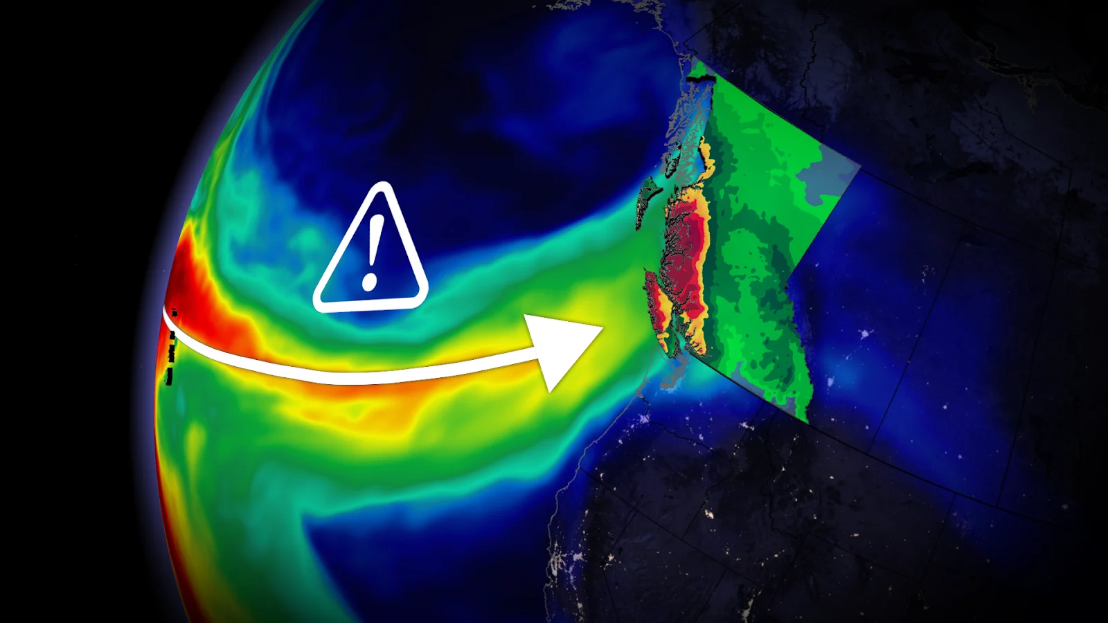
Flood, wind threats continue into Sunday as atmospheric river hits B.C.

B.C. will feel the effects of two significant storm systems, with high rainfall totals, strong wind gusts, and alpine snowfall expected
Significant precipitation and blustery conditions will continue across British Columbia through this weekend as a strengthening system drags an atmospheric river into the coast.
Higher-elevation portions of Vancouver Island may see storm totals of 300+ mm by next week.
SEE ALSO: Two historic events point a question mark over Canada's November
Watch the potential for localized flooding in the hardest-hit areas. Gusty winds could lead to ferry delays, power outages, and high surf along the coast.
As well, landslides and mudslides are a concern. An evacuation order has been issued for Zeballos on Vancouver Island.
Atmospheric rivers threaten flooding, power outages this weekend
A strong low-pressure system will affect the West Coast into the day on Sunday.
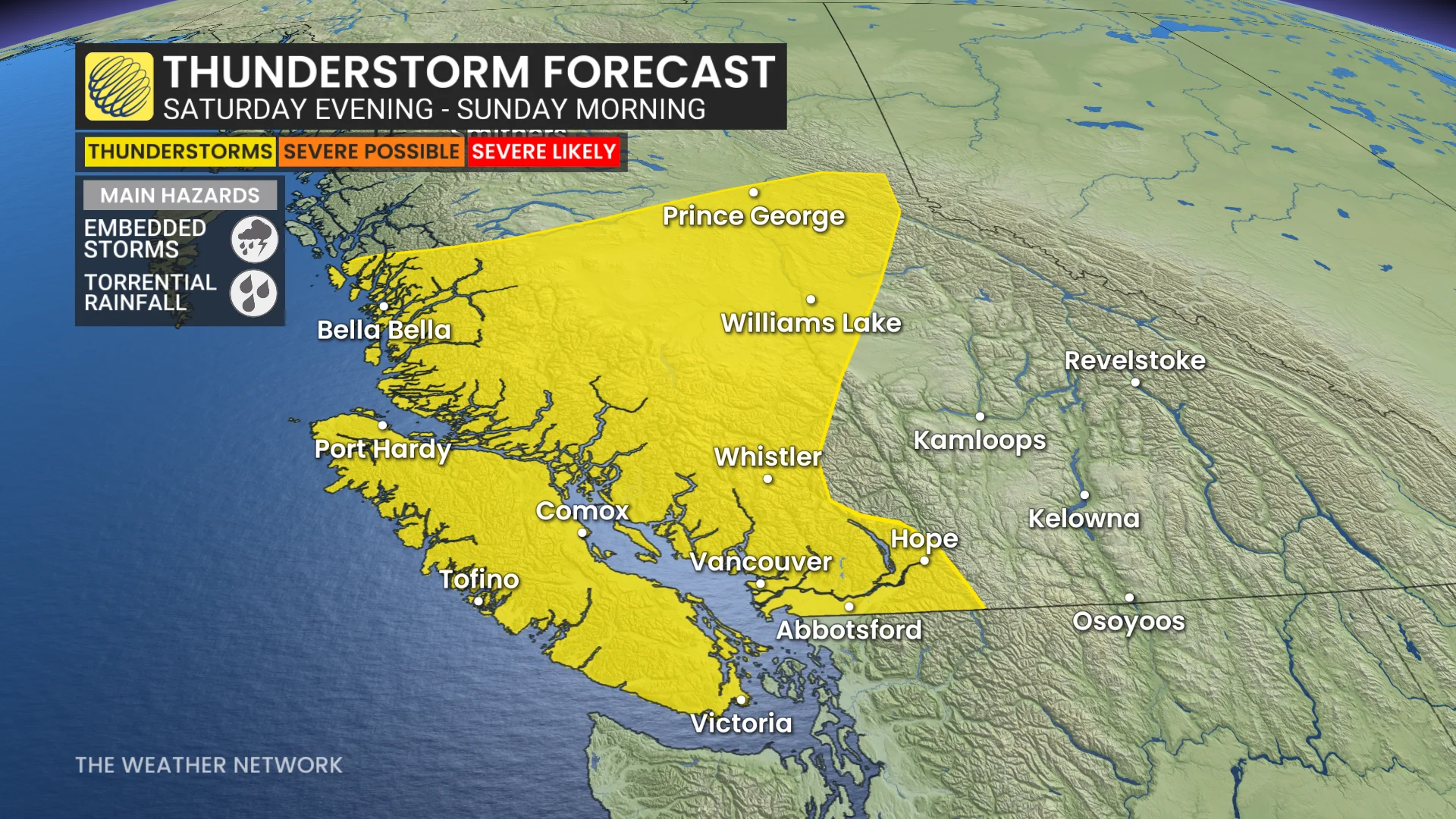
Wind warnings remain for northern Vancouver Island and onto the Lower Mainland as the next low pushes in. There is a thunderstorm risk from Saturday evening through Sunday morning for Vancouver Island, the South Coast and inland sections.
Heavy rainfall is forecast Saturday evening, along with the strongest wind gusts.
60-90 km/h: Coastal wind gusts possible for western Vancouver Island
50-80km/h: Gusts in Vancouver and Victoria
70-80+ km/h: The Sunshine Coast, North Shore and south of Metro Vancouver, including Tsawwassen
Additional rainfall totals of 30-50+ mm are expected along the North Shore, including West Vancouver and North Vancouver, as well as Coquitlam and Howe Sound.
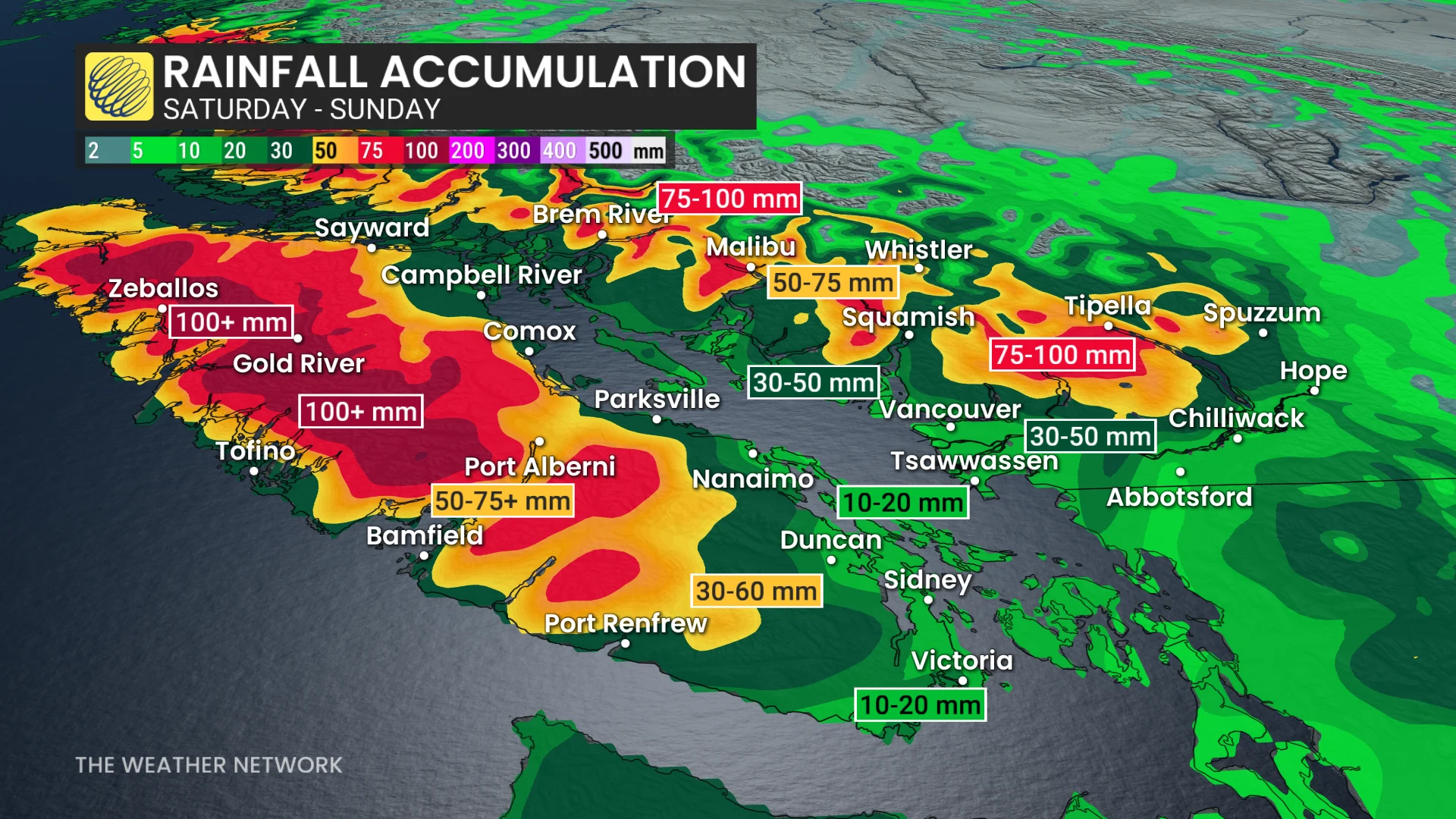
The highest totals will fall on the Central Coast and western Vancouver Island. Communities across the Lower Mainland can expect 10-30 mm. Abbotsford, Chilliwack and the Fraser River are in line to see 30-50 mm.
A coastal flood Statement issued for western Vancouver Island. That region is expecting an additional 100-150+ mm through Sunday.
High waves are also expected on Sunday morning, with heights up to eight metres away from shore.
Landslides and mudslides are a concern, as well. An evacuation order has been issued for Zeballos on Vancouver Island.
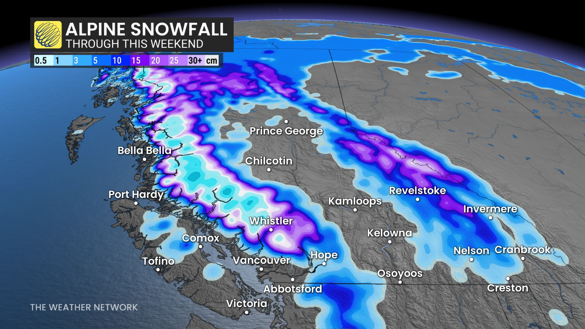
Heavy alpine snow will accompany this system, as well. Freezing levels will surge as warm, moist air pushes inland, followed by a sharp descent toward 1500 metres through Sunday behind the storm’s cold front.
Looking ahead, forecasters are closely watching another strong atmospheric river expected to affect the region into next week.
Higher impacts are possible since the ground will be saturated from this weekend’s coming rainfall. Strong winds and significant precipitation, both rain and snow, are expected with this upcoming event.
Stay with The Weather Network for all the latest on conditions across British Columbia.