Flooding rains, 100 km/h winds, sudden freeze hit the East Coast
Thursday started with school closures and climbing power outages, as a potent storm brings heavy rain, winds, and a sudden freeze across much of Atlantic Canada
Heavy rain and powerful winds swept into the Maritimes Wednesday, with gusts over 100 km/h reported at Halifax's airport by Thursday morning. That prompted widespread warnings across the region.
By the early morning hours, more than 32,000 were already left in the dark, though those numbers dropped to about 10,000 before 11 a.m., local time.

SPRING 2024: Get an in-depth look at the Spring Forecast, tips to plan for it, and much more!
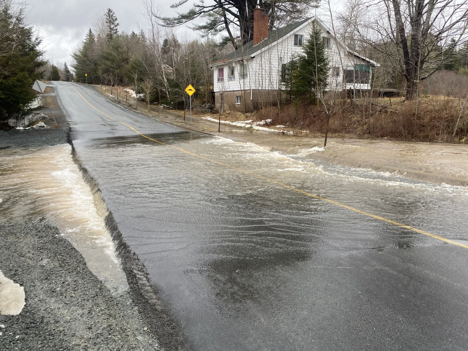
Rainfall totals have been significant as well, with major flooding and impacts across parts of southern New Brunswick. Around 100 mm of rain, possibly more, was reported in the town of Sussex, which resulted in evacuations and street closures there.
The threat of a flash freeze follows the wind and rain, as temperatures take a fast and steady tumble, freezing any standing water on roads and surfaces. The quickly deteriorating conditions prompted several school closures across New Brunswick first thing Thursday.
Thursday: Rain, wind and a flash freeze
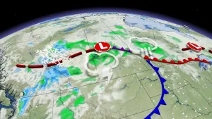
The Maritimes were the first in the region to see the impacts from this powerful late season winter storm. With the heaviest rain falling through the overnight hours on Wednesday, most areas woke up to a decent soaking Thursday morning.
The rain will continue to be persistent for the eastern Maritimes through the day on Thursday, with a transition over to snow on the backside of the system.
An additional 10-20 mm of rain is expected for most areas, with storm totals widely ranging, depending on location. Southern New Brunswick bears the brunt of this soggy system, with over 100 mm possible, locally, before it winds down.

People will need to be cautious around waterways as a quick snowmelt from rising temperatures and rain could cause some rivers to overflow their banks.
MUST SEE: Sussex, N.B., faces major flooding, evacuations, street closures
Light rain will push into southwestern Newfoundland through Thursday, with just scattered showers expected for northern and eastern sections of the island.

The winds have been fierce and will remain quite strong through the first half of the day, with gusts between 80-100 km/h persisting for the southern Maritimes. The winds have taken a toll on power lines, and travel conditions, with ferry cancellations reported early Thursday, as well.
Drivers are urged to adapt to the changing road conditions due to the high winds.
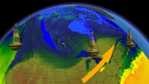
In addition to the rain, and winds, temperatures are taking a quick and steady tumble with the passing of the cold front, prompting a flash freeze warning for parts of the region.
Areas of northern New Brunswick could see a 20-25°C drop in just six hours, while Nova Scotia and P.E.I. will see temperatures tumble by about 10°C. Factor in the wind chill, and things will be feeling brutally frigid by Friday, especially in comparison to the milder conditions earlier this week.

Surfaces, such as roads, streets, sidewalks and parking lots, may become icy and slippery with the sudden temperature drop.
Expect more travel troubles as sea-effect snow squalls follow the cold front, bringing snow to Cape Breton and western Newfoundland Friday.
Temperatures rebound significantly through the weekend
This blast of winter will be intense, but quick, as temperatures will rebound greatly on Saturday. Daytime high values will reach the double digits for much of the Maritimes.

Temperatures will be more typical of April, and even May, across the Maritimes through the middle of next week. Newfoundland will turn very mild for a few days next week. A couple of systems will bring primarily rain to the region mid and late next week.
An active pattern is expected through mid-March, and it is possible that there will be more cold air available for messy systems during the second week of the month.
Floods in eastern Canada overwhelm sump pumps and roads:
Stay tuned to The Weather Network for the latest forecast updates for Atlantic Canada.