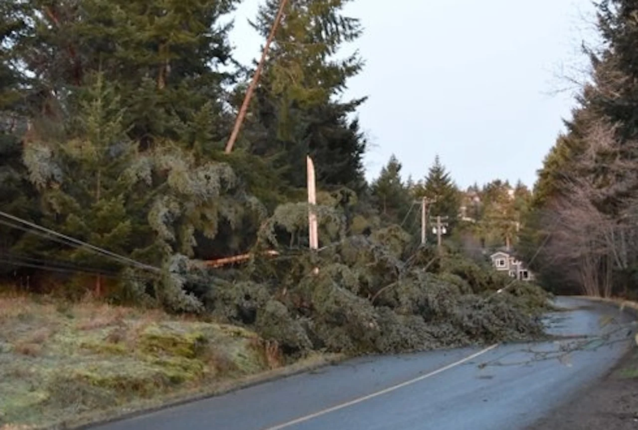
Power outages, tricky travel for B.C. as powerful spring storm looms

Hazardous travel and localized power outages are possible as a formidable spring storm reaches B.C. on Sunday.
A formidable early-spring storm will spread over British Columbia to close out the weekend, bringing the threat for heavy rain, snow, and blustery winds lasting into the beginning of the week. We could see travel disruptions and power outages as a result of the impending system. More on the timing and impacts, below.
MUST SEE: Hint of summer or winter flashback? Canada's April 2022 forecast
POTENT SYSTEM ARRIVES WITH RAIN, SNOW, AND GUSTY WINDS
April is off to a sour note across the West Coast as an approaching storm threatens to bring heavy rain, heavy mountain snow, and gusty winds that could lead to power outages.
Conditions will quickly go downhill on Sunday as a low-pressure system moves toward the South Coast. Rain will begin early Sunday morning and intensify through the evening, with the heaviest occurring through the overnight hours into Monday.
Rainfall and wind warnings are starting to fill out the map across Vancouver Island and portions of the South Coast ahead of the system.
“Heavy downpours can cause flash floods and water pooling on roads. Watch for possible washouts near rivers, creeks and culverts,” Environment and Climate Change Canada (ECCC) said in its rainfall warning for West Vancouver Island.
The agency’s special weather statement for Metro Vancouver notes that rainfall and wind warnings may be issued for the area as we get closer to the main impacts.
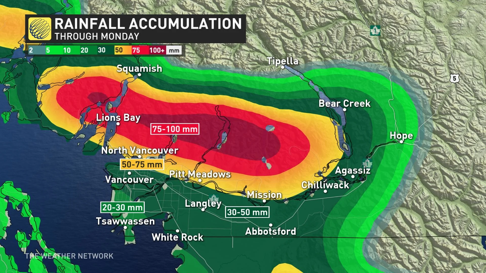
Upslope areas from the Lower Sunshine Coast to the Lower Fraser Valley are expected to receive the heaviest amounts of precipitation through the period. Heavy rain should ease to showers by Monday morning.
Rainfall amounts will be heaviest along the western Vancouver Island coast, with 100+ mm expected through Monday. The Lower Mainland can expect to see a range of 20-50+ mm, depending on where you are in the region. Localized flooding is possible.
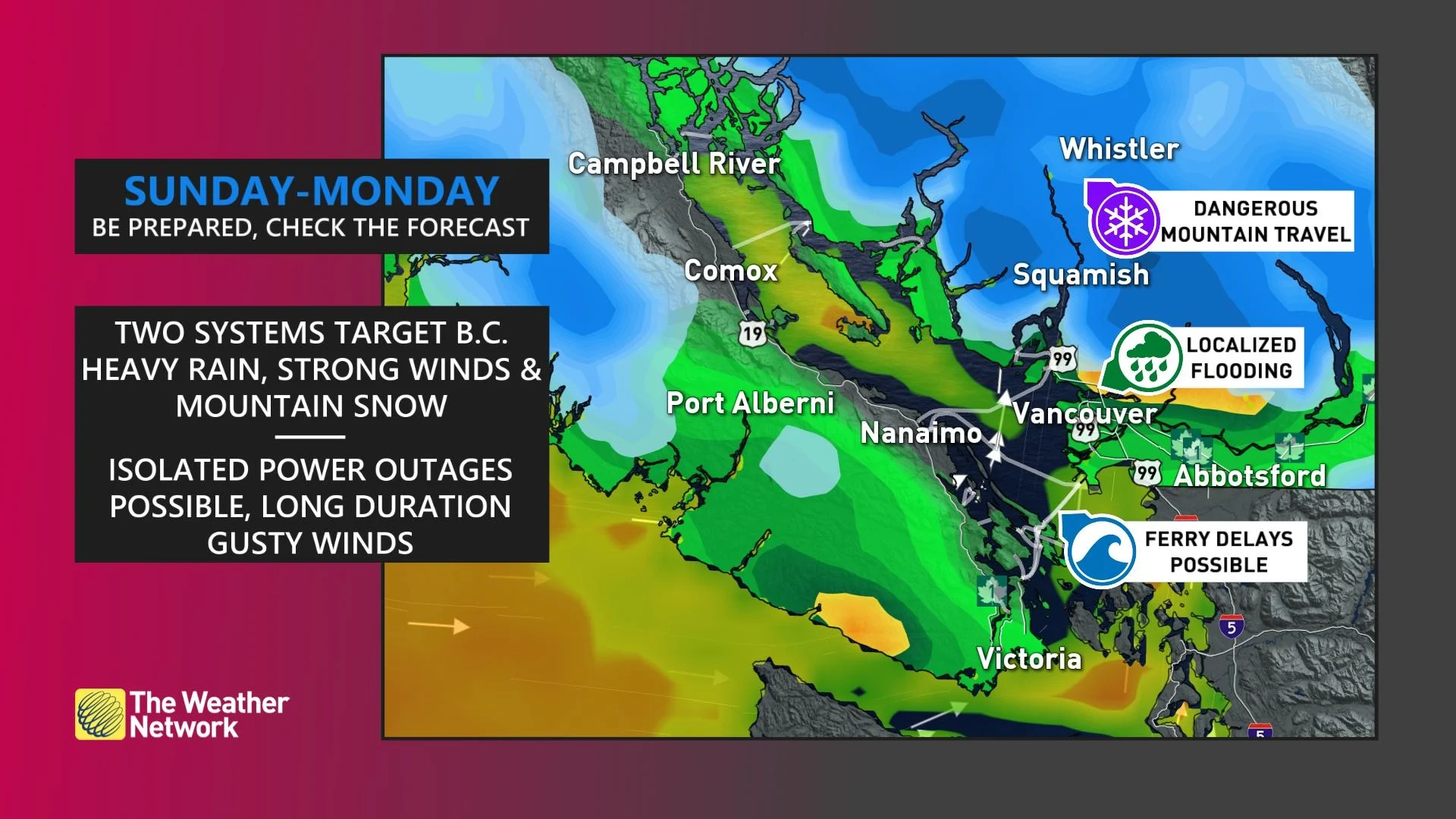
Winds will pick up as we head into early next week. We can expect gusts of 50-80 km/h across the Central Coast by Sunday afternoon, spreading over Vancouver Island and the Lower Mainland heading into our Monday. The blustery conditions could lead to ferry delays and localized power outages.
Cooler air at higher elevations will lead to significant amounts of snow across the mountain passes beginning overnight Sunday. The snow will be heavy at times.
Hazardous road conditions will hamper travel through Tuesday, so factor in likely delays if you plan to travel through the highway passes over the next couple of days. Freezing levels dropping below 1000 metres will bring heavy snow to the ski areas.
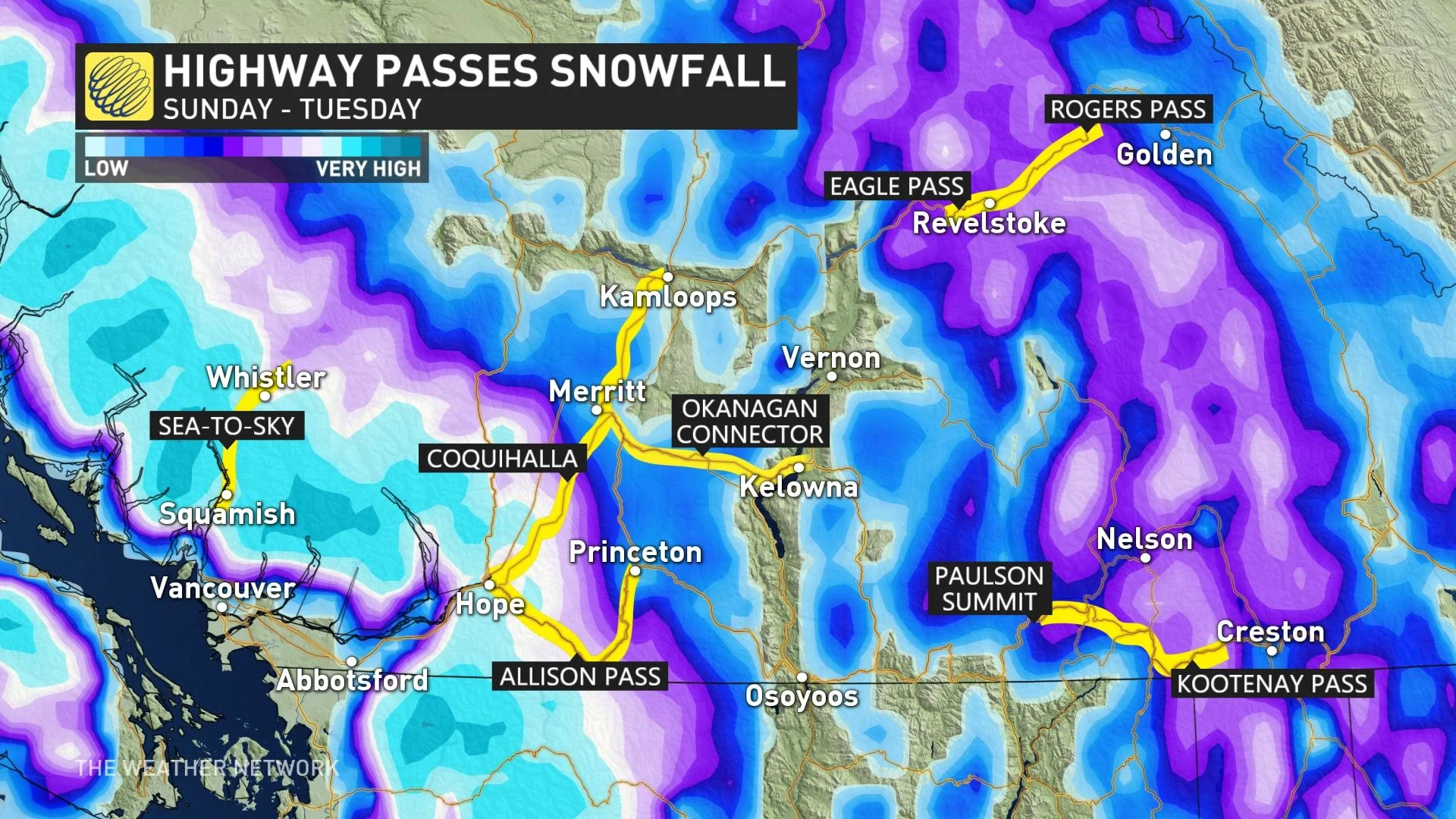
Exact snowfall amounts are uncertain at this time, but guidance is beginning to agree on amounts ranging between 15-30 cm, depending on location and elevation. Travellers should be prepared for adverse weather conditions and significant travel interruptions.
The threat of new precipitation and gusty winds will increase the avalanche risk, as well. The danger rating will reach moderate to considerable across many of B.C.’s mountain ranges on Sunday and Monday, with one or two at a high rating, according to Avalanche Canada.
There's the potential for a day or two of warmer spring weather later next week for the South Coast, but otherwise temperatures will be near or on the cool side of seasonal as we kick off the month of April.
Thumbnail courtesy of BC Hydro/Twitter.
Be sure to check back for the latest weather updates across B.C.