Record snowfall buries parts of Maritimes, sets sights on Newfoundland
Snowfall totals continue to rack up in parts of Atlantic Canada as a marathon event holds on through the end of the weekend, leading to numerous delays, cancellations and closures
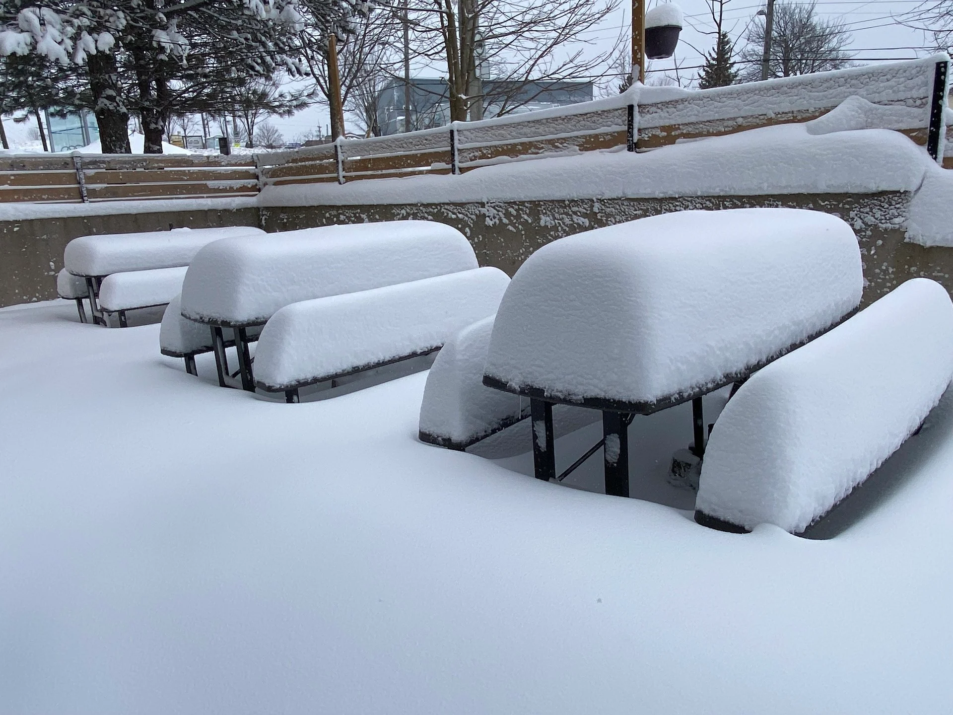
Heavy snowfall has been taking up multiple days of residency across the East Coast, adding up to major, potentially historic totals for some areas through Monday.
And, when combined with high wind gusts, the snow has made travel quite treacherous, and even impossible for many locales, since the start of the storm. The Nova Scotia government and RCMP are urging people to stay off the roads, unless their travel is essential. Visibility will be suddenly reduced to near zero at times in heavy snow and blowing snow.
In addition, Cape Breton Regional Municipality has declared a local state of emergency for the next seven days due to the unrelenting snowfall overwhelming their plow force. The regional municipality is urging residents to stay off the roadways so that crews can work on clearing roads quickly for any first responders to reach people.
MUST SEE: El Niño and the polar vortex take centre stage for winter’s final chapter
Major road closures have occurred Sunday across Nova Scotia as a result, along with numerous collisions.
There have also been widespread school closure announcements across Nova Scotia for Monday as it is unlikely the snow will be cleared in time.
As well, there are more than 4,400 Nova Scotia Power customers are in the dark as of early Sunday evening.
Confidence is greatest that Cape Breton and parts of Newfoundland will see the most substantial snowfall totals by the time snow finally stops early in the week.
RELATED: PHOTOS: 'Blockbuster' East Coast storm is bringing historic snowfall
East Coast on track to see substantial snowfall
An unusual stalling low-pressure system will be dancing off the coast of Nova Scotia, bringing the highest snowfall totals seen in two decades for a big swath of Atlantic Canada.
A low-pressure system is going to hit the pause button and stall just southeast of Sable Island for 48 hours. An Arctic high over Labrador will supply the cold air, which will be a blockbuster snowfall event for those in the eastern Maritimes and central Newfoundland.

Sunday
Conditions improve for Halifax, N.S., but become even more intense across Cape Breton and those communities along the Northumberland Strait. While snowfall rates remain generally below one centimetre an hour for Halifax, they will be as high as 5 cm an hour across Cape Breton.

KNOW THE SIGNS: How shovelling heavy snow can lead to heart attacks
If your county is listed below, pay special attention to the weather forecasts the next 24 hours and only travel if necessary
Antigonish County
Inverness County
Victoria County
Cape Breton County
Richmond County
Guysborough County
WATCH: Blowing snow in Halifax poses risk for dangerous travel
Reported and forecast snowfall totals throughout the event
As of 2 p.m. local time Sunday, 58 cm of snowfall had been reported at Halifax's Stanfield International Airport, while a whopping 71 cm of snow was reported in Sydney, N.S.

East of Truro, along Highway 104, is where the totals really pile up past half a metre of snowfall. Travel will be impossible throughout the region Sunday night with intense drifts and zero visibility.
The Cape Breton region, including Sydney, and Glace Bay, is forecast to have more than 100 cm of snowfall accumulation. With these snowfall rates forecast, a long-duration blizzard is likely to linger into the overnight Sunday.
When all is said and done, some regions are likely to record up to 150 cm of snowfall accumulation in localized spots.
The Avalon is a tricky forecast with two waves of snowfall forecast for St. John’s, resulting in more than 20 cm of snow forecast through Tuesday. Farther inland, and west along the Trans-Canada Highway, folks can expect 20-40 cm of snow from Gander to Deer Lake.

Gusty winds of 60-80 km/h will accompany the snowfall across Newfoundland, leading to a risk for near-blizzard conditions during periods of moderate to heavy snowfall.
Much like we’ll see in the Maritimes, travel will be difficult if not impossible during these whiteouts.
The storm will eventually weaken and depart the area later Tuesday.
Stay with The Weather Network and continue checking back as forecasters break down the details on this long-duration snowstorm across Atlantic Canada.