Fresh snow and wind hit Ontario on Friday, 5-15+ cm expected
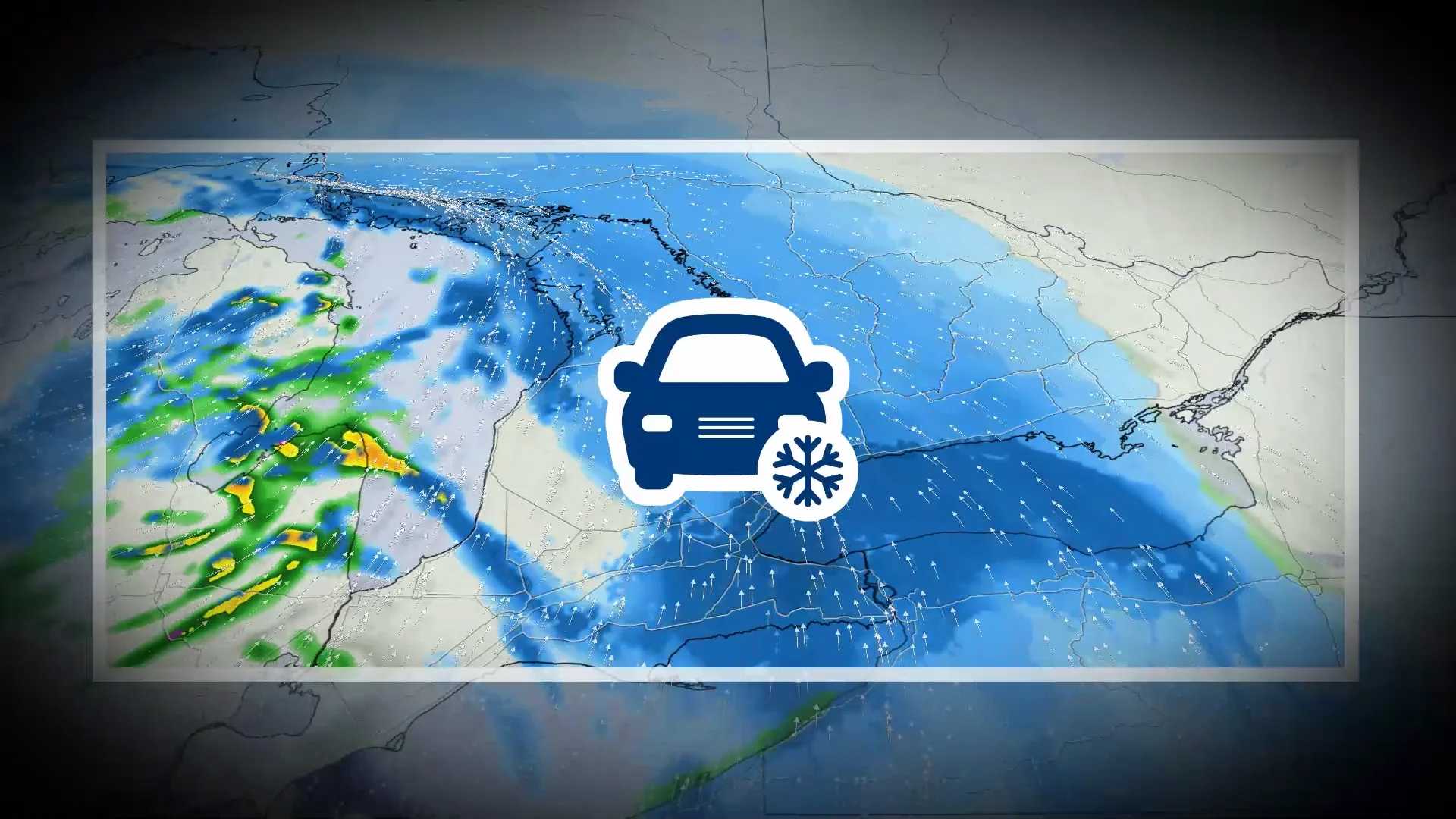
A blanket of snow arriving Friday will likely slow evening commutes throughout southern Ontario
No rest for the weary across southern Ontario as folks here prepare for a disruptive bout of snow on Friday.
Traffic slowdowns and delays are likely during the afternoon and evening hours. Strong winds could knock out power in some areas, as well as reduce visibility due to blowing snow.
Forecasters are closely watching another system that could affect the province later this weekend.
DON'T MISS: The Storm of the Century spawned historic snows, destructive twisters
Snowy system to snarl Friday’s evening commute
Flurries will begin Friday morning from Windsor to London, eventually spreading into the Greater Toronto Area (GTA) through the late morning and into the lunch hour. The GTA’s flurries may melt on contact due to the recent mild weather.

Heavier snow will push into the GTA by Friday afternoon, at which point we’ll begin to see accumulations on untreated surfaces.
By the evening hours, heavier snowfall rates will shift east of Toronto toward Oshawa, Peterborough, and Kingston. The snow will move east into Ottawa late Friday evening and continue into Saturday morning.
Prepare for slowdowns and travel delays amid the evening commute as drivers head out on snowy roads.

SEE ALSO: The hottest place on Earth is experiencing a wildflower superbloom
Snowfall totals of 5-10+ cm are expected across most of southern Ontario, with lower totals across the southwestern corner of the province.
A swath of communities from the Huron shores to Kitchener-Waterloo to the 401 will transition to a wet mixture of rain and snow. Along the lakeshore, Toronto and Hamilton will see reduced snowfall accumulations as light rain mixes in.
Light snow will continue off of Lake Huron and Georgian Bay through the pre-dawn hours Saturday.

Wind gusts will increase up to 90 km/h, especially in Windsor, the Lake Erie shores, and across the Niagara Peninsula. Localized power outages are possible in the strongest gusts.
Folks across and west of the GTA should watch for blowing snow overnight Friday and into Saturday morning.
Looking ahead, we’ll see a brief break from the active weather on Saturday with below-seasonal temperatures. Forecasters will closely monitor the progress of a powerful weekend storm in the works, which could bring more impactful snow and rain to the region.