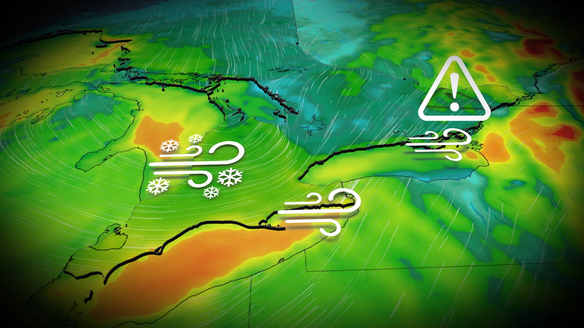
Poor travel continues in Ontario as winter storm effects hang on
With the last of the winter storm hanging on in eastern Ontario Wednesday, attention will turn to the province's next potent system on the weekend –– potentially bringing much more snow this time for southern locales
Ontario's first significant storm of the season heralded winter's tightening grip on the province after a slow start.
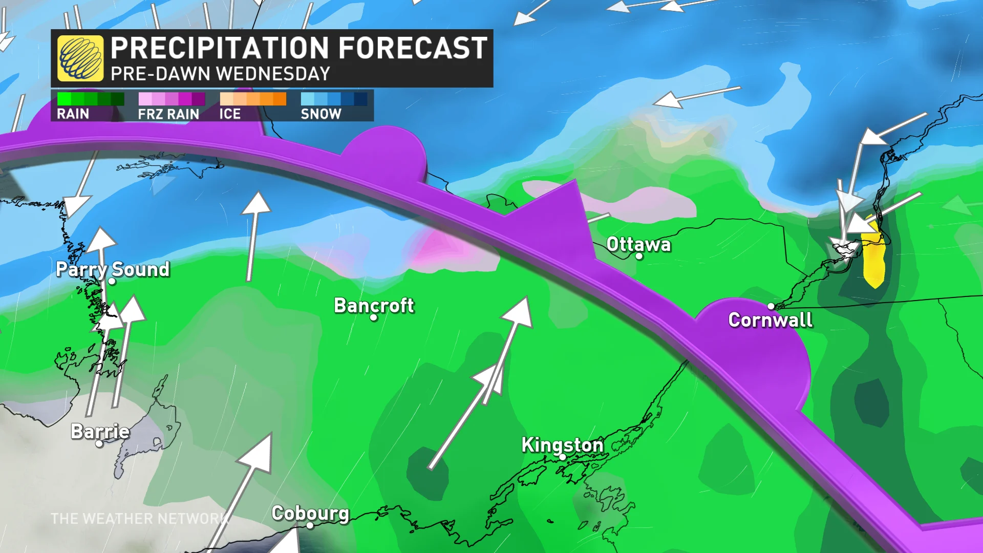
The storm brought a barrage of wintry effects Tuesday, from heavy snow to rain and ice, leaving a mess on the roads for travellers to navigate through. The system isn't quite finished with Ontario, yet, as it pushes its effects farther into eastern Ontario and Quebec for Wednesday.
Going somewhere? Check out the current highway conditions before heading out!
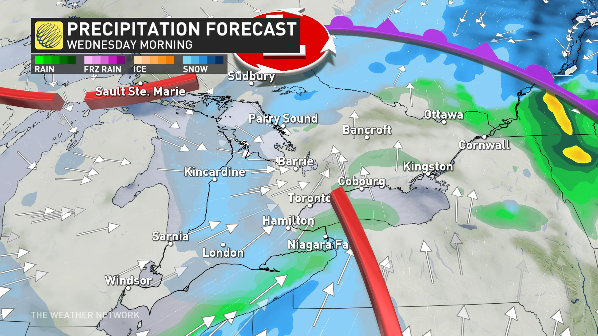
While conditions will gradually improve Wednesday as the day progresses, that is not the end of the active weather in the short term for Ontario. In fact, beyond a weak system Thursday lies an even more potent storm, snowfall-wise, potentially, than this week's Texas low.
Tuesday night to Wednesday: What's left of the storm
Heavy, wet snowfall moves across eastern Ontario late Tuesday, with a messy commute expected Wednesday morning.
A transition to rain is expected by Wednesday morning, but it may not wash away all of Tuesday overnight’s snow. You may need a shovel and car brush, so expect a slow drive in Ontario’s east. Expect slippery roads Wednesday morning.
MUST SEE: Record-breaking: El Niño stole winter from Ontario in December
In Ottawa and parts of eastern Ontario, there is the chance for a period of ice pellets, and even freezing rain, before a rainfall moves in Wednesday.
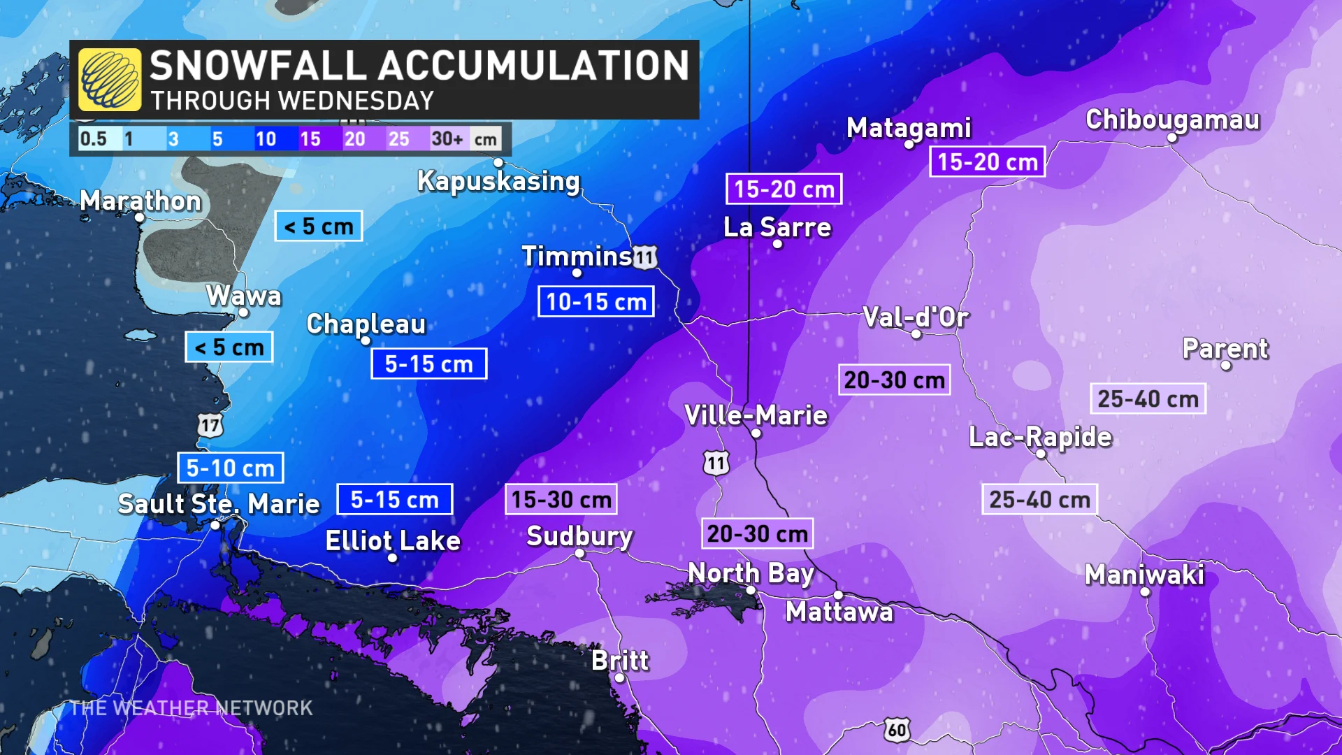
The heaviest snow will be in central and northeastern Ontario where upwards to 30 cm of snow is possible for regions stretching from Algonquin to Sudbury. Places like Huntsville and North Bay will see some of the highest accumulations where it will remain snow for the entire system.
A transition into mixed, wintry weather is expected very early Wednesday, which may impact snow totals for Ottawa and southeast Ontario.
Much less snow may pile up in Ontario’s southeast with 5-15 cm from Kingston to Cornwall. Sault Ste Marie and Timmins will be on the northern edge where 5-15 cm of snow is possible.
Tuesday overnight into Wednesday will winds shift to the southwest and eventually west, bringing in milder temperatures.
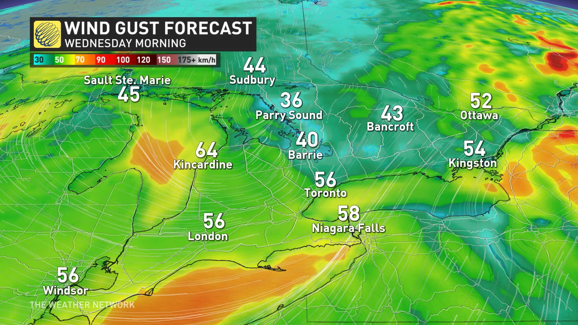
Wind gusts are expected to reach a widespread 50-60 km/h throughout southern and eastern Ontario, with some gusts along the Huron shorelines hitting upwards to 70 km/h.
Looking ahead
This period of active winter weather will continue for Ontario as a weak clipper system moves in on Thursday -- but the next system beyond that is the one to watch.
Late Friday and into Saturday, another strong, colder system is forecast to bring widespread, heavy snow to the province. Low pressure will rapidly intensify as it heads northeast into the Great Lakes. This storm will bring widespread strong winds and heavy snow to the Great Lakes region.
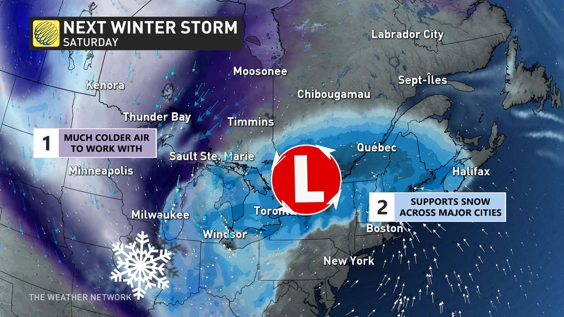
Areas near and south of Highway 401 and the St. Lawrence River could see the snow change to rain for a while, but much of the precipitation should fall as snow. The hardest-hit areas may see 20-30+cm of snow with extensive blowing and drifting snow, but totals will be much lower where mixing occurs. Depending on the storm track, we could also have localized wind damage.
On top of that, it will bring in some of the coldest air of the season and set up some lake-effect snow for a couple of days.
Stay with The Weather Network for the latest on this major storm in Ontario
Thumbnail credit: Getty images/stock photo