Snow, wind, and rain: Rare May nor'easter targets Atlantic Canada
A rare May nor'easter is setting its sights on Atlantic Canada on Sunday, threatening the East Coast with heavy rains, damaging winds, and snow.
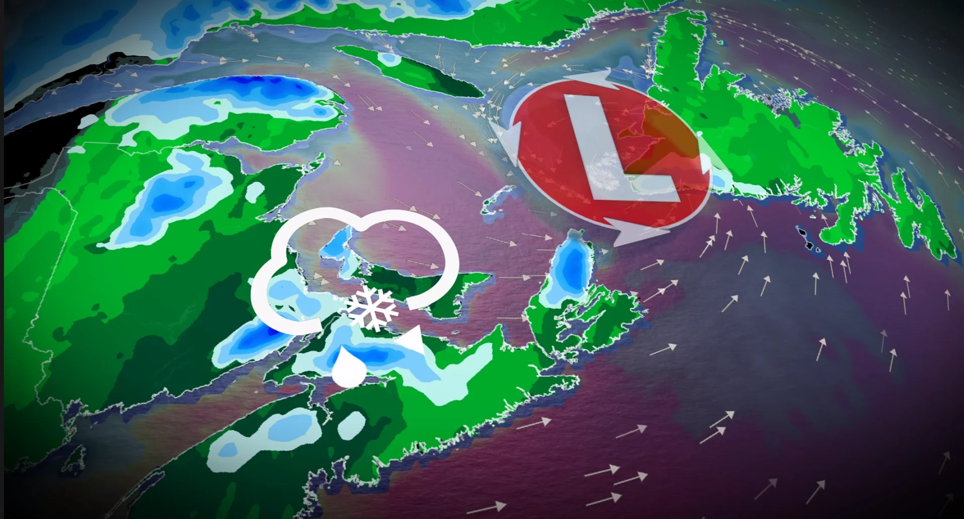
May is here, but the winter season is still trying to desperately keep a hold on Atlantic Canada as a rare late spring nor'easter sets its sights on the region late Sunday.
A deep trough over Eastern Canada will set the stage and provide the necessary ingredients to fuel an intensifying nor'easter--a storm most commonly seen in the winter months.
Nor’easters become rarer in late spring because the necessary temperature differences needed to develop these low-pressure systems become less prevalent as the season consistently warms.
But the current pattern of below-seasonal temperatures in Eastern Canada has created the ideal conditions for a nor’easter, with the atmosphere behaving more like early April than early May.
SEE ALSO: Sudden summer or sputtering spring: Which side are you on this May?
As the deep upper trough moves into Atlantic Canada on Sunday, it will interact with a weak frontal boundary drifting off the U.S. East Coast. This will not only help fuel the incoming storm but will steer it directly toward Atlantic Canada on Sunday.
Beware of localized flooding from heavy rains and power outages from gusty winds late Sunday and into Monday. Some folks may even see some snow mix in with the rain, which could cause roads to become slick.

Snow threatens the Maritimes
Temperatures across the Maritime provinces will be hovering only a few degrees above freezing on Sunday night, raising the likelihood of some wet snow mixing in with the rainfall as the nor'easter crosses eastern Nova Scotia.
We'll likely see more snow across higher terrains in western Prince Edward Island, New Brunswick, and northern Nova Scotia (including Cape Breton), but luckily, no significant accumulation is forecast.
Where we could see some snow accumulation, though, is along the Cobequid Pass, where about 5 cm of snow may fall during this event.

Gusty winds and heavy rains are the main threats across Atlantic Canada
The main impacts forecasters are keeping an eye on with this unusual event are power outages from gusty winds and localized flooding from heavy rains. Large waves along coastal areas will also pose an increased danger to any beachgoers or ocean-admirers.
DON'T MISS: When does hurricane season start? Do these things sooner than later
The winds will begin to pick up in Nova Scotia Sunday evening and will continue to lift north across the East Coast through the overnight and into Monday.

Maximum gust projections:
Halifax: 80 km/h (Sunday evening)
Cape Breton: 70-90 km/h (pre-dawn Monday)
P.E.I.: 80 km/h (pre-dawn Monday)
St. John’s: 90 km/h (Monday afternoon)
Nova Scotia will bear the brunt of the heavy rainfall in the Maritimes, with 30-50 mm forecast for the Halifax and Yarmouth areas.
Western Newfoundland will also be getting a healthy dump of rain on Monday as the nor'easter makes its way northeast. Folks across the western half of the province can expect to see around 30+ mm of rainfall.
Stay with The Weather Network for more information and updates on your weather across Atlantic Canada.